TopoQuest Logo
Do you find TopoQuest useful?
Help keep TopoQuest running and adding new maps/features by donating!
Bitcoin:  19c7KJd3qBynnjoSw5npx9KScwjBe4ifkT
Litecoin:  LXs6TkuXGGXo1vDsWCkWVdjQX94eUKd6ui
Home View Maps Find Maps Find Places Resources & Links


Concord, Vermont Topographic Map

USGS Map Title: Concord, VT
USGS Map MRC: 44071D8
DRG (GeoTIFF) Download: o44071d8.tif


Neighboring USGS Topographic Map Quads:


  Lyndonville, VT  
44072E1
 

  Burke Mountain, VT  
44071E8
 

  Gallup Mills, VT  
44071E7


  Concord, VT  
44071D8
 

  Miles Pond, VT  
44071D7


  Lower Waterford, VT  
44071C8
 

  Littleton, NH  
44071C7


Map MRC Location:

N45°
W72°
N45°
W71°
H8 H7 H6 H5 H4 H3 H2 H1
G8 G7 G6 G5 G4 G3 G2 G1
F8 F7 F6 F5 F4 F3 F2 F1
E8 E7 E6 E5 E4 E3 E2 E1
D8 D7 D6 D5 D4 D3 D2 D1
C8 C7 C6 C5 C4 C3 C2 C1
B8 B7 B6 B5 B4 B3 B2 B1
A8 A7 A6 A5 A4 A3 A2 A1
N44°
W72°
N44°
W71°

Concord, VT USGS 1:24K Topographic Map Preview:
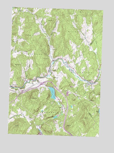
Concord, VT USGS Topographic Map
Click on map above to begin viewing in our Map Viewer.

This topographic map contains these locations and features:
Feature Name Type Latitude Longitude GNIS ID View Map
Adams - Babcock CemeteryCemeteryN44.4317°W71.9367°1919423View Map
Badger MountainSummitN44.3839°W71.9176°1456203View Map
Bible HillSummitN44.4737°W71.9934°1456405View Map
Caste School (historical)SchoolN44.4437°W71.9115°1919312View Map
Chesterfield ValleyValleyN44.4481°W71.9415°1456875View Map
ConcordPopulated PlaceN44.4289°W71.8901°1456992View Map
Concord Census Designated PlaceCensusN44.4322°W71.8863°2586624View Map
Concord East Side CemeteryCemeteryN44.4255°W71.8919°1919319View Map
Concord Fire and RescueBuildingN44.4286°W71.8889°2121441View Map
Concord High School / Graded SchoolSchoolN44.4265°W71.8904°1919320View Map
Concord Post OfficePost OfficeN44.4290°W71.8888°2760006View Map
Concord West Side CemeteryCemeteryN44.4258°W71.8929°1919325View Map
Cushman CemeteryCemeteryN44.4344°W71.9307°1457077View Map
Duck PondLakeN44.3933°W71.9349°1457204View Map
Duck Pond BrookStreamN44.4095°W71.9345°1457207View Map
East Saint JohnsburyPopulated PlaceN44.4387°W71.9456°1457319View Map
East Saint Johnsbury Post OfficePost OfficeN44.4378°W71.9469°1919501View Map
Essex - Caledonia Supervisory UnionSchoolN44.4290°W71.8889°2427359View Map
Fuller HillSummitN44.3928°W71.8962°1457501View Map
Graves School (historical)SchoolN44.4262°W71.9584°1919518View Map
Grays PondLakeN44.4961°W71.9903°1457620View Map
Grove CemeteryCemeteryN44.4504°W71.9382°1457664View Map
Hastings School (historical)SchoolN44.3906°W71.9979°1919540View Map
Hill CemeteryCemeteryN44.4243°W71.9629°1457828View Map
Interchange 1CrossingN44.4256°W71.9551°1919553View Map
Kirby BrookStreamN44.4406°W71.8776°1458109View Map
Kirby Mountain QuarriesMineN44.4987°W71.8920°1919567View Map
Maple Grove MuseumBuildingN44.4214°W71.9951°1919590View Map
Moose River CampgroundLocaleN44.4289°W71.9662°1919600View Map
Mount PisgahSummitN44.4731°W71.9784°1458989View Map
Mud HollowValleyN44.4698°W71.9481°1458602View Map
Powers Wheeler CemeteryCemeteryN44.3912°W71.9676°1460195View Map
Ranney BrookStreamN44.4578°W71.8823°1459143View Map
Remick School (historical)SchoolN44.3851°W71.9320°1919667View Map
Rustic Haven CampgroundLocaleN44.4326°W71.8815°1919398View Map
Saddleback MountainSummitN44.4420°W71.9923°1459305View Map
Saint Johnsbury Municipal ForestForestN44.4112°W71.9404°1919688View Map
Silsby MountainSummitN44.3831°W71.9848°1459507View Map
South KirbyPopulated PlaceN44.4703°W71.9023°1919710View Map
South Kirby CemeteryCemeteryN44.4718°W71.9022°1919711View Map
South Kirby SchoolSchoolN44.4709°W71.9015°1459594View Map
Spaulding BrookStreamN44.4234°W71.9798°1459631View Map
Stiles BrookStreamN44.4295°W71.9643°1459713View Map
Stiles CemeteryCemeteryN44.4233°W71.9479°1459714View Map
Stiles PondReservoirN44.4162°W71.9396°1459716View Map
Stiles Pond DamDamN44.4217°W71.9462°1766387View Map
Stockwell BrookStreamN44.4309°W71.9037°1459725View Map
Sugar HillSummitN44.4881°W71.9451°1459767View Map
Third Congregational ChurchChurchN44.4381°W71.9556°1919737View Map
Town of WaterfordCivilN44.3791°W71.9404°1462245View Map
Waterford Elementary SchoolSchoolN44.4028°W71.9277°1460078View Map
Waterford Volunteer Fire DepartmentBuildingN44.3794°W71.9545°2121404View Map
Whites CornerPopulated PlaceN44.4123°W71.8845°1460229View Map
WNKV-FM (Saint Johnsbury)TowerN44.4106°W71.9698°1462007View Map
WSTJ-AM (Saint Johnsbury)TowerN44.4184°W71.9954°1461992View Map

Note: Coordinates in the location and feature list above are referenced to NAD83 datum.


Copyright (C) 2008-2025 Ryan Niemi / Sunset Dynamics ... All Rights Reserved