TopoQuest Logo
Do you find TopoQuest useful?
Help keep TopoQuest running and adding new maps/features by donating!
Bitcoin:  19c7KJd3qBynnjoSw5npx9KScwjBe4ifkT
Litecoin:  LXs6TkuXGGXo1vDsWCkWVdjQX94eUKd6ui
Home View Maps Find Maps Find Places Resources & Links


Condon, Oregon Topographic Map

USGS Map Title: Condon, OR
USGS Map MRC: 45120B2
DRG (GeoTIFF) Download: o45120b2.tif


Neighboring USGS Topographic Map Quads:


  Igo Butte, OR  
45120C3
 

  Gwendolen, OR  
45120C2
 

  Devils Gap, OR  
45120C1
 

  Schott Canyon, OR  
45120B3
 

  Condon, OR  
45120B2
 

  Matney Flat, OR  
45120B1
 

  Buckhorn Canyon, OR  
45120A3
 

  Fossil North, OR  
45120A2
 

  Salmon Fork, OR  
45120A1


Map MRC Location:

N46°
W121°
N46°
W120°
H8 H7 H6 H5 H4 H3 H2 H1
G8 G7 G6 G5 G4 G3 G2 G1
F8 F7 F6 F5 F4 F3 F2 F1
E8 E7 E6 E5 E4 E3 E2 E1
D8 D7 D6 D5 D4 D3 D2 D1
C8 C7 C6 C5 C4 C3 C2 C1
B8 B7 B6 B5 B4 B3 B2 B1
A8 A7 A6 A5 A4 A3 A2 A1
N45°
W121°
N45°
W120°

Condon, OR USGS 1:24K Topographic Map Preview:
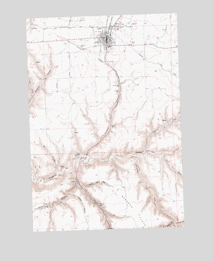
Condon, OR USGS Topographic Map
Click on map above to begin viewing in our Map Viewer.

This topographic map contains these locations and features:
Feature Name Type Latitude Longitude GNIS ID View Map
Badger CanyonValleyN45.1279°W120.1348°1117132View Map
Beecher FlatFlatN45.1351°W120.1667°1117476View Map
Beecher Flat CanyonValleyN45.1504°W120.2100°1117475View Map
Box CanyonValleyN45.1590°W120.2300°1118000View Map
Burns ParkParkN45.2421°W120.1800°1118341View Map
City of CondonCivilN45.2366°W120.1859°2410215View Map
City of Condon Volunteer Fire DepartmentBuildingN45.2365°W120.1845°2576531View Map
CondonPopulated PlaceN45.2343°W120.1850°1119195View Map
Condon Ambulance ServiceBuildingN45.2383°W120.1845°2553801View Map
Condon CanyonValleyN45.1662°W120.2025°1119196View Map
Condon City HallBuildingN45.2365°W120.1846°2698927View Map
Condon City ParkParkN45.2324°W120.1850°2058329View Map
Condon DivisionCivilN45.2500°W120.2138°1937984View Map
Condon Elementary SchoolSchoolN45.2357°W120.1820°1639084View Map
Condon Golf CourseLocaleN45.2401°W120.1928°1639085View Map
Condon High SchoolSchoolN45.2318°W120.1826°1639086View Map
Condon Police DepartmentBuildingN45.2364°W120.1844°2737671View Map
Condon Post OfficePost OfficeN45.2344°W120.1845°1165080View Map
Condon Public WorksBuildingN45.2365°W120.1846°2698929View Map
Condon ReservoirReservoirN45.2471°W120.2067°1130388View Map
Condon Sewer Treatment PlantLocaleN45.2270°W120.1805°2697125View Map
Condon State Pauling FieldAirportN45.2449°W120.1673°1131407View Map
Cooney RanchLocaleN45.2060°W120.2209°1639088View Map
Crazy ForkValleyN45.2046°W120.2478°1119525View Map
Department of Motor Vehicles CondonBuildingN45.2356°W120.1864°2699287View Map
Devils BackboneRidgeN45.1693°W120.2103°1119891View Map
Dry Fork Thirtymile CreekStreamN45.1899°W120.1264°1120155View Map
East Fork Thirtymile CreekStreamN45.1671°W120.1653°1141612View Map
Gilliam County FairgroundsLocaleN45.2426°W120.1772°1639087View Map
Gilliam County Historical Society Depot MuseumBuildingN45.2420°W120.1798°2699387View Map
Gilliam County Justice Court Condon BranchBuildingN45.2356°W120.1864°2698928View Map
Gilliam County LibraryBuildingN45.2349°W120.1845°2698926View Map
Gilliam County Road DepartmentBuildingN45.2328°W120.1885°2698930View Map
Gilliam County Sheriff's OfficeBuildingN45.2355°W120.1863°2737809View Map
Greiner CanyonValleyN45.1460°W120.2209°1121422View Map
Greiner RanchLocaleN45.1276°W120.2164°1639089View Map
Independent Order of Odd Fellows CemeteryCemeteryN45.2439°W120.1726°1163964View Map
King of Peace CemeteryCemeteryN45.2439°W120.1733°1122752View Map
Liberty TheatreBuildingN45.2358°W120.1844°2700441View Map
Masonic CemeteryCemeteryN45.2439°W120.1746°1163965View Map
Patill CanyonValleyN45.1662°W120.2103°1125219View Map
PotholeBasinN45.1618°W120.2248°1125605View Map
Saint Joseph CemeteryCemeteryN45.2428°W120.1744°1126476View Map
Snyder Ranch AirportAirportN45.1986°W120.2151°1131718View Map
South Gilliam County Rural Fire Protection DistrictBuildingN45.2383°W120.1845°2576948View Map
Springston CanyonValleyN45.1268°W120.1331°1127459View Map
ThirtymilePopulated PlaceN45.1693°W120.1586°1136824View Map
Trail Fork CanyonValleyN45.1679°W120.1403°1128192View Map
Wehrli CanyonValleyN45.1532°W120.2153°1128778View Map

Note: Coordinates in the location and feature list above are referenced to NAD83 datum.


Copyright (C) 2008-2025 Ryan Niemi / Sunset Dynamics ... All Rights Reserved