TopoQuest Logo
Do you find TopoQuest useful?
Help keep TopoQuest running and adding new maps/features by donating!
Bitcoin:  19c7KJd3qBynnjoSw5npx9KScwjBe4ifkT
Litecoin:  LXs6TkuXGGXo1vDsWCkWVdjQX94eUKd6ui
Home View Maps Find Maps Find Places Resources & Links


Fossil North, Oregon Topographic Map

USGS Map Title: Fossil North, OR
USGS Map MRC: 45120A2
DRG (GeoTIFF) Download: o45120a2.tif


Neighboring USGS Topographic Map Quads:


  Schott Canyon, OR  
45120B3
 

  Condon, OR  
45120B2
 

  Matney Flat, OR  
45120B1
 

  Buckhorn Canyon, OR  
45120A3
 

  Fossil North, OR  
45120A2
 

  Salmon Fork, OR  
45120A1
 

  Porcupine Butte, OR  
44120H3
 

  Fossil South, OR  
44120H2
 

  Kinzua, OR  
44120H1


Map MRC Location:

N46°
W121°
N46°
W120°
H8 H7 H6 H5 H4 H3 H2 H1
G8 G7 G6 G5 G4 G3 G2 G1
F8 F7 F6 F5 F4 F3 F2 F1
E8 E7 E6 E5 E4 E3 E2 E1
D8 D7 D6 D5 D4 D3 D2 D1
C8 C7 C6 C5 C4 C3 C2 C1
B8 B7 B6 B5 B4 B3 B2 B1
A8 A7 A6 A5 A4 A3 A2 A1
N45°
W121°
N45°
W120°

Fossil North, OR USGS 1:24K Topographic Map Preview:
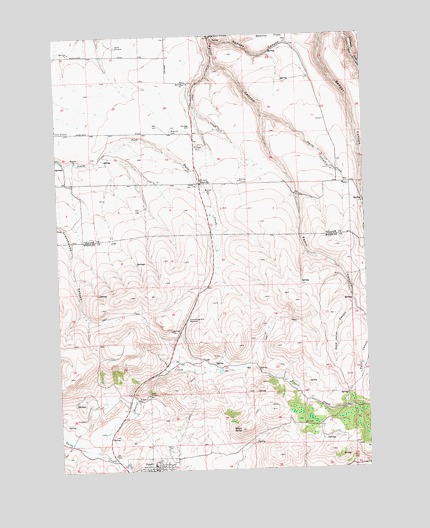
Fossil North, OR USGS Topographic Map
Click on map above to begin viewing in our Map Viewer.

This topographic map contains these locations and features:
Feature Name Type Latitude Longitude GNIS ID View Map
Black ButteSummitN45.0115°W120.1775°1117747View Map
Cummings Hill SummitGapN45.0432°W120.1986°1119622View Map
Dead Horse CanyonValleyN45.0457°W120.1314°1119738View Map
Dyer CreekStreamN45.1168°W120.1861°1120249View Map
Dyer State ParkParkN45.1246°W120.1870°1120250View Map
Fossil City HallBuildingN45.0003°W120.2139°2700307View Map
Fossil Public LibraryBuildingN45.0003°W120.2139°2700309View Map
Fossil Public WorksBuildingN45.0003°W120.2139°2700310View Map
Fossil Sewage Treatment PlantLocaleN45.0049°W120.2317°2697183View Map
Fossil Volunteer Fire DepartmentBuildingN45.0020°W120.2102°2576577View Map
Hoover CreekStreamN45.0057°W120.2364°1121972View Map
Hoover Creek ReservoirReservoirN45.0283°W120.1859°1158713View Map
Masonic CemeteryCemeteryN45.0068°W120.2073°1123829View Map
MayvillePopulated PlaceN45.0824°W120.1923°1123881View Map
Mayville CemeteryCemeteryN45.0975°W120.2043°1123882View Map
Mayville Post OfficePost OfficeN45.0824°W120.1923°1165599View Map
Mayville School (historical)SchoolN45.0804°W120.1970°1162302View Map
Putnams Airfield (historical)AirportN45.0610°W120.1831°1131695View Map
Ramsey CanyonValleyN45.1235°W120.1864°1125795View Map
Smith CreekStreamN45.1015°W120.1667°1127111View Map
Smith RanchLocaleN45.0860°W120.1386°1638464View Map
Wheeler High SchoolSchoolN45.0015°W120.2133°1638461View Map

Note: Coordinates in the location and feature list above are referenced to NAD83 datum.


Copyright (C) 2008-2024 Ryan Niemi / Sunset Dynamics ... All Rights Reserved