TopoQuest Logo
Do you find TopoQuest useful?
Help keep TopoQuest running and adding new maps/features by donating!
Bitcoin:  19c7KJd3qBynnjoSw5npx9KScwjBe4ifkT
Litecoin:  LXs6TkuXGGXo1vDsWCkWVdjQX94eUKd6ui
Home View Maps Find Maps Find Places Resources & Links


Conns Creek, Missouri Topographic Map

USGS Map Title: Conns Creek, MO
USGS Map MRC: 37092H4
DRG (GeoTIFF) Download: o37092h4.tif


Neighboring USGS Topographic Map Quads:


  Toronto, MO  
38092A5
 

  Brumley, MO  
38092A4
 

  Iberia, MO  
38092A3
 

  Montreal, MO  
37092H5
 

  Conns Creek, MO  
37092H4
 

  Crocker, MO  
37092H3
 

  Stoutland, MO  
37092G5
 

  Richland, MO  
37092G4
 

  Ozark Springs, MO  
37092G3


Map MRC Location:

N38°
W93°
N38°
W92°
H8 H7 H6 H5 H4 H3 H2 H1
G8 G7 G6 G5 G4 G3 G2 G1
F8 F7 F6 F5 F4 F3 F2 F1
E8 E7 E6 E5 E4 E3 E2 E1
D8 D7 D6 D5 D4 D3 D2 D1
C8 C7 C6 C5 C4 C3 C2 C1
B8 B7 B6 B5 B4 B3 B2 B1
A8 A7 A6 A5 A4 A3 A2 A1
N37°
W93°
N37°
W92°

Conns Creek, MO USGS 1:24K Topographic Map Preview:
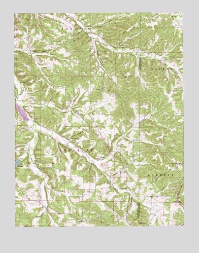
Conns Creek, MO USGS Topographic Map
Click on map above to begin viewing in our Map Viewer.

This topographic map contains these locations and features:
Feature Name Type Latitude Longitude GNIS ID View Map
Atkisson Lake DamDamN37.8900°W92.4835°765452View Map
Beulah ChurchChurchN37.8784°W92.4530°714118View Map
Brumley HollowValleyN37.9792°W92.4230°714813View Map
Chalfant CemeteryCemeteryN37.9261°W92.4582°715700View Map
Conns CreekStreamN37.9309°W92.4835°749447View Map
Deberry CreekStreamN37.9134°W92.4435°716758View Map
Elm Grove ChurchChurchN37.9550°W92.4366°717513View Map
Elm Grove SchoolLocaleN37.9548°W92.4338°742313View Map
Fairview School (historical)LocaleN37.8939°W92.4399°742314View Map
Gibson School (historical)SchoolN37.9128°W92.4913°745273View Map
Glaize (historical)Populated PlaceN37.9356°W92.4452°759570View Map
Hawkeye SchoolSchoolN37.9981°W92.3793°719231View Map
Julia HollowValleyN37.9898°W92.4482°720455View Map
Lewis CemeteryCemeteryN37.8964°W92.4466°720937View Map
Lucas HollowValleyN37.9764°W92.4871°721657View Map
Miles CemeteryCemeteryN37.9917°W92.3810°722313View Map
Montrose ChurchChurchN37.9073°W92.4177°722553View Map
Mountview ChurchChurchN37.9353°W92.4449°729786View Map
Murphy CreekStreamN37.9309°W92.4835°751241View Map
O'Halloran School (historical)SchoolN37.9125°W92.4216°745274View Map
Oak Grove SchoolSchoolN37.9592°W92.4916°729790View Map
Oak Law School (historical)SchoolN37.9536°W92.3888°744623View Map
Oak View School (historical)SchoolN37.9328°W92.4618°745272View Map
Richland Municipal AirportAirportN37.8755°W92.4075°758889View Map
Russell HollowValleyN37.9911°W92.4443°725685View Map
Saint JohnPopulated PlaceN37.8892°W92.3796°725763View Map
Sellars CreekStreamN37.9311°W92.4841°736045View Map
Seven Springs HollowValleyN37.9250°W92.4593°726215View Map
Sock HollowValleyN37.9845°W92.4418°726684View Map
Stoops BranchStreamN37.8928°W92.4146°752382View Map
Thornsberry CemeteryCemeteryN37.9764°W92.4016°727616View Map
Tri - County Fire and Rescue Association Station 2BuildingN37.9837°W92.4719°2621262View Map
Zaring (historical)LocaleN37.9809°W92.4985°759571View Map

Note: Coordinates in the location and feature list above are referenced to NAD83 datum.


Copyright (C) 2008-2024 Ryan Niemi / Sunset Dynamics ... All Rights Reserved