TopoQuest Logo
Do you find TopoQuest useful?
Help keep TopoQuest running and adding new maps/features by donating!
Bitcoin:  19c7KJd3qBynnjoSw5npx9KScwjBe4ifkT
Litecoin:  LXs6TkuXGGXo1vDsWCkWVdjQX94eUKd6ui
Home View Maps Find Maps Find Places Resources & Links


Brumley, Missouri Topographic Map

USGS Map Title: Brumley, MO
USGS Map MRC: 38092A4
DRG (GeoTIFF) Download: o38092a4.tif


Neighboring USGS Topographic Map Quads:


  Bagnell, MO  
38092B5
 

  Tuscumbia, MO  
38092B4
 

  Saint Anthony, MO  
38092B3
 

  Toronto, MO  
38092A5
 

  Brumley, MO  
38092A4
 

  Iberia, MO  
38092A3
 

  Montreal, MO  
37092H5
 

  Conns Creek, MO  
37092H4
 

  Crocker, MO  
37092H3


Map MRC Location:

N39°
W93°
N39°
W92°
H8 H7 H6 H5 H4 H3 H2 H1
G8 G7 G6 G5 G4 G3 G2 G1
F8 F7 F6 F5 F4 F3 F2 F1
E8 E7 E6 E5 E4 E3 E2 E1
D8 D7 D6 D5 D4 D3 D2 D1
C8 C7 C6 C5 C4 C3 C2 C1
B8 B7 B6 B5 B4 B3 B2 B1
A8 A7 A6 A5 A4 A3 A2 A1
N38°
W93°
N38°
W92°

Brumley, MO USGS 1:24K Topographic Map Preview:
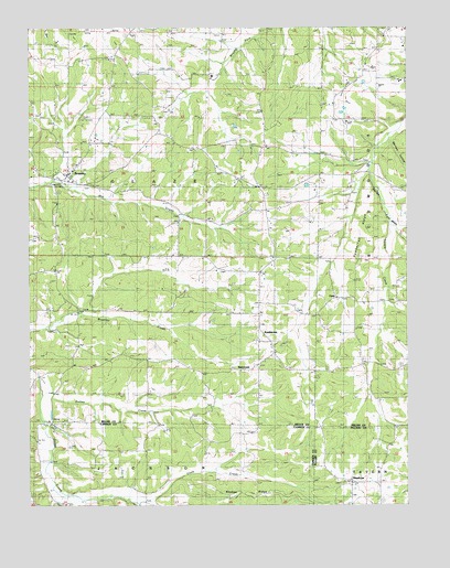
Brumley, MO USGS Topographic Map
Click on map above to begin viewing in our Map Viewer.

This topographic map contains these locations and features:
Feature Name Type Latitude Longitude GNIS ID View Map
Barnes HollowValleyN38.0948°W92.3793°713675View Map
Barton School (historical)SchoolN38.0467°W92.4380°713708View Map
BrumleyPopulated PlaceN38.0864°W92.4868°729447View Map
Brumley Fire Protection DistrictBuildingN38.0874°W92.4888°2621123View Map
Brumley Post OfficePost OfficeN38.0871°W92.4864°2782926View Map
Coon CreekStreamN38.0009°W92.4641°716242View Map
Curry Chapel (historical)ChurchN38.0456°W92.3916°729468View Map
Curry School (historical)SchoolN38.0423°W92.3835°744548View Map
FaithPopulated PlaceN38.0545°W92.3977°740844View Map
George SchoolSchoolN38.0031°W92.4999°718400View Map
Glover ChapelChurchN38.0003°W92.4868°718533View Map
Gott ChurchChurchN38.1236°W92.4649°729500View Map
Gott SchoolSchoolN38.1164°W92.4668°718635View Map
HawkeyePopulated PlaceN38.0056°W92.3930°740914View Map
Hawkins CemeteryCemeteryN38.1006°W92.4568°719236View Map
Hickory Point Baptist Church (historical)ChurchN38.1231°W92.3818°744547View Map
Hickory Point Christian Church (historical)ChurchN38.1245°W92.3835°744546View Map
Honey Spring SchoolSchoolN38.0845°W92.4305°719771View Map
KeethtownPopulated PlaceN38.0431°W92.4241°729527View Map
Mount Union ChurchChurchN38.0614°W92.4371°722907View Map
Pemberton RidgeRidgeN38.0731°W92.3857°724186View Map
Rollins CreekStreamN38.0325°W92.4971°729630View Map
Ross SchoolSchoolN38.0450°W92.4924°725582View Map
SamtownPopulated PlaceN38.0367°W92.4241°741238View Map
Shahan RidgeRidgeN38.0028°W92.4313°726258View Map
Skin Heel School (historical)SchoolN38.0023°W92.4335°745267View Map
Town of BrumleyCivilN38.0880°W92.4845°2396614View Map
Twelve Corners Church (historical)ChurchN38.0142°W92.4699°727921View Map
WatkinsPopulated PlaceN38.1236°W92.3813°741347View Map
Whittle CreekStreamN38.0734°W92.3791°728810View Map

Note: Coordinates in the location and feature list above are referenced to NAD83 datum.


Copyright (C) 2008-2024 Ryan Niemi / Sunset Dynamics ... All Rights Reserved