TopoQuest Logo
Do you find TopoQuest useful?
Help keep TopoQuest running and adding new maps/features by donating!
Bitcoin:  19c7KJd3qBynnjoSw5npx9KScwjBe4ifkT
Litecoin:  LXs6TkuXGGXo1vDsWCkWVdjQX94eUKd6ui
Home View Maps Find Maps Find Places Resources & Links


Convoy, Ohio Topographic Map

USGS Map Title: Convoy, OH
USGS Map MRC: 40084H6
DRG (GeoTIFF) Download: o40084h6.tif


Neighboring USGS Topographic Map Quads:


  Woodburn South, IN  
41084A7
 

  Payne, OH  
41084A6
 

  Latty, OH  
41084A5
 

  Dixon, IN  
40084H7
 

  Convoy, OH  
40084H6
 

  Scott, OH  
40084H5
 

  Wren, OH  
40084G7
 

  Glenmore, OH  
40084G6
 

  Van Wert, OH  
40084G5


Map MRC Location:

N41°
W85°
N41°
W84°
H8 H7 H6 H5 H4 H3 H2 H1
G8 G7 G6 G5 G4 G3 G2 G1
F8 F7 F6 F5 F4 F3 F2 F1
E8 E7 E6 E5 E4 E3 E2 E1
D8 D7 D6 D5 D4 D3 D2 D1
C8 C7 C6 C5 C4 C3 C2 C1
B8 B7 B6 B5 B4 B3 B2 B1
A8 A7 A6 A5 A4 A3 A2 A1
N40°
W85°
N40°
W84°

Convoy, OH USGS 1:24K Topographic Map Preview:
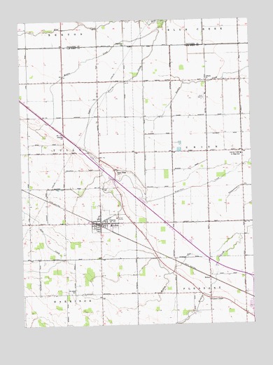
Convoy, OH USGS Topographic Map
Click on map above to begin viewing in our Map Viewer.

This topographic map contains these locations and features:
Feature Name Type Latitude Longitude GNIS ID View Map
Arts DairyLocaleN40.9725°W84.7139°2707402View Map
Asbury ChurchChurchN40.9753°W84.6480°1037504View Map
Brumback Library Convoy BranchBuildingN40.9169°W84.7067°2707379View Map
Burley FarmsLocaleN40.8961°W84.6867°2707403View Map
ConvoyPopulated PlaceN40.9167°W84.7027°1056836View Map
Convoy Fire Station and Emergency Medical Services DepartmentBuildingN40.9174°W84.7065°2549816View Map
Convoy Post OfficePost OfficeN40.9167°W84.7028°2081252View Map
Convoy Union Junior High SchoolSchoolN40.9448°W84.6302°1039327View Map
Crestview High SchoolSchoolN40.9162°W84.7013°1053830View Map
Crestview North Elementary SchoolSchoolN40.9156°W84.7022°1053829View Map
Davis School (historical)SchoolN40.9437°W84.7075°1053705View Map
Dix CemeteryCemeteryN40.8853°W84.6491°1807424View Map
Dix School (historical)SchoolN40.8881°W84.6300°1053702View Map
Edgewood ParkParkN40.9320°W84.7063°1807425View Map
Fairview ChurchChurchN40.9898°W84.6922°1040361View Map
Friends ChurchLocaleN40.9531°W84.7263°1061083View Map
Gunsett School (historical)SchoolN40.8884°W84.7072°1053709View Map
Macabob FarmsLocaleN40.9033°W84.7492°2707405View Map
Marcarl FarmsLocaleN40.9181°W84.6544°2707408View Map
McClure School (historical)SchoolN40.9164°W84.6300°1053701View Map
Middle CreekStreamN40.9995°W84.6702°1043270View Map
Monkey RunStreamN40.9114°W84.6313°1043436View Map
Pleasant ChapelChurchN40.8850°W84.6483°1065236View Map
Redeemer Lutheran CemeteryCemeteryN40.8881°W84.7219°1807433View Map
Reidenbach School (historical)SchoolN40.8884°W84.7419°1053713View Map
RicheyPopulated PlaceN40.8942°W84.6480°1062974View Map
Robinson School (historical)SchoolN40.8878°W84.6675°1053708View Map
Saint Johns CemeteryCemeteryN40.8881°W84.7175°1045515View Map
Saint Johns SchoolSchoolN40.8892°W84.7213°1045549View Map
School Number 1 (historical)SchoolN40.9748°W84.7072°1053704View Map
School Number 2 (historical)SchoolN40.9748°W84.6300°1053699View Map
School Number 3 (historical)SchoolN40.9753°W84.6672°1053703View Map
School Number 4 (historical)SchoolN40.9462°W84.6680°1053706View Map
School Number 5 (historical)SchoolN40.9462°W84.6302°1053700View Map
School Number 9 (historical)SchoolN40.9167°W84.6680°1053707View Map
Scott QuarryMineN40.9658°W84.6517°2567606View Map
Shook School (historical)SchoolN40.9456°W84.7455°1053712View Map
Speelman FarmLocaleN40.9156°W84.6425°2707647View Map
Storm DitchCanalN40.8767°W84.7347°1068851View Map
Sugar Grove Church (historical)ChurchN40.9748°W84.7269°1053710View Map
Sugar Ridge CemeteryCemeteryN40.9384°W84.6983°1807437View Map
Sugar Ridge ChurchChurchN40.9384°W84.6969°1046819View Map
Swick School (historical)SchoolN40.9748°W84.7452°1053711View Map
Thompson FarmLocaleN40.9586°W84.6289°2707648View Map
Township CemeteryCemeteryN40.9309°W84.7016°1047112View Map
Township of TullyCivilN40.9460°W84.7456°1087094View Map
Township of UnionCivilN40.9460°W84.6303°1087095View Map
Upper Prairie CreekStreamN40.9962°W84.6733°1047372View Map
Village of ConvoyCivilN40.9179°W84.7053°2398620View Map
Web DitchCanalN40.9384°W84.6511°1068853View Map
West Fork DitchCanalN40.9987°W84.7144°1047751View Map

Note: Coordinates in the location and feature list above are referenced to NAD83 datum.


Copyright (C) 2008-2025 Ryan Niemi / Sunset Dynamics ... All Rights Reserved