TopoQuest Logo
Do you find TopoQuest useful?
Help keep TopoQuest running and adding new maps/features by donating!
Bitcoin:  19c7KJd3qBynnjoSw5npx9KScwjBe4ifkT
Litecoin:  LXs6TkuXGGXo1vDsWCkWVdjQX94eUKd6ui
Home View Maps Find Maps Find Places Resources & Links


Dixon, Indiana Topographic Map

USGS Map Title: Dixon, IN
USGS Map MRC: 40084H7
DRG (GeoTIFF) Download: o40084h7.tif


Neighboring USGS Topographic Map Quads:


  Maples, IN  
41084A8
 

  Woodburn South, IN  
41084A7
 

  Payne, OH  
41084A6
 

  Hoagland, IN  
40084H8
 

  Dixon, IN  
40084H7
 

  Convoy, OH  
40084H6
 

  Decatur, IN  
40084G8
 

  Wren, OH  
40084G7
 

  Glenmore, OH  
40084G6


Map MRC Location:

N41°
W85°
N41°
W84°
H8 H7 H6 H5 H4 H3 H2 H1
G8 G7 G6 G5 G4 G3 G2 G1
F8 F7 F6 F5 F4 F3 F2 F1
E8 E7 E6 E5 E4 E3 E2 E1
D8 D7 D6 D5 D4 D3 D2 D1
C8 C7 C6 C5 C4 C3 C2 C1
B8 B7 B6 B5 B4 B3 B2 B1
A8 A7 A6 A5 A4 A3 A2 A1
N40°
W85°
N40°
W84°

Dixon, IN USGS 1:24K Topographic Map Preview:
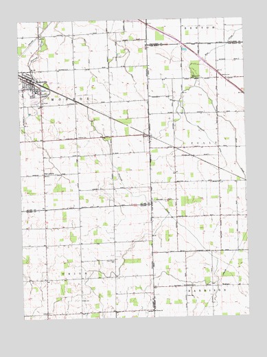
Dixon, IN USGS Topographic Map
Click on map above to begin viewing in our Map Viewer.

This topographic map contains these locations and features:
Feature Name Type Latitude Longitude GNIS ID View Map
Bethel CemeteryCemeteryN40.8828°W84.8419°430112View Map
Bethlehem ChurchChurchN40.8881°W84.7841°1037969View Map
Clark Chapel CemeteryCemeteryN40.8989°W84.8236°432555View Map
Dealey FarmsLocaleN40.9867°W84.7733°2707404View Map
DixonPopulated PlaceN40.9506°W84.8044°1048662View Map
Dixon Post Office (historical)Post OfficeN40.9500°W84.8042°2081225View Map
East LibertyPopulated PlaceN40.9356°W84.8616°433917View Map
Fralick FarmLocaleN40.8772°W84.7683°2707406View Map
Freck School (historical)SchoolN40.9173°W84.7847°1068246View Map
Greyhound School (historical)SchoolN40.9748°W84.7844°1053714View Map
Harting FarmsLocaleN40.9322°W84.8000°2707407View Map
Hoffman CemeteryCemeteryN40.9512°W84.8425°436274View Map
Kings CemeteryCemeteryN40.8839°W84.7842°1042280View Map
Kings School (historical)SchoolN40.8881°W84.7850°1053716View Map
McNeal CemeteryCemeteryN40.9760°W84.7620°1043142View Map
Mentzer ChurchChurchN40.9314°W84.7650°1043228View Map
Metzer CemeteryCemeteryN40.9312°W84.7647°1807430View Map
MonroevillePopulated PlaceN40.9748°W84.8683°439348View Map
Monroeville Emergency Medical ServicesBuildingN40.9734°W84.8651°2719270View Map
Monroeville Fire DepartmentBuildingN40.9745°W84.8697°2625915View Map
Monroeville Police DepartmentBuildingN40.9745°W84.8696°2758173View Map
Mount Victory ChurchChurchN40.8775°W84.8027°439722View Map
Odd Fellows CemeteryCemeteryN40.9653°W84.8647°440508View Map
Olsthoom DairyLocaleN40.9581°W84.7669°2703621View Map
Railroad School (historical)SchoolN40.9467°W84.7897°1053715View Map
Rose Lane FarmLocaleN40.8869°W84.7619°2707409View Map
Scott DitchCanalN40.9812°W84.8494°443149View Map
Spall's Mobile Home VillagePopulated PlaceN40.9667°W84.8675°2651768View Map
Sponseller DitchCanalN40.9487°W84.7700°1066220View Map
Town of MonroevilleCivilN40.9733°W84.8681°2396773View Map
Township of MonroeCivilN40.9652°W84.8425°453634View Map
Township of UnionCivilN40.8777°W84.8416°453906View Map
Walnut Grove ChurchChurchN40.9750°W84.7797°1047537View Map
Walnut Grove Grange (historical)BuildingN40.9909°W84.7866°1053356View Map
WolfcalePopulated PlaceN40.8881°W84.7608°1049341View Map
Wolfcale Post Office (historical)Post OfficeN40.8875°W84.7611°2081248View Map

Note: Coordinates in the location and feature list above are referenced to NAD83 datum.


Copyright (C) 2008-2024 Ryan Niemi / Sunset Dynamics ... All Rights Reserved