TopoQuest Logo
Do you find TopoQuest useful?
Help keep TopoQuest running and adding new maps/features by donating!
Bitcoin:  19c7KJd3qBynnjoSw5npx9KScwjBe4ifkT
Litecoin:  LXs6TkuXGGXo1vDsWCkWVdjQX94eUKd6ui
Home View Maps Find Maps Find Places Resources & Links


Cooley Lake, New Mexico Topographic Map

USGS Map Title: Cooley Lake, NM
USGS Map MRC: 34104A2
DRG (GeoTIFF) Download: o34104a2.tif


Neighboring USGS Topographic Map Quads:


  Conejo Creek East, NM  
34104B3
 

  Eighteenmile Hill, NM  
34104B2
 

  Watts Hill, NM  
34104B1
 

  La Espia Peak, NM  
34104A3
 

  Cooley Lake, NM  
34104A2
 

  Howell Ranch, NM  
34104A1
 

  Deering Place, NM  
33104H3
 

  Hernandez Lake, NM  
33104H2
 

  Olive, NM  
33104H1


Map MRC Location:

N35°
W105°
N35°
W104°
H8 H7 H6 H5 H4 H3 H2 H1
G8 G7 G6 G5 G4 G3 G2 G1
F8 F7 F6 F5 F4 F3 F2 F1
E8 E7 E6 E5 E4 E3 E2 E1
D8 D7 D6 D5 D4 D3 D2 D1
C8 C7 C6 C5 C4 C3 C2 C1
B8 B7 B6 B5 B4 B3 B2 B1
A8 A7 A6 A5 A4 A3 A2 A1
N34°
W105°
N34°
W104°

Cooley Lake, NM USGS 1:24K Topographic Map Preview:
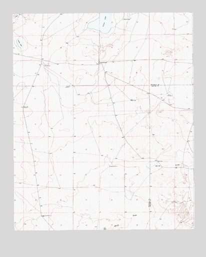
Cooley Lake, NM USGS Topographic Map
Click on map above to begin viewing in our Map Viewer.

This topographic map contains these locations and features:
Feature Name Type Latitude Longitude GNIS ID View Map
10711 Water WellWellN34.0831°W104.2079°930888View Map
10712 Water WellWellN34.0834°W104.2111°930889View Map
10713 Water WellWellN34.0712°W104.2419°931401View Map
10714 Water WellWellN34.0712°W104.2416°931400View Map
10715 Water WellWellN34.0671°W104.2277°931399View Map
10716 Water WellWellN34.0445°W104.2255°931398View Map
10718 Water WellWellN34.0368°W104.1833°930887View Map
10719 Water WellWellN34.0363°W104.1838°931397View Map
10720 Water WellWellN34.0085°W104.2312°930886View Map
10785 Water WellWellN34.0950°W104.2296°930890View Map
Cooley LakeLakeN34.1079°W104.2452°896956View Map
Good RanchLocaleN34.0392°W104.1500°889498View Map
Heifer WindmillLocaleN34.0154°W104.1380°889879View Map
Howell WindmillLocaleN34.0829°W104.2105°897052View Map
McDowell RanchLocaleN34.0959°W104.1897°897111View Map
Middle Spy WindmillLocaleN34.0087°W104.2314°897115View Map
North Spy WindmillLocaleN34.0709°W104.2430°897141View Map
North TankReservoirN34.1212°W104.1734°897142View Map
Sea CampLocaleN34.0945°W104.2277°897215View Map
Urton LakeLakeN34.1224°W104.1883°897266View Map
West WindmillsLocaleN34.0367°W104.1830°897282View Map
White DrawValleyN34.0001°W104.1850°897285View Map

Note: Coordinates in the location and feature list above are referenced to NAD83 datum.


Copyright (C) 2008-2025 Ryan Niemi / Sunset Dynamics ... All Rights Reserved