TopoQuest Logo
Do you find TopoQuest useful?
Help keep TopoQuest running and adding new maps/features by donating!
Bitcoin:  19c7KJd3qBynnjoSw5npx9KScwjBe4ifkT
Litecoin:  LXs6TkuXGGXo1vDsWCkWVdjQX94eUKd6ui
Home View Maps Find Maps Find Places Resources & Links


Coon Lake, Minnesota Topographic Map

USGS Map Title: Coon Lake, MN
USGS Map MRC: 47093F5
DRG (GeoTIFF) Download: o47093f5.tif


Neighboring USGS Topographic Map Quads:


  Bigfork, MN  
47093F6
 

  Coon Lake, MN  
47093F5


  Clubhouse Lake, MN  
47093E5
 

  Balsam Lake, MN  
47093E4


Map MRC Location:

N48°
W94°
N48°
W93°
H8 H7 H6 H5 H4 H3 H2 H1
G8 G7 G6 G5 G4 G3 G2 G1
F8 F7 F6 F5 F4 F3 F2 F1
E8 E7 E6 E5 E4 E3 E2 E1
D8 D7 D6 D5 D4 D3 D2 D1
C8 C7 C6 C5 C4 C3 C2 C1
B8 B7 B6 B5 B4 B3 B2 B1
A8 A7 A6 A5 A4 A3 A2 A1
N47°
W94°
N47°
W93°

Coon Lake, MN USGS 1:24K Topographic Map Preview:
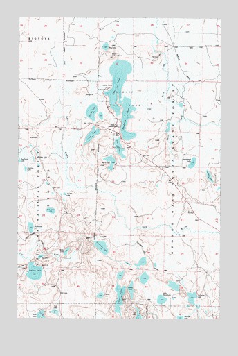
Coon Lake, MN USGS Topographic Map
Click on map above to begin viewing in our Map Viewer.

This topographic map contains these locations and features:
Feature Name Type Latitude Longitude GNIS ID View Map
Batson LakeLakeN47.6442°W93.6146°655266View Map
Cad LakeLakeN47.6277°W93.6014°655590View Map
Cameron LakeLakeN47.6547°W93.5732°655603View Map
Cameron Lake TrailTrailN47.6511°W93.5449°655605View Map
Canoe LakeLakeN47.6370°W93.5551°655624View Map
Cedar LakeLakeN47.7107°W93.5796°655687View Map
Coon LakeLakeN47.7230°W93.5637°655796View Map
Erickson LakeLakeN47.6844°W93.5072°656164View Map
Fox Farm LakeLakeN47.6903°W93.6241°656313View Map
Gorman LakeLakeN47.6869°W93.6203°656418View Map
Herron LakeLakeN47.6349°W93.5738°656577View Map
Homestead LakeLakeN47.6899°W93.5177°656626View Map
Isaac LakeLakeN47.7012°W93.5795°656719View Map
Joe Fell LakeLakeN47.6768°W93.5961°656799View Map
Joel LakeLakeN47.6698°W93.6044°656800View Map
Johnson CreekStreamN47.6469°W93.6180°656804View Map
La Barge LakeLakeN47.6333°W93.5674°659303View Map
Lake of IslesIslandN47.6958°W93.5630°656930View Map
Little Neck LakeLakeN47.6331°W93.5360°657095View Map
Marie LakeLakeN47.6876°W93.5688°657321View Map
McDonald LakeLakeN47.6627°W93.6168°657355View Map
Pine LakeLakeN47.7378°W93.5715°657837View Map
Sandwick LakeLakeN47.7082°W93.5582°658159View Map
Scenic Lookout TowerTowerN47.7333°W93.5680°659942View Map
Scenic State ParkParkN47.7158°W93.5630°658175View Map
Slauson LakeLakeN47.6338°W93.5621°658301View Map
State Park HeadquartersLocaleN47.7044°W93.5630°658459View Map
Tye LakeLakeN47.6506°W93.6107°658808View Map
Willis LakeLakeN47.6528°W93.5948°659020View Map
Woodland Terrace Mobile Home ParkPopulated PlaceN47.6972°W93.5333°2096568View Map

Note: Coordinates in the location and feature list above are referenced to NAD83 datum.


Copyright (C) 2008-2025 Ryan Niemi / Sunset Dynamics ... All Rights Reserved