TopoQuest Logo
Do you find TopoQuest useful?
Help keep TopoQuest running and adding new maps/features by donating!
Bitcoin:  19c7KJd3qBynnjoSw5npx9KScwjBe4ifkT
Litecoin:  LXs6TkuXGGXo1vDsWCkWVdjQX94eUKd6ui
Home View Maps Find Maps Find Places Resources & Links


Gordonsville, Tennessee Topographic Map

USGS Map Title: Gordonsville, TN
USGS Map MRC: 36085B8
DRG (GeoTIFF) Download: o36085b8.tif


Neighboring USGS Topographic Map Quads:


  Dixon Springs, TN  
36086C1
 

  Carthage, TN  
36085C8
 

  Granville, TN  
36085C7
 

  New Middleton, TN  
36086B1
 

  Gordonsville, TN  
36085B8
 

  Buffalo Valley, TN  
36085B7
 

  Alexandria, TN  
36086A1
 

  Liberty, TN  
36085A8
 

  Center Hill Dam, TN  
36085A7


Map MRC Location:

N37°
W86°
N37°
W85°
H8 H7 H6 H5 H4 H3 H2 H1
G8 G7 G6 G5 G4 G3 G2 G1
F8 F7 F6 F5 F4 F3 F2 F1
E8 E7 E6 E5 E4 E3 E2 E1
D8 D7 D6 D5 D4 D3 D2 D1
C8 C7 C6 C5 C4 C3 C2 C1
B8 B7 B6 B5 B4 B3 B2 B1
A8 A7 A6 A5 A4 A3 A2 A1
N36°
W86°
N36°
W85°

Gordonsville, TN USGS 1:24K Topographic Map Preview:
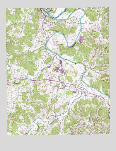
Gordonsville, TN USGS Topographic Map
Click on map above to begin viewing in our Map Viewer.

This topographic map contains these locations and features:
Feature Name Type Latitude Longitude GNIS ID View Map
Agee BranchStreamN36.1562°W85.9236°1275504View Map
Allgier HollowValleyN36.2264°W85.8837°1275616View Map
Baird CemeteryCemeteryN36.1809°W85.9819°1276125View Map
Baird Memorial CemeteryCemeteryN36.1417°W85.9483°1276132View Map
Ballard ChapelChurchN36.1828°W85.9003°1307261View Map
Ballard HollowValleyN36.1659°W85.8843°1276242View Map
Bennett CemeteryCemeteryN36.1278°W85.8833°1277012View Map
Benton McMillian Memorial BridgeBridgeN36.2345°W85.9089°1321083View Map
Bluff CreekStreamN36.2139°W85.9522°1277827View Map
Bluff CreekPopulated PlaceN36.2170°W85.9564°1314706View Map
Bluff Creek School (historical)SchoolN36.2123°W85.9536°1321084View Map
Bolling BranchStreamN36.1709°W85.8961°1277910View Map
Bolling Branch Church (historical)ChurchN36.1437°W85.8994°1321085View Map
Bolling Branch School (historical)SchoolN36.1562°W85.8955°1321086View Map
Boman BranchStreamN36.2139°W85.9608°1277916View Map
Boulton BendBendN36.2337°W85.9180°1305357View Map
Bowlings Branch Church of God of ProphecyChurchN36.1406°W85.9003°1321087View Map
Bradford CemeteryCemeteryN36.1937°W85.9964°1278164View Map
Bransford CemeteryCemeteryN36.1692°W85.9878°1278237View Map
Caney ForkStreamN36.2389°W85.9417°1326386View Map
Caney Fork ChurchChurchN36.2017°W85.9033°1305674View Map
Carthage JunctionPopulated PlaceN36.1678°W85.9133°1279828View Map
Cedar Point ChurchChurchN36.2164°W85.9561°1305783View Map
Coffee CemeteryCemeteryN36.1884°W85.9316°1280861View Map
Commissioner District 5CivilN36.1450°W85.9227°2464493View Map
Commissioner District 7CivilN36.2327°W85.9941°2464643View Map
Condit HollowValleyN36.2318°W85.8867°1306069View Map
Coopers School (historical)SchoolN36.2048°W85.9139°1321101View Map
Cordell Hull BridgeBridgeN36.2484°W85.9553°1281292View Map
Cowan CemeteryCemeteryN36.1614°W85.8869°1281456View Map
Cowan HollowValleyN36.1257°W85.8757°1269499View Map
Dripping Rock BluffCliffN36.2123°W85.9192°1282793View Map
Dry Fork CreekStreamN36.1801°W85.9703°1282978View Map
Ducktown CemeteryCemeteryN36.1812°W85.9805°1283052View Map
Ducktown ChurchChurchN36.1809°W85.9755°1307265View Map
Dyer BranchStreamN36.1923°W85.9936°1283255View Map
ElmwoodPopulated PlaceN36.2259°W85.8847°1283724View Map
Elmwood Post OfficePost OfficeN36.2247°W85.8845°1651662View Map
Elmwood School (historical)SchoolN36.2228°W85.8847°1321107View Map
Elmwood United Methodist ChurchChurchN36.2270°W85.8855°1321108View Map
Gibbs CemeteryCemeteryN36.2267°W85.9486°1285333View Map
GordonsvillePopulated PlaceN36.1726°W85.9297°1285704View Map
Gordonsville CemeteryCemeteryN36.1834°W85.9330°1285705View Map
Gordonsville Fire DepartmentBuildingN36.1733°W85.9300°2654996View Map
Gordonsville First Baptist ChurchChurchN36.1720°W85.9280°1321113View Map
Gordonsville High SchoolSchoolN36.1717°W85.9300°1321114View Map
Gordonsville Police DepartmentBuildingN36.1732°W85.9374°2765778View Map
Gordonsville Post OfficePost OfficeN36.1696°W85.9369°1651665View Map
Gwaltney CemeteryCemeteryN36.1395°W85.9364°1286467View Map
Heflin CemeteryCemeteryN36.1273°W85.9033°1287327View Map
Hell BendBendN36.2156°W85.9372°1287336View Map
HickmanPopulated PlaceN36.1439°W85.9405°1287546View Map
Hickman Baptist ChurchChurchN36.1428°W85.9428°1321120View Map
Hickman BranchStreamN36.1351°W85.9014°1287550View Map
Hickman CreekStreamN36.1787°W85.9100°1287556View Map
Hickman Post OfficePost OfficeN36.1450°W85.9409°1651667View Map
Hickman School (historical)SchoolN36.1420°W85.9380°1321121View Map
Hogan Creek ChurchChurchN36.2412°W85.9733°1287988View Map
Hogan Creek School (historical)SchoolN36.2342°W85.9942°1321122View Map
Interchange 258CrossingN36.1787°W85.9478°1312124View Map
James CemeteryCemeteryN36.1687°W85.9061°1289271View Map
Jersey Miniery Zinc Company DamDamN36.2184°W85.9117°1302427View Map
Jersey Miniery Zinc Company LakeReservoirN36.2170°W85.9097°1302426View Map
Lancaster HillPopulated PlaceN36.1273°W85.8822°1290573View Map
Manners CemeteryCemeteryN36.1542°W85.9061°1292585View Map
McDonald CemeteryCemeteryN36.1767°W85.9689°1293253View Map
Moore CemeteryCemeteryN36.1445°W85.9819°1294273View Map
Mulherrin CreekStreamN36.2039°W85.9394°1295075View Map
New Middleton Elementary SchoolSchoolN36.1764°W85.9989°1648446View Map
Newbell BranchStreamN36.1453°W85.9286°1295677View Map
Old MiddletonPopulated PlaceN36.1762°W85.9936°1296338View Map
Perkins BranchStreamN36.1876°W85.9039°1297185View Map
Pig BranchStreamN36.1412°W85.9605°1297432View Map
Preston CemeteryCemeteryN36.1762°W85.9203°1298485View Map
Raccoon BranchStreamN36.1370°W85.9350°1298788View Map
Smith County Vocational CenterSchoolN36.2270°W85.9447°1321150View Map
Snow CreekStreamN36.2406°W85.9069°1270783View Map
South CarthagePopulated PlaceN36.2420°W85.9519°1270836View Map
South Carthage Division (historical)CensusN36.1951°W85.9869°1648961View Map
South Carthage Police DepartmentBuildingN36.2417°W85.9525°2765903View Map
South Carthage Volunteer Fire DepartmentBuildingN36.2417°W85.9527°2654995View Map
Stewart CemeteryCemeteryN36.1506°W85.8766°1271364View Map
StonewallPopulated PlaceN36.1903°W85.8989°1271509View Map
Stonewall BridgeBridgeN36.1812°W85.9080°1307251View Map
Stonewall School (historical)SchoolN36.1828°W85.9005°1321152View Map
Sullivan Hall BranchStreamN36.1942°W85.9064°1271759View Map
Sykes Fire Department District 1BuildingN36.1344°W85.9729°2654623View Map
Town of GordonsvilleCivilN36.1814°W85.9322°2406592View Map
Town of South CarthageCivilN36.2409°W85.9575°2407369View Map
Trousdale HollowValleyN36.1887°W85.9011°1272913View Map
Trousdales Ferry (historical)CrossingN36.1862°W85.9050°1312143View Map
Turner High SchoolSchoolN36.2498°W85.9494°1273081View Map
Turney Ford FieldParkN36.1717°W85.9314°1307253View Map
Union Hill Cumberland Presbyterian ChurchChurchN36.1334°W85.9747°1307264View Map
Waggoner CemeteryCemeteryN36.2389°W85.9700°1273526View Map
Ward BranchStreamN36.2376°W85.9792°1273775View Map
Wilkerson CemeteryCemeteryN36.2031°W85.9961°1274588View Map
Winfree CemeteryCemeteryN36.2045°W85.9300°1274871View Map
Winfree KnobSummitN36.1576°W85.9675°1274872View Map
WRKM-AM (Carthage)TowerN36.2451°W85.9455°1639968View Map

Note: Coordinates in the location and feature list above are referenced to NAD83 datum.


Copyright (C) 2008-2024 Ryan Niemi / Sunset Dynamics ... All Rights Reserved