TopoQuest Logo
Do you find TopoQuest useful?
Help keep TopoQuest running and adding new maps/features by donating!
Bitcoin:  19c7KJd3qBynnjoSw5npx9KScwjBe4ifkT
Litecoin:  LXs6TkuXGGXo1vDsWCkWVdjQX94eUKd6ui
Home View Maps Find Maps Find Places Resources & Links


New Middleton, Tennessee Topographic Map

USGS Map Title: New Middleton, TN
USGS Map MRC: 36086B1
DRG (GeoTIFF) Download: o36086b1.tif


Neighboring USGS Topographic Map Quads:


  Bellwood, TN  
36086C2
 

  Dixon Springs, TN  
36086C1
 

  Carthage, TN  
36085C8
 

  Shop Springs, TN  
36086B2
 

  New Middleton, TN  
36086B1
 

  Gordonsville, TN  
36085B8
 

  Watertown, TN  
36086A2
 

  Alexandria, TN  
36086A1
 

  Liberty, TN  
36085A8


Map MRC Location:

N37°
W87°
N37°
W86°
H8 H7 H6 H5 H4 H3 H2 H1
G8 G7 G6 G5 G4 G3 G2 G1
F8 F7 F6 F5 F4 F3 F2 F1
E8 E7 E6 E5 E4 E3 E2 E1
D8 D7 D6 D5 D4 D3 D2 D1
C8 C7 C6 C5 C4 C3 C2 C1
B8 B7 B6 B5 B4 B3 B2 B1
A8 A7 A6 A5 A4 A3 A2 A1
N36°
W87°
N36°
W86°

New Middleton, TN USGS 1:24K Topographic Map Preview:
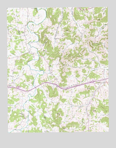
New Middleton, TN USGS Topographic Map
Click on map above to begin viewing in our Map Viewer.

This topographic map contains these locations and features:
Feature Name Type Latitude Longitude GNIS ID View Map
Agee BranchStreamN36.1528°W86.0264°1275503View Map
Barnett CemeteryCemeteryN36.2331°W86.0933°1276366View Map
Belle HillSummitN36.1926°W86.0555°1276957View Map
Bethlehem CemeteryCemeteryN36.2042°W86.0933°1277160View Map
Big Caney BranchStreamN36.1528°W86.1053°1277269View Map
Blue KnobSummitN36.2214°W86.0786°1277769View Map
Burgess KnobSummitN36.1467°W86.0194°1279041View Map
Clinton College (historical)SchoolN36.1742°W86.0111°1645087View Map
CommercePopulated PlaceN36.1401°W86.1033°1281040View Map
Commerce CemeteryCemeteryN36.1428°W86.1050°1281041View Map
Commerce School (historical)SchoolN36.1395°W86.1047°1323164View Map
Commissioner District 3CivilN36.1520°W86.0300°2464197View Map
Commissioner District 4CivilN36.2292°W86.0675°2464087View Map
Cub KnobSummitN36.2270°W86.0514°1281797View Map
Cumberland ChurchChurchN36.1442°W86.1061°1306225View Map
Davis CemeteryCemeteryN36.1345°W86.0317°1282155View Map
Denny BranchStreamN36.1870°W86.0005°1306328View Map
Denny CemeteryCemeteryN36.1737°W86.0119°1282345View Map
Dry Fork CreekStreamN36.1934°W86.0997°1282979View Map
Enoch CemeteryCemeteryN36.2239°W86.0625°1283805View Map
Evans MountainSummitN36.1489°W86.0069°1283912View Map
Flat RockPopulated PlaceN36.2256°W86.1028°1284415View Map
Flat Rock Church of ChristChurchN36.2253°W86.1039°1321110View Map
Fuller HollowValleyN36.1370°W86.0542°1285018View Map
Gills BranchStreamN36.1956°W86.0125°1285423View Map
Good Hope ChurchChurchN36.1814°W86.1192°1285624View Map
GrantPopulated PlaceN36.1889°W86.0722°1285846View Map
Grant Baptist ChurchChurchN36.1842°W86.0714°1321115View Map
Grant ChurchChurchN36.1914°W86.0722°1285849View Map
Grant School (historical)SchoolN36.1831°W86.0711°1321116View Map
Haley BranchStreamN36.1328°W86.1003°1286534View Map
Highers CemeteryCemeteryN36.2223°W86.0561°1287728View Map
Holmes Gap School (historical)SchoolN36.1262°W86.0764°1323188View Map
House CemeteryCemeteryN36.1784°W86.0639°1288486View Map
Interchange 254CrossingN36.1751°W86.0203°1312123View Map
Jennings (historical)Populated PlaceN36.2037°W86.0950°1312894View Map
Jennings ForkStreamN36.2098°W86.0958°1289382View Map
Kent CemeteryCemeteryN36.1845°W86.0714°1290089View Map
Little Caney BranchStreamN36.1526°W86.1169°1291413View Map
Locust KnobSummitN36.2376°W86.0122°1291795View Map
Macedonia Baptist ChurchChurchN36.1784°W86.0050°1321128View Map
Moore CemeteryCemeteryN36.1712°W86.0636°1294274View Map
New MiddletonPopulated PlaceN36.1748°W86.0058°1295606View Map
New Middleton Baptist ChurchChurchN36.1751°W86.0069°1321134View Map
Oliver BranchStreamN36.1889°W86.0094°1296416View Map
Phillips CemeteryCemeteryN36.1350°W86.0136°1297342View Map
Pilot KnobSummitN36.1292°W86.0567°1297489View Map
Rawls Creek ChurchChurchN36.2184°W86.0650°1298980View Map
Rollins CemeteryCemeteryN36.1728°W86.0380°1300036View Map
SaulsburyPopulated PlaceN36.1723°W86.1242°1312883View Map
Saulsbury ChurchChurchN36.1731°W86.1228°1300807View Map
Shaver CemeteryCemeteryN36.1850°W86.0703°1301288View Map
Shaver TownPopulated PlaceN36.1723°W86.0389°1315911View Map
Smith County Fire Department District 7BuildingN36.1734°W86.0100°2654866View Map
Tomahawk KnobSummitN36.1687°W86.0258°1272751View Map
Tuggle CemeteryCemeteryN36.2067°W86.0783°1272959View Map
Tuggle HollowValleyN36.2119°W86.0831°1272960View Map
Walnut KnobSummitN36.1434°W86.0608°1273740View Map

Note: Coordinates in the location and feature list above are referenced to NAD83 datum.


Copyright (C) 2008-2024 Ryan Niemi / Sunset Dynamics ... All Rights Reserved