TopoQuest Logo
Do you find TopoQuest useful?
Help keep TopoQuest running and adding new maps/features by donating!
Bitcoin:  19c7KJd3qBynnjoSw5npx9KScwjBe4ifkT
Litecoin:  LXs6TkuXGGXo1vDsWCkWVdjQX94eUKd6ui
Home View Maps Find Maps Find Places Resources & Links


Bark Shanty Gulch, California Topographic Map

USGS Map Title: Bark Shanty Gulch, CA
USGS Map MRC: 41123D5
DRG (GeoTIFF) Download: o41123d5.tif


Neighboring USGS Topographic Map Quads:


  Chimney Rock, CA  
41123E6
 

  Dillon Mountain, CA  
41123E5
 

  Ukonom Mountain, CA  
41123E4
 

  Lonesome Ridge, CA  
41123D6
 

  Bark Shanty Gulch, CA  
41123D5
 

  Somes Bar, CA  
41123D4
 

  Fish Lake, CA  
41123C6
 

  Orleans, CA  
41123C5
 

  Orleans Mountain, CA  
41123C4


Map MRC Location:

N42°
W124°
N42°
W123°
H8 H7 H6 H5 H4 H3 H2 H1
G8 G7 G6 G5 G4 G3 G2 G1
F8 F7 F6 F5 F4 F3 F2 F1
E8 E7 E6 E5 E4 E3 E2 E1
D8 D7 D6 D5 D4 D3 D2 D1
C8 C7 C6 C5 C4 C3 C2 C1
B8 B7 B6 B5 B4 B3 B2 B1
A8 A7 A6 A5 A4 A3 A2 A1
N41°
W124°
N41°
W123°

Bark Shanty Gulch, CA USGS 1:24K Topographic Map Preview:
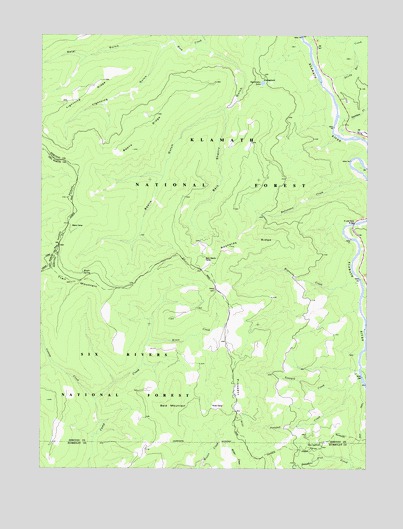
Bark Shanty Gulch, CA USGS Topographic Map
Click on map above to begin viewing in our Map Viewer.

This topographic map contains these locations and features:
Feature Name Type Latitude Longitude GNIS ID View Map
Bald MountainSummitN41.3921°W123.5756°1657982View Map
Bark Shanty CampLocaleN41.4351°W123.5642°256512View Map
Bark Shanty GulchValleyN41.4962°W123.5670°256514View Map
Beans CampLocaleN41.4440°W123.6126°256618View Map
Beans GulchValleyN41.4779°W123.5590°256619View Map
Beans RidgeRidgeN41.4704°W123.5876°256620View Map
Catsup CreekStreamN41.3846°W123.6045°258086View Map
Davis CreekStreamN41.4040°W123.5031°259086View Map
Donahue FlatFlatN41.3801°W123.5209°259467View Map
Green RiffleRapidsN41.4332°W123.5067°276871View Map
Halverson CreekStreamN41.4582°W123.5012°261033View Map
Hines CampLocaleN41.3929°W123.5606°261363View Map
Hines CreekStreamN41.4121°W123.5851°261364View Map
Irving CreekStreamN41.4679°W123.5006°225996View Map
Lightning GulchValleyN41.4966°W123.5800°262449View Map
Lightning RidgeRidgeN41.4837°W123.6076°262450View Map
Maple SpringSpringN41.4314°W123.6097°263184View Map
Natuket CreekStreamN41.4012°W123.5031°264006View Map
Ogaromtoc LakeLakeN41.4861°W123.5414°264307View Map
Prospect HillSummitN41.3915°W123.5514°265049View Map
Prospect Hill MineMineN41.3798°W123.5389°1665268View Map
R Lyle Davis BridgeBridgeN41.4454°W123.5064°265117View Map
Reynolds CreekStreamN41.4298°W123.5042°265384View Map
Reynolds RidgeRidgeN41.4390°W123.5470°265387View Map
Salal GulchValleyN41.4971°W123.5820°265746View Map
Sandy Bar CreekStreamN41.4862°W123.5173°265820View Map
Stanshaw CreekStreamN41.4762°W123.5123°267674View Map
Teneyck CreekStreamN41.4029°W123.5039°268141View Map
Trail MountainSummitN41.4285°W123.6142°1660021View Map
Young RanchLocaleN41.4721°W123.5034°276872View Map

Note: Coordinates in the location and feature list above are referenced to NAD83 datum.


Copyright (C) 2008-2024 Ryan Niemi / Sunset Dynamics ... All Rights Reserved