TopoQuest Logo
Do you find TopoQuest useful?
Help keep TopoQuest running and adding new maps/features by donating!
Bitcoin:  19c7KJd3qBynnjoSw5npx9KScwjBe4ifkT
Litecoin:  LXs6TkuXGGXo1vDsWCkWVdjQX94eUKd6ui
Home View Maps Find Maps Find Places Resources & Links


Milton, Tennessee Topographic Map

USGS Map Title: Milton, TN
USGS Map MRC: 35086H2
DRG (GeoTIFF) Download: o35086h2.tif


Neighboring USGS Topographic Map Quads:


  Vine, TN  
36086A3
 

  Watertown, TN  
36086A2
 

  Alexandria, TN  
36086A1
 

  Lascassas, TN  
35086H3
 

  Milton, TN  
35086H2
 

  Auburntown, TN  
35086H1
 

  Dillton, TN  
35086G3
 

  Readyville, TN  
35086G2
 

  Woodbury, TN  
35086G1


Map MRC Location:

N36°
W87°
N36°
W86°
H8 H7 H6 H5 H4 H3 H2 H1
G8 G7 G6 G5 G4 G3 G2 G1
F8 F7 F6 F5 F4 F3 F2 F1
E8 E7 E6 E5 E4 E3 E2 E1
D8 D7 D6 D5 D4 D3 D2 D1
C8 C7 C6 C5 C4 C3 C2 C1
B8 B7 B6 B5 B4 B3 B2 B1
A8 A7 A6 A5 A4 A3 A2 A1
N35°
W87°
N35°
W86°

Milton, TN USGS 1:24K Topographic Map Preview:
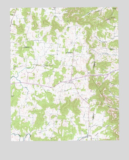
Milton, TN USGS Topographic Map
Click on map above to begin viewing in our Map Viewer.

This topographic map contains these locations and features:
Feature Name Type Latitude Longitude GNIS ID View Map
Alexander CemeteryCemeteryN35.8876°W86.1325°1643495View Map
Bains HollowValleyN35.9394°W86.1257°1647250View Map
Bradley Creek ChurchChurchN35.9465°W86.2194°1305383View Map
Bradley Creek Missionary ChurchChurchN35.9453°W86.2086°1305384View Map
Bradley Mill (historical)LocaleN35.9345°W86.2433°1323458View Map
Bradleys Creek CemeteryCemeteryN35.9456°W86.2197°1645549View Map
CainsvillePopulated PlaceN35.9853°W86.2489°1279296View Map
Cainsville Methodist ChurchChurchN35.9862°W86.2480°1323150View Map
Center Point Church (historical)ChurchN35.9687°W86.1350°1323159View Map
Cook CemeteryCemeteryN35.9592°W86.2094°1645589View Map
Cook CemeteryCemeteryN35.9145°W86.1622°1281111View Map
Craddock CemeteryCemeteryN35.9278°W86.2114°1645593View Map
Dement CemeteryCemeteryN35.9395°W86.2314°1645604View Map
Dry ForkStreamN35.9348°W86.2436°1282957View Map
Elrod CemeteryCemeteryN35.8862°W86.1928°1645631View Map
Ewingsville (historical)Populated PlaceN35.9742°W86.1736°1312834View Map
Fisher KnobSummitN35.9892°W86.1311°1284325View Map
Floyd CemeteryCemeteryN35.8920°W86.2244°1652137View Map
Floyd-Alexander CemeteryCemeteryN35.8867°W86.2244°1652136View Map
Gaines CemeteryCemeteryN35.9401°W86.2008°1285067View Map
Gloriana (historical)Populated PlaceN35.9759°W86.1886°1312840View Map
Gloriana ChurchChurchN35.9456°W86.2092°1285531View Map
Green Valley Dairy FarmsLocaleN35.9619°W86.1747°2635266View Map
GreenvalePopulated PlaceN35.9998°W86.1978°1314263View Map
Halls Mill (historical)LocaleN35.8756°W86.2350°1645674View Map
Jones CemeteryCemeteryN35.8920°W86.2247°1645734View Map
Knight School (historical)SchoolN35.9959°W86.1519°1323196View Map
Lascassas Volunteer Fire Department SubstationBuildingN35.9307°W86.1914°2654066View Map
Lawrence KnobSummitN35.9987°W86.1261°1290789View Map
Mathes CemeteryCemeteryN35.9301°W86.2269°1645786View Map
McKnight CemeteryCemeteryN35.8895°W86.1550°1643590View Map
McPeaks Mill (historical)LocaleN35.9512°W86.2189°1323526View Map
MiltonPopulated PlaceN35.9298°W86.1817°1294012View Map
Milton CemeteryCemeteryN35.9309°W86.1900°1294015View Map
Milton Post OfficePost OfficeN35.9301°W86.1815°1652154View Map
Northcutt BranchStreamN35.8787°W86.1619°1295953View Map
Oregon (historical)Populated PlaceN35.9692°W86.2128°1312878View Map
Oregon Church (historical)ChurchN35.9673°W86.2086°1323231View Map
Overall ChurchChurchN35.9173°W86.2486°1296535View Map
Overalls Camp Ground (historical)LocaleN35.9170°W86.2325°1645851View Map
Patterson CemeteryCemeteryN35.9442°W86.1667°1645862View Map
Patterson CemeteryCemeteryN35.9120°W86.2336°1645863View Map
PorterfieldPopulated PlaceN35.8798°W86.1617°1315769View Map
Rucker Goodloe CemeteryCemeteryN35.9020°W86.1444°1643633View Map
Simpson CemeteryCemeteryN35.9501°W86.1778°1645934View Map
Stonewall AirparkAirportN35.9002°W86.2036°2675521View Map
Travis CemeteryCemeteryN35.8828°W86.1372°1643658View Map
Trimble BranchStreamN35.8809°W86.2280°1272882View Map
Trimble ChurchChurchN35.8926°W86.1986°1304165View Map
Turney KnobSummitN35.9881°W86.1383°1273095View Map
Vaught CemeteryCemeteryN35.9251°W86.2047°1645976View Map
Vaught CemeteryCemeteryN35.9109°W86.2005°1645977View Map

Note: Coordinates in the location and feature list above are referenced to NAD83 datum.


Copyright (C) 2008-2024 Ryan Niemi / Sunset Dynamics ... All Rights Reserved