TopoQuest Logo
Do you find TopoQuest useful?
Help keep TopoQuest running and adding new maps/features by donating!
Bitcoin:  19c7KJd3qBynnjoSw5npx9KScwjBe4ifkT
Litecoin:  LXs6TkuXGGXo1vDsWCkWVdjQX94eUKd6ui
Home View Maps Find Maps Find Places Resources & Links


Palomar Observatory, California Topographic Map

USGS Map Title: Palomar Observatory, CA
USGS Map MRC: 33116C7
DRG (GeoTIFF) Download: o33116c7.tif


Neighboring USGS Topographic Map Quads:


  Vail Lake, CA  
33116D8
 

  Aguanga, CA  
33116D7
 

  Beauty Mountain, CA  
33116D6
 

  Boucher Hill, CA  
33116C8
 

  Palomar Observatory, CA  
33116C7
 

  Warner Springs, CA  
33116C6
 

  Rodriguez Mountain, CA  
33116B8
 

  Mesa Grande, CA  
33116B7
 

  Warners Ranch, CA  
33116B6


Map MRC Location:

N34°
W117°
N34°
W116°
H8 H7 H6 H5 H4 H3 H2 H1
G8 G7 G6 G5 G4 G3 G2 G1
F8 F7 F6 F5 F4 F3 F2 F1
E8 E7 E6 E5 E4 E3 E2 E1
D8 D7 D6 D5 D4 D3 D2 D1
C8 C7 C6 C5 C4 C3 C2 C1
B8 B7 B6 B5 B4 B3 B2 B1
A8 A7 A6 A5 A4 A3 A2 A1
N33°
W117°
N33°
W116°

Palomar Observatory, CA USGS 1:24K Topographic Map Preview:
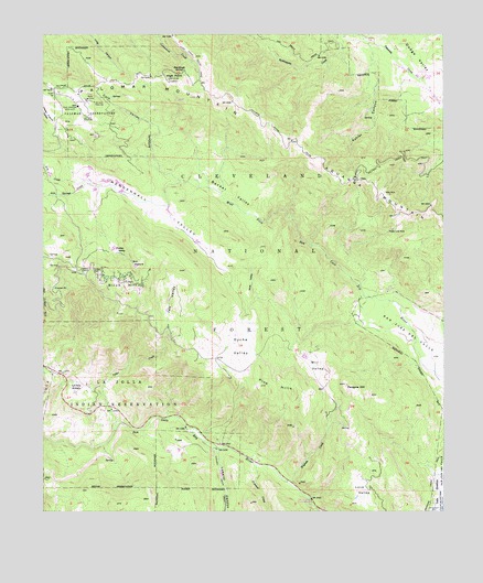
Palomar Observatory, CA USGS Topographic Map
Click on map above to begin viewing in our Map Viewer.

This topographic map contains these locations and features:
Feature Name Type Latitude Longitude GNIS ID View Map
Aguanga MountainSummitN33.3384°W116.7853°1660236View Map
Barker ValleyValleyN33.3264°W116.8064°269679View Map
Barker Valley SpurTrailN33.3420°W116.7992°269680View Map
Barker Valley TrailTrailN33.3484°W116.8231°274862View Map
Birch HillSummitN33.3086°W116.8453°269864View Map
Bull PastureFlatN33.3150°W116.8456°239813View Map
Cedar CreekStreamN33.2706°W116.8536°270363View Map
Colb ValleyValleyN33.3375°W116.8347°270529View Map
Crestline CampLocaleN33.3145°W116.8631°270686View Map
Dyche ValleyValleyN33.2909°W116.8084°270960View Map
Eighteen-Inch TelescopeLocaleN33.3534°W116.8614°1654621View Map
Fifty-Two Inch TelescopeLocaleN33.3573°W116.8597°1654636View Map
Frazier PointCapeN33.3081°W116.8725°271212View Map
Fry CreekStreamN33.3359°W116.8625°271247View Map
Grammer Ranch (historical)LocaleN33.3531°W116.7717°1703108View Map
Hale TelescopeLocaleN33.3564°W116.8647°1654658View Map
Halfway Truck TrailTrailN33.3425°W116.7667°271477View Map
Henshaw Truck TrailTrailN33.2584°W116.7542°271553View Map
Henshaw Wildlife Viewing SiteLocaleN33.2555°W116.7597°2548704View Map
High PointSummitN33.3634°W116.8356°271572View Map
High Point LookoutLocaleN33.3631°W116.8367°274861View Map
Iron Springs CreekStreamN33.3359°W116.8625°271733View Map
Jeff ValleyValleyN33.3014°W116.8364°271778View Map
Kohler CanyonValleyN33.3681°W116.7731°244358View Map
La Jolla AmagoPopulated PlaceN33.2828°W116.8634°1660857View Map
La Jolla Recreation SiteLocaleN33.2767°W116.8547°1662407View Map
Love ValleyBasinN33.2539°W116.7772°272248View Map
Lusardi CanyonValleyN33.2664°W116.8209°272285View Map
Maple Lode MineMineN33.3239°W116.7664°272340View Map
Mendenhall ValleyBasinN33.3298°W116.8370°272411View Map
Oak Grove Truck TrailTrailN33.3695°W116.7892°272746View Map
Palomar Divide Truck TrailTrailN33.3617°W116.8486°272857View Map
Palomar Fire StationLocaleN33.3598°W116.8725°274860View Map
Palomar MountainRidgeN33.3634°W116.8361°272858View Map
Palomar Mountain Interpretive SiteBuildingN33.3143°W116.8654°2548721View Map
Palomar Mountain Post OfficePost OfficeN33.3145°W116.8655°2769551View Map
Palomar Mountain Volunteer Fire DepartmentBuildingN33.3127°W116.8626°2664630View Map
Palomar ObservatoryLocaleN33.3545°W116.8614°1654756View Map
Palomar ParkFlatN33.3134°W116.8606°272861View Map
Parayne HillSummitN33.2831°W116.7809°272875View Map
Pedley ValleyValleyN33.3203°W116.8548°272915View Map
Pine HillsRangeN33.2814°W116.8047°272990View Map
Pine ValleyValleyN33.3067°W116.8089°273006View Map
Prisoner CreekStreamN33.2620°W116.8092°273130View Map
San Luis Rey CampLocaleN33.2531°W116.7920°273499View Map
San Luis Rey Picnic GroundLocaleN33.2528°W116.7922°1703110View Map
Sourdough SpringSpringN33.3653°W116.8322°273809View Map
Ware MineMineN33.3331°W116.7672°274379View Map
West Fork Conservation CampLocaleN33.3081°W116.7672°1662406View Map
Wigham CreekStreamN33.2578°W116.7997°274491View Map
Will ValleyValleyN33.2948°W116.7947°274502View Map

Note: Coordinates in the location and feature list above are referenced to NAD83 datum.


Copyright (C) 2008-2024 Ryan Niemi / Sunset Dynamics ... All Rights Reserved