TopoQuest Logo
Do you find TopoQuest useful?
Help keep TopoQuest running and adding new maps/features by donating!
Bitcoin:  19c7KJd3qBynnjoSw5npx9KScwjBe4ifkT
Litecoin:  LXs6TkuXGGXo1vDsWCkWVdjQX94eUKd6ui
Home View Maps Find Maps Find Places Resources & Links


Aguanga, California Topographic Map

USGS Map Title: Aguanga, CA
USGS Map MRC: 33116D7
DRG (GeoTIFF) Download: o33116d7.tif


Neighboring USGS Topographic Map Quads:


  Sage, CA  
33116E8
 

  Cahuilla Mountain, CA  
33116E7
 

  Anza, CA  
33116E6
 

  Vail Lake, CA  
33116D8
 

  Aguanga, CA  
33116D7
 

  Beauty Mountain, CA  
33116D6
 

  Boucher Hill, CA  
33116C8
 

  Palomar Observatory, CA  
33116C7
 

  Warner Springs, CA  
33116C6


Map MRC Location:

N34°
W117°
N34°
W116°
H8 H7 H6 H5 H4 H3 H2 H1
G8 G7 G6 G5 G4 G3 G2 G1
F8 F7 F6 F5 F4 F3 F2 F1
E8 E7 E6 E5 E4 E3 E2 E1
D8 D7 D6 D5 D4 D3 D2 D1
C8 C7 C6 C5 C4 C3 C2 C1
B8 B7 B6 B5 B4 B3 B2 B1
A8 A7 A6 A5 A4 A3 A2 A1
N33°
W117°
N33°
W116°

Aguanga, CA USGS 1:24K Topographic Map Preview:
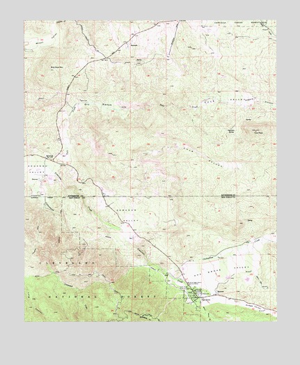
Aguanga, CA USGS Topographic Map
Click on map above to begin viewing in our Map Viewer.

This topographic map contains these locations and features:
Feature Name Type Latitude Longitude GNIS ID View Map
AguangaPopulated PlaceN33.4428°W116.8650°269448View Map
Aguanga Census Designated PlaceCensusN33.4522°W116.8555°2582929View Map
Aguanga Post OfficePost OfficeN33.4429°W116.8646°2769530View Map
Aguanga TrailTrailN33.4095°W116.8692°269449View Map
Billy Goat MountainSummitN33.4798°W116.8625°269862View Map
Cahuilla CreekStreamN33.4989°W116.8603°270143View Map
Cahuilla ValleyValleyN33.4959°W116.7925°255394View Map
Camp Wright Historical MarkerParkN33.3884°W116.7934°270233View Map
Chihuahua CreekStreamN33.3978°W116.8089°270416View Map
Culp ValleyValleyN33.4409°W116.8189°270713View Map
Cutca TrailTrailN33.3942°W116.8639°270720View Map
Dameron ValleyValleyN33.4201°W116.8412°270750View Map
Dodge ValleyValleyN33.3848°W116.7834°270886View Map
Dry RanchLocaleN33.4650°W116.8406°270932View Map
High Point Truck TrailTrailN33.3917°W116.8339°271573View Map
Oak GrovePopulated PlaceN33.3850°W116.7892°272744View Map
Oak Grove CampgroundLocaleN33.3864°W116.7892°2548717View Map
Oak Grove Census Designated PlaceCensusN33.3843°W116.7915°2628768View Map
Oak Grove Ranger StationBuildingN33.3857°W116.7913°2548718View Map
Oak Grove Stage Station Historical MarkerParkN33.3903°W116.7947°1654747View Map
Oak Grove ValleyValleyN33.3936°W116.7947°272747View Map
Rattlesnake CreekStreamN33.3761°W116.7809°273215View Map
Rogers CanyonValleyN33.4636°W116.7911°273336View Map
Sycamore SpringSpringN33.4549°W116.7736°274013View Map
Tule CreekStreamN33.4398°W116.8645°274214View Map
Tule PeakSummitN33.4539°W116.7611°274215View Map
Tule ValleyValleyN33.4633°W116.7915°274217View Map
Ward Ranch AirportAirportN33.4278°W116.8434°1653205View Map

Note: Coordinates in the location and feature list above are referenced to NAD83 datum.


Copyright (C) 2008-2024 Ryan Niemi / Sunset Dynamics ... All Rights Reserved