TopoQuest Logo
Do you find TopoQuest useful?
Help keep TopoQuest running and adding new maps/features by donating!
Bitcoin:  19c7KJd3qBynnjoSw5npx9KScwjBe4ifkT
Litecoin:  LXs6TkuXGGXo1vDsWCkWVdjQX94eUKd6ui
Home View Maps Find Maps Find Places Resources & Links


Como, Tennessee Topographic Map

USGS Map Title: Como, TN
USGS Map MRC: 36088C5
DRG (GeoTIFF) Download: o36088c5.tif


Neighboring USGS Topographic Map Quads:


  Latham, TN  
36088D6
 

  Palmersville, TN  
36088D5
 

  Cottage Grove, TN  
36088D4
 

  Dresden, TN  
36088C6
 

  Como, TN  
36088C5
 

  Osage, TN  
36088C4
 

  Pillowville, TN  
36088B6
 

  McKenzie, TN  
36088B5
 

  Henry, TN  
36088B4


Map MRC Location:

N37°
W89°
N37°
W88°
H8 H7 H6 H5 H4 H3 H2 H1
G8 G7 G6 G5 G4 G3 G2 G1
F8 F7 F6 F5 F4 F3 F2 F1
E8 E7 E6 E5 E4 E3 E2 E1
D8 D7 D6 D5 D4 D3 D2 D1
C8 C7 C6 C5 C4 C3 C2 C1
B8 B7 B6 B5 B4 B3 B2 B1
A8 A7 A6 A5 A4 A3 A2 A1
N36°
W89°
N36°
W88°

Como, TN USGS 1:24K Topographic Map Preview:
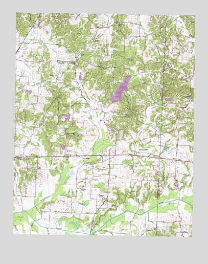
Como, TN USGS Topographic Map
Click on map above to begin viewing in our Map Viewer.

This topographic map contains these locations and features:
Feature Name Type Latitude Longitude GNIS ID View Map
Allman CemeteryCemeteryN36.2939°W88.5759°1322257View Map
Arnold BranchStreamN36.2506°W88.5689°1275881View Map
Campbell CemeteryCemeteryN36.2659°W88.5567°1279434View Map
Campbell CemeteryCemeteryN36.3537°W88.5045°1326004View Map
Capps BranchStreamN36.3023°W88.5670°1279633View Map
Central High School (historical)SchoolN36.2939°W88.5578°1322284View Map
Central SchoolSchoolN36.2920°W88.5634°1280181View Map
ComoPopulated PlaceN36.2931°W88.5123°1281048View Map
Como Post OfficePost OfficeN36.2934°W88.5120°1650785View Map
Cunningham MineMineN36.3503°W88.5292°2724760View Map
Cypress Creek Dam Number SevenDamN36.3317°W88.6151°1302513View Map
Cypress Creek Dam Number SixDamN36.3551°W88.6001°1302535View Map
Cypress Creek Lake Number SevenReservoirN36.3306°W88.6156°1302514View Map
Cypress Creek Lake Number SixReservoirN36.3551°W88.6001°1302534View Map
Dry CreekStreamN36.2673°W88.6059°1282922View Map
Dunlap (historical)Populated PlaceN36.3473°W88.6056°1312591View Map
Eagle HillPopulated PlaceN36.3195°W88.5431°1312592View Map
Eagle Hill Community CenterLocaleN36.3178°W88.5453°1283294View Map
Eagle Hill School (historical)SchoolN36.3178°W88.5453°1322304View Map
Fields CemeteryCemeteryN36.3717°W88.5170°1326036View Map
Garrett CemeteryCemeteryN36.3189°W88.5753°1285191View Map
Garrett LakeReservoirN36.3319°W88.5518°1302507View Map
Glasgow BranchStreamN36.2778°W88.5909°1285487View Map
Hickory Grove CemeteryCemeteryN36.3378°W88.5950°1322339View Map
Hickory Grove ChurchChurchN36.3384°W88.5959°1287593View Map
Hodgers PondLakeN36.2725°W88.5653°1287954View Map
Hodges CemeteryCemeteryN36.3626°W88.5578°1287962View Map
Hodges ChapelChurchN36.3606°W88.5706°1287966View Map
Hodges Chapel CemeteryCemeteryN36.3609°W88.5698°1322341View Map
J and S Poultry FarmsLocaleN36.3522°W88.5050°2635248View Map
JewellPopulated PlaceN36.3362°W88.6064°1289423View Map
Jolley Springs ChurchChurchN36.3062°W88.5834°1289681View Map
Jolly Springs CemeteryCemeteryN36.3059°W88.5817°1322345View Map
Kennedy CemeteryCemeteryN36.3498°W88.5467°1290073View Map
Little Zion CemeteryCemeteryN36.3687°W88.5542°1322356View Map
Little Zion ChurchChurchN36.3695°W88.5545°1291716View Map
Little Zion School (historical)SchoolN36.3701°W88.5559°1322357View Map
Macks Grove CemeteryCemeteryN36.3667°W88.6134°1322360View Map
Macks Grove ChurchChurchN36.3673°W88.6137°1292455View Map
Millers Store (historical)LocaleN36.3506°W88.5826°1322377View Map
Morris BranchStreamN36.2537°W88.6023°1294409View Map
Muzzalls PondLakeN36.2673°W88.5757°1295177View Map
New Hope CemeteryCemeteryN36.2551°W88.5687°1322390View Map
New Hope ChurchChurchN36.2551°W88.5695°1295555View Map
Old Town CreekStreamN36.2689°W88.5031°1296383View Map
Olive Branch CemeteryCemeteryN36.3276°W88.5028°1326099View Map
Olive Branch ChurchChurchN36.3284°W88.5025°1296408View Map
Olivet CemeteryCemeteryN36.2751°W88.5775°1322403View Map
Olivet ChurchChurchN36.2753°W88.5781°1296429View Map
Ore SpringsPopulated PlaceN36.2948°W88.5781°1315655View Map
Ore Springs / Como Volunteer Fire Department Station 1BuildingN36.2916°W88.5118°2653893View Map
Ore Springs / Como Volunteer Fire Department Station 2BuildingN36.3415°W88.5577°2654100View Map
Osteen Store (historical)LocaleN36.3628°W88.6164°1322404View Map
Owens CemeteryCemeteryN36.3517°W88.5800°1296573View Map
Peelers PondLakeN36.3470°W88.5936°1297115View Map
Phelps CemeteryCemeteryN36.2803°W88.5037°1326110View Map
Platts PondReservoirN36.2997°W88.5202°1297781View Map
Pleasant View Church (historical)ChurchN36.3267°W88.5959°1322425View Map
Pride CemeteryCemeteryN36.2864°W88.5239°1298527View Map
Steel BranchStreamN36.2628°W88.6187°1271301View Map
Summers CreekStreamN36.2528°W88.5928°1271838View Map
Taylor CemeteryCemeteryN36.3353°W88.6175°1272215View Map
Taylors PondLakeN36.2946°W88.6201°1272253View Map
Thompson CreekStreamN36.2601°W88.6128°1304078View Map
Thompson Creek BranchStreamN36.3137°W88.5662°1272541View Map
Thompson Creek ChurchChurchN36.2978°W88.5384°1304080View Map
Thompson Creek Dam FourDamN36.3259°W88.5570°1302508View Map
Thompson Creek Number Eight DamDamN36.3384°W88.5801°1302517View Map
Thompson Creek Number Eight LakeReservoirN36.3396°W88.5796°1302518View Map
Thompson Creek Number Five DamDamN36.3273°W88.5202°1302506View Map
Thompson Creek Number Five LakeReservoirN36.3275°W88.5176°1307199View Map
Thompson Creek Number Three DamDamN36.3167°W88.5867°1302500View Map
Thompson Creek Number Three LakeReservoirN36.3145°W88.5897°1302501View Map
Thompson Creek Number Two DamDamN36.3001°W88.5934°1302488View Map
Thompson Creek Number Two LakeReservoirN36.3000°W88.5913°1302489View Map
Tomlinson CemeteryCemeteryN36.3045°W88.5356°1272757View Map
Tumbling CreekStreamN36.2528°W88.5656°1304190View Map
Wesley Chapel CemeteryCemeteryN36.3476°W88.5828°1322480View Map
Wesleys ChapelChurchN36.3476°W88.5839°1274128View Map
Wesleys Chapel School (historical)SchoolN36.3481°W88.5834°1322481View Map

Note: Coordinates in the location and feature list above are referenced to NAD83 datum.


Copyright (C) 2008-2024 Ryan Niemi / Sunset Dynamics ... All Rights Reserved