TopoQuest Logo
Do you find TopoQuest useful?
Help keep TopoQuest running and adding new maps/features by donating!
Bitcoin:  19c7KJd3qBynnjoSw5npx9KScwjBe4ifkT
Litecoin:  LXs6TkuXGGXo1vDsWCkWVdjQX94eUKd6ui
Home View Maps Find Maps Find Places Resources & Links


Biggs, Illinois Topographic Map

USGS Map Title: Biggs, IL
USGS Map MRC: 40089B8
DRG (GeoTIFF) Download: o40089b8.tif


Neighboring USGS Topographic Map Quads:


  Havana, IL  
40090C1
 

  Topeka, IL  
40089C8
 

  Forest City, IL  
40089C7
 

  Kilbourne, IL  
40090B1
 

  Biggs, IL  
40089B8
 

  Easton, IL  
40089B7
 

  Newmansville, IL  
40090A1
 

  Oakford, IL  
40089A8
 

  Petersburg, IL  
40089A7


Map MRC Location:

N41°
W90°
N41°
W89°
H8 H7 H6 H5 H4 H3 H2 H1
G8 G7 G6 G5 G4 G3 G2 G1
F8 F7 F6 F5 F4 F3 F2 F1
E8 E7 E6 E5 E4 E3 E2 E1
D8 D7 D6 D5 D4 D3 D2 D1
C8 C7 C6 C5 C4 C3 C2 C1
B8 B7 B6 B5 B4 B3 B2 B1
A8 A7 A6 A5 A4 A3 A2 A1
N40°
W90°
N40°
W89°

Biggs, IL USGS 1:24K Topographic Map Preview:
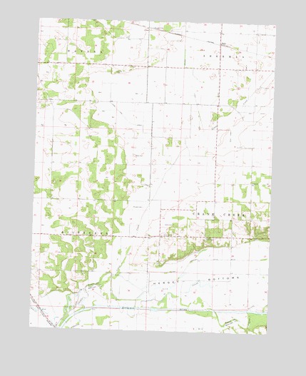
Biggs, IL USGS Topographic Map
Click on map above to begin viewing in our Map Viewer.

This topographic map contains these locations and features:
Feature Name Type Latitude Longitude GNIS ID View Map
Baker CemeteryCemeteryN40.1959°W89.9479°403821View Map
Baker School (historical)SchoolN40.1995°W89.9387°423857View Map
BiggsPopulated PlaceN40.2414°W89.9043°422462View Map
Biggs DitchCanalN40.2250°W89.9043°404442View Map
Carter CemeteryCemeteryN40.1681°W89.9265°405648View Map
Chaney CemeteryCemeteryN40.2295°W89.9590°405951View Map
Chaney Union School (historical)SchoolN40.2387°W89.9612°423858View Map
Crane CreekStreamN40.1334°W89.9715°406738View Map
Crane Creek Town HallBuildingN40.1859°W89.8851°423859View Map
Herget Drainage DitchCanalN40.1548°W89.8979°410093View Map
Herget Grove School (historical)SchoolN40.1598°W89.9051°423862View Map
Holstlaw CemeteryCemeteryN40.1639°W89.9309°410415View Map
Hurd Lake DitchCanalN40.2106°W89.9532°410705View Map
Mason CountyCivilN40.2396°W89.9168°424261View Map
Morgan CemeteryCemeteryN40.1749°W89.9427°413814View Map
New Lebanon CemeteryCemeteryN40.1845°W89.9393°1966348View Map
New Lebanon ChurchChurchN40.1839°W89.9396°414438View Map
Newton DitchCanalN40.2250°W89.9190°414501View Map
Oneal School (historical)SchoolN40.1625°W89.9532°423869View Map
Pecan CreekStreamN40.1309°W89.9901°415498View Map
Perry SloughLakeN40.1442°W89.9111°415565View Map
PetervillePopulated PlaceN40.2170°W89.9932°1821489View Map
Peterville Hall (historical)BuildingN40.2323°W89.9973°423870View Map
Peterville School (historical)SchoolN40.2267°W89.9996°423871View Map
Poplar CityPopulated PlaceN40.2473°W89.9398°423075View Map
Sear's CemeteryCemeteryN40.1796°W89.9015°1964950View Map
Sears Grove School (historical)SchoolN40.1800°W89.9043°423873View Map
Sherman Valley School (historical)SchoolN40.2317°W89.8946°423874View Map
Tomlin DitchCanalN40.2420°W89.8898°419773View Map
Township of Crane CreekCivilN40.1745°W89.8827°428852View Map
Township of KilbourneCivilN40.1665°W89.9988°422228View Map
Wash Lake SloughCanalN40.2000°W89.8976°420547View Map

Note: Coordinates in the location and feature list above are referenced to NAD83 datum.


Copyright (C) 2008-2024 Ryan Niemi / Sunset Dynamics ... All Rights Reserved