TopoQuest Logo
Do you find TopoQuest useful?
Help keep TopoQuest running and adding new maps/features by donating!
Bitcoin:  19c7KJd3qBynnjoSw5npx9KScwjBe4ifkT
Litecoin:  LXs6TkuXGGXo1vDsWCkWVdjQX94eUKd6ui
Home View Maps Find Maps Find Places Resources & Links


Oakford, Illinois Topographic Map

USGS Map Title: Oakford, IL
USGS Map MRC: 40089A8
DRG (GeoTIFF) Download: o40089a8.tif


Neighboring USGS Topographic Map Quads:


  Kilbourne, IL  
40090B1
 

  Biggs, IL  
40089B8
 

  Easton, IL  
40089B7
 

  Newmansville, IL  
40090A1
 

  Oakford, IL  
40089A8
 

  Petersburg, IL  
40089A7
 

  Ashland, IL  
39090H1
 

  Tallula, IL  
39089H8
 

  Salisbury, IL  
39089H7


Map MRC Location:

N41°
W90°
N41°
W89°
H8 H7 H6 H5 H4 H3 H2 H1
G8 G7 G6 G5 G4 G3 G2 G1
F8 F7 F6 F5 F4 F3 F2 F1
E8 E7 E6 E5 E4 E3 E2 E1
D8 D7 D6 D5 D4 D3 D2 D1
C8 C7 C6 C5 C4 C3 C2 C1
B8 B7 B6 B5 B4 B3 B2 B1
A8 A7 A6 A5 A4 A3 A2 A1
N40°
W90°
N40°
W89°

Oakford, IL USGS 1:24K Topographic Map Preview:
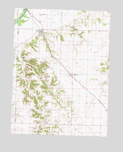
Oakford, IL USGS Topographic Map
Click on map above to begin viewing in our Map Viewer.

This topographic map contains these locations and features:
Feature Name Type Latitude Longitude GNIS ID View Map
AtterberryPopulated PlaceN40.0609°W89.9237°403706View Map
Atterberry CemeteryCemeteryN40.0374°W89.9282°403707View Map
Atterberry Community Baptist ChurchChurchN40.0606°W89.9243°1808796View Map
Atterberry Number 10 Election PrecinctCivilN40.0434°W89.9480°1928440View Map
Atterberry Post OfficePost OfficeN40.0603°W89.9240°1808797View Map
BobtownPopulated PlaceN40.0762°W89.9882°422483View Map
Concord CemeteryCemeteryN40.0550°W89.8814°406442View Map
Cuttington CreekStreamN40.0137°W89.9571°406914View Map
Dunschen CemeteryCemeteryN40.0534°W89.9946°407515View Map
Hash CemeteryCemeteryN40.0142°W89.9251°409910View Map
Hazel Dell School (historical)SchoolN40.0248°W89.9568°423881View Map
HilltopPopulated PlaceN40.0259°W89.8754°422808View Map
Kay Watkins School (historical)SchoolN40.1159°W89.9084°423884View Map
Kingfisher HillSummitN40.0734°W89.9840°411503View Map
Lafayette School (historical)SchoolN40.0289°W89.9946°423886View Map
Little Grove CreekStreamN40.0720°W89.9876°412348View Map
Little Grove School (historical)SchoolN40.0106°W89.9126°423888View Map
Millseed HollowValleyN40.0606°W89.9840°413624View Map
Mott HollowValleyN40.1010°W89.9637°413895View Map
Mound LakeLakeN40.1195°W89.9650°413914View Map
New Hope Baptist ChurchChurchN40.1050°W89.8893°414430View Map
OakfordPopulated PlaceN40.1025°W89.9632°414883View Map
Oakford Fire DepartmentBuildingN40.1022°W89.9633°2640473View Map
Oakford Number 9 Election PrecinctCivilN40.1049°W89.9487°1928582View Map
Oakford Post OfficePost OfficeN40.1020°W89.9654°2788849View Map
Oakford United Methodist ChurchChurchN40.1028°W89.9632°1808809View Map
Old Concord CemeteryCemeteryN40.0405°W89.8786°415008View Map
Panther School (historical)SchoolN40.0614°W89.8862°423890View Map
Tar CreekStreamN40.1106°W89.9962°419543View Map
Tebrugge MineMineN40.0106°W89.9612°423895View Map
Village of OakfordCivilN40.1009°W89.9653°2399542View Map
Watkins CemeteryCemeteryN40.0714°W89.9440°420639View Map
William Watkins School (historical)SchoolN40.0945°W89.9132°423897View Map

Note: Coordinates in the location and feature list above are referenced to NAD83 datum.


Copyright (C) 2008-2024 Ryan Niemi / Sunset Dynamics ... All Rights Reserved