TopoQuest Logo
Do you find TopoQuest useful?
Help keep TopoQuest running and adding new maps/features by donating!
Bitcoin:  19c7KJd3qBynnjoSw5npx9KScwjBe4ifkT
Litecoin:  LXs6TkuXGGXo1vDsWCkWVdjQX94eUKd6ui
Home View Maps Find Maps Find Places Resources & Links


Topeka, Illinois Topographic Map

USGS Map Title: Topeka, IL
USGS Map MRC: 40089C8
DRG (GeoTIFF) Download: o40089c8.tif


Neighboring USGS Topographic Map Quads:


  Saint David, IL  
40090D1
 

  Duck Island, IL  
40089D8
 

  Manito, IL  
40089D7
 

  Havana, IL  
40090C1
 

  Topeka, IL  
40089C8
 

  Forest City, IL  
40089C7
 

  Kilbourne, IL  
40090B1
 

  Biggs, IL  
40089B8
 

  Easton, IL  
40089B7


Map MRC Location:

N41°
W90°
N41°
W89°
H8 H7 H6 H5 H4 H3 H2 H1
G8 G7 G6 G5 G4 G3 G2 G1
F8 F7 F6 F5 F4 F3 F2 F1
E8 E7 E6 E5 E4 E3 E2 E1
D8 D7 D6 D5 D4 D3 D2 D1
C8 C7 C6 C5 C4 C3 C2 C1
B8 B7 B6 B5 B4 B3 B2 B1
A8 A7 A6 A5 A4 A3 A2 A1
N40°
W90°
N40°
W89°

Topeka, IL USGS 1:24K Topographic Map Preview:
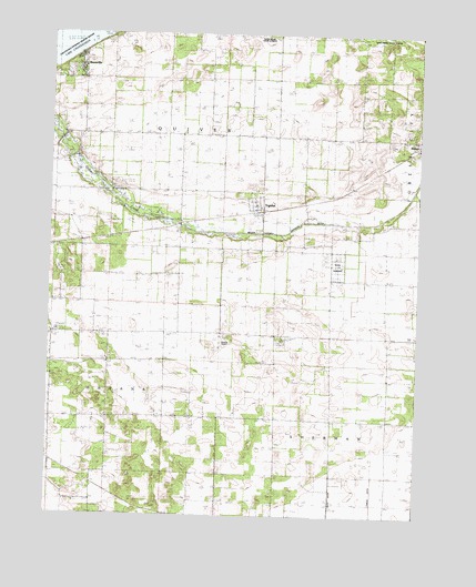
Topeka, IL USGS Topographic Map
Click on map above to begin viewing in our Map Viewer.

This topographic map contains these locations and features:
Feature Name Type Latitude Longitude GNIS ID View Map
Bishop CemeteryCemeteryN40.3504°W89.8791°1964911View Map
BuzzvillePopulated PlaceN40.3662°W89.9904°1720354View Map
Christian ChurchChurchN40.3498°W89.9882°406093View Map
Coon School (historical)SchoolN40.3395°W89.9565°406543View Map
Deverman School (historical)SchoolN40.3209°W89.9137°407155View Map
Dieffenbacher School (historical)SchoolN40.2895°W89.9623°407207View Map
Ebenezer School (historical)SchoolN40.3709°W89.9507°407749View Map
EckardPopulated PlaceN40.3198°W89.9890°422656View Map
Havana Airport (historical)AirportN40.2939°W89.9404°1720359View Map
Heater CemeteryCemeteryN40.2767°W89.9040°1964927View Map
Larry Barrett RLA Airport (historical)AirportN40.2959°W89.9418°427361View Map
Mason State NurseryLocaleN40.3153°W89.9026°1720367View Map
Mason Tazewell Drainage DitchCanalN40.3262°W89.8912°413106View Map
McHarry PondReservoirN40.3434°W89.9929°413274View Map
Pleasant Row School (historical)SchoolN40.3487°W89.9276°415893View Map
Pleasant View CemeteryCemeteryN40.2823°W89.9536°415916View Map
Presbyterian ChurchChurchN40.3495°W89.9679°425696View Map
Quiver Presbyterian CemeteryCemeteryN40.3492°W89.9679°1964937View Map
Quiver School (historical)SchoolN40.3450°W89.9976°416327View Map
Rakestraw CemeteryCemeteryN40.3541°W89.9963°1964936View Map
Samm's CemeteryCemeteryN40.2517°W89.9448°1964947View Map
South Heater School (historical)SchoolN40.2756°W89.9134°418780View Map
Steging CemeteryCemeteryN40.2702°W89.9898°1964942View Map
TopekaPopulated PlaceN40.3303°W89.9312°419782View Map
Topeka Post OfficePost OfficeN40.3292°W89.9313°2788553View Map
Township of QuiverCivilN40.3723°W89.9381°429612View Map
Township of ShermanCivilN40.2604°W89.8854°429742View Map
Trout School (historical)SchoolN40.2967°W89.9084°419893View Map
Village of TopekaCivilN40.3304°W89.9306°2399995View Map
Walker School (historical)SchoolN40.3192°W89.9737°420410View Map

Note: Coordinates in the location and feature list above are referenced to NAD83 datum.


Copyright (C) 2008-2024 Ryan Niemi / Sunset Dynamics ... All Rights Reserved