TopoQuest Logo
Do you find TopoQuest useful?
Help keep TopoQuest running and adding new maps/features by donating!
Bitcoin:  19c7KJd3qBynnjoSw5npx9KScwjBe4ifkT
Litecoin:  LXs6TkuXGGXo1vDsWCkWVdjQX94eUKd6ui
Home View Maps Find Maps Find Places Resources & Links


Albertson, North Carolina Topographic Map

USGS Map Title: Albertson, NC
USGS Map MRC: 35077A7
DRG (GeoTIFF) Download: o35077a7.tif


Neighboring USGS Topographic Map Quads:


  Williams, NC  
35077B8
 

  Seven Springs, NC  
35077B7
 

  Deep Run, NC  
35077B6
 

  Summerlins Crossroads, NC  
35077A8
 

  Albertson, NC  
35077A7
 

  Pink Hill, NC  
35077A6
 

  Kenansville, NC  
34077H8
 

  Beulaville, NC  
34077H7
 

  Potters Hill, NC  
34077H6


Map MRC Location:

N36°
W78°
N36°
W77°
H8 H7 H6 H5 H4 H3 H2 H1
G8 G7 G6 G5 G4 G3 G2 G1
F8 F7 F6 F5 F4 F3 F2 F1
E8 E7 E6 E5 E4 E3 E2 E1
D8 D7 D6 D5 D4 D3 D2 D1
C8 C7 C6 C5 C4 C3 C2 C1
B8 B7 B6 B5 B4 B3 B2 B1
A8 A7 A6 A5 A4 A3 A2 A1
N35°
W78°
N35°
W77°

Albertson, NC USGS 1:24K Topographic Map Preview:
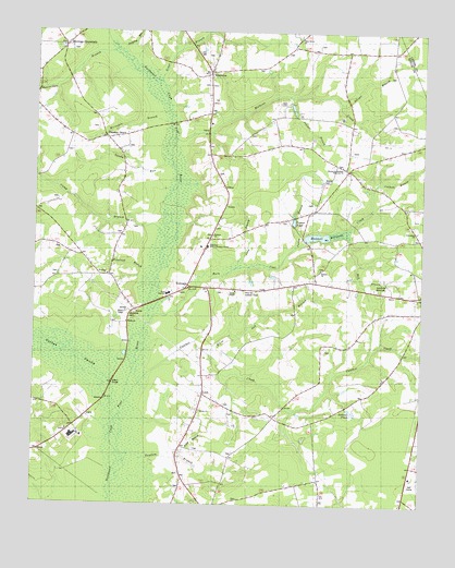
Albertson, NC USGS Topographic Map
Click on map above to begin viewing in our Map Viewer.

This topographic map contains these locations and features:
Feature Name Type Latitude Longitude GNIS ID View Map
AlbertsonPopulated PlaceN35.1143°W77.8189°980076View Map
Albertson Adult Education CenterSchoolN35.0682°W77.8189°1004261View Map
Albertson Post OfficePost OfficeN35.1141°W77.8183°2774205View Map
Beaverdam BranchStreamN35.1149°W77.8630°1023813View Map
Bethany ChurchChurchN35.0713°W77.8175°1004500View Map
Branch SchoolSchoolN35.0679°W77.8191°981825View Map
Burn Coat CreekStreamN35.0485°W77.8372°982282View Map
Camp BranchStreamN35.0743°W77.8508°982496View Map
Cowhole BranchStreamN35.0827°W77.7658°983652View Map
Deavers ChapelChurchN35.0649°W77.8583°984040View Map
Duplin County Emergency Medical Services Medic 6BuildingN35.1131°W77.8733°2720484View Map
Friendship ChurchChurchN35.0727°W77.7683°1004263View Map
Goshen SwampStreamN35.0241°W77.8472°1025342View Map
Goshen SwampSwampN35.0130°W77.8477°985850View Map
Grady High SchoolSchoolN35.0560°W77.8319°985904View Map
Gradys CemeteryCemeteryN35.0860°W77.7814°1004259View Map
Great BranchStreamN35.1102°W77.8336°1024001View Map
Harper-Southerland Memorial ChurchChurchN35.0896°W77.7758°986431View Map
Hebron ChurchChurchN35.0627°W77.7828°986578View Map
Herrings CrossroadsPopulated PlaceN35.1216°W77.8658°1020691View Map
Horsepen BranchStreamN35.1029°W77.8375°987128View Map
Housland BranchStreamN35.0624°W77.8405°987172View Map
Jenkins PondLakeN35.0248°W77.7720°987556View Map
Jones ChapelChurchN35.1157°W77.8178°987733View Map
Jumping RunStreamN35.1216°W77.8444°1024069View Map
Juniper BranchStreamN35.1082°W77.7925°987837View Map
KornegayPopulated PlaceN35.0579°W77.8255°1006268View Map
LeonPopulated PlaceN35.0291°W77.8200°988356View Map
Long BranchStreamN35.0627°W77.8108°988890View Map
Mathews CreekStreamN35.0966°W77.8264°989457View Map
Maxwell MillpondReservoirN35.0716°W77.7801°989494View Map
Mill BranchStreamN35.0716°W77.7741°989869View Map
Millers BridgeBridgeN35.0282°W77.8519°990007View Map
Oak Ridge Memorial CemeteryCemeteryN35.0574°W77.7650°1004264View Map
Panther CreekStreamN35.0324°W77.8397°991832View Map
Piney Grove ChurchChurchN35.1243°W77.7897°992341View Map
Pink Hill Lookout TowerTowerN35.0568°W77.8069°1023681View Map
Pleasant GrovePopulated PlaceN35.0938°W77.8486°1022001View Map
Pleasant Grove Volunteer Fire DepartmentBuildingN35.1132°W77.8733°2638075View Map
Poley BranchStreamN35.0132°W77.8264°992639View Map
ResacaPopulated PlaceN35.0702°W77.7580°1008037View Map
Salem ChapelChurchN35.0566°W77.8103°1024287View Map
Sandy RunStreamN35.0891°W77.8347°994324View Map
Sawyer BranchStreamN35.1071°W77.7772°994397View Map
Smiths ChurchChurchN35.0243°W77.8211°1024306View Map
Sutton BranchStreamN35.0688°W77.7905°995726View Map
Tandam BranchStreamN35.0121°W77.8353°995834View Map
Taylor CemeteryCemeteryN35.0821°W77.8486°995884View Map
Township of AlbertsonCivilN35.1182°W77.8100°1026639View Map
Township of SmithCivilN35.0041°W77.7940°1026649View Map
Turner PondReservoirN35.0750°W77.7912°1004262View Map
Westbrook CemeteryCemeteryN35.0507°W77.8436°997055View Map
White Oak BranchStreamN35.0399°W77.8183°997158View Map
Woodland ChurchChurchN35.0607°W77.8511°1004260View Map

Note: Coordinates in the location and feature list above are referenced to NAD83 datum.


Copyright (C) 2008-2024 Ryan Niemi / Sunset Dynamics ... All Rights Reserved