TopoQuest Logo
Do you find TopoQuest useful?
Help keep TopoQuest running and adding new maps/features by donating!
Bitcoin:  19c7KJd3qBynnjoSw5npx9KScwjBe4ifkT
Litecoin:  LXs6TkuXGGXo1vDsWCkWVdjQX94eUKd6ui
Home View Maps Find Maps Find Places Resources & Links


Seven Springs, North Carolina Topographic Map

USGS Map Title: Seven Springs, NC
USGS Map MRC: 35077B7
DRG (GeoTIFF) Download: o35077b7.tif


Neighboring USGS Topographic Map Quads:


  Southeast Goldsboro, NC  
35077C8
 

  La Grange, NC  
35077C7
 

  Falling Creek, NC  
35077C6
 

  Williams, NC  
35077B8
 

  Seven Springs, NC  
35077B7
 

  Deep Run, NC  
35077B6
 

  Summerlins Crossroads, NC  
35077A8
 

  Albertson, NC  
35077A7
 

  Pink Hill, NC  
35077A6


Map MRC Location:

N36°
W78°
N36°
W77°
H8 H7 H6 H5 H4 H3 H2 H1
G8 G7 G6 G5 G4 G3 G2 G1
F8 F7 F6 F5 F4 F3 F2 F1
E8 E7 E6 E5 E4 E3 E2 E1
D8 D7 D6 D5 D4 D3 D2 D1
C8 C7 C6 C5 C4 C3 C2 C1
B8 B7 B6 B5 B4 B3 B2 B1
A8 A7 A6 A5 A4 A3 A2 A1
N35°
W78°
N35°
W77°

Seven Springs, NC USGS 1:24K Topographic Map Preview:
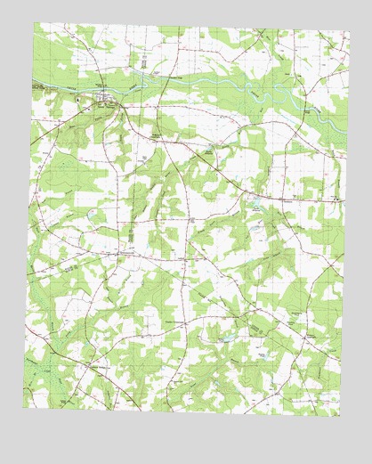
Seven Springs, NC USGS Topographic Map
Click on map above to begin viewing in our Map Viewer.

This topographic map contains these locations and features:
Feature Name Type Latitude Longitude GNIS ID View Map
Albertson TabernacleChurchN35.1271°W77.7930°980077View Map
Albertson Volunteer Fire DepartmentBuildingN35.1291°W77.8454°2638841View Map
Bear CreekStreamN35.2318°W77.7789°980709View Map
Beaverdam BranchStreamN35.1429°W77.7914°1023812View Map
Belch BranchStreamN35.2188°W77.7553°980923View Map
Bens BranchStreamN35.1904°W77.7797°981003View Map
Bethel ChurchChurchN35.1327°W77.8178°1003908View Map
Buck Marsh BranchStreamN35.1443°W77.8614°1023855View Map
Cabin BranchStreamN35.1710°W77.8744°982385View Map
Cox CreekStreamN35.2279°W77.8383°997829View Map
Dalys ChapelChurchN35.1879°W77.8116°983912View Map
Dalys CreekStreamN35.2102°W77.8055°983913View Map
Davis MillpondReservoirN35.1933°W77.7842°1023940View Map
Davis Millpond DamDamN35.1952°W77.7830°998523View Map
Davis PondReservoirN35.1854°W77.7852°998498View Map
Davis Pond DamDamN35.1852°W77.7830°998497View Map
Deerhaven Mobile Home ParkPopulated PlaceN35.1617°W77.8564°2505456View Map
DrummersvillePopulated PlaceN35.1757°W77.8389°1003906View Map
Frank Nunn BranchStreamN35.1927°W77.7864°1023982View Map
Gradys ChapelChurchN35.1746°W77.8289°985906View Map
Gradys CrossroadsPopulated PlaceN35.1541°W77.8116°1003907View Map
Hardy Mill RunStreamN35.2263°W77.7841°986399View Map
Hardy MillpondReservoirN35.2108°W77.8039°986400View Map
Hardys BridgeBridgeN35.2246°W77.7666°986401View Map
Holy Innocence ChurchChurchN35.1957°W77.7828°1023491View Map
Huckleberry PondBasinN35.1593°W77.7689°1025039View Map
Hussey PondReservoirN35.1439°W77.7793°987294View Map
Husseys CrossroadsPopulated PlaceN35.2127°W77.8230°1002669View Map
Jacks BranchStreamN35.1777°W77.7741°1024056View Map
Jerusalem ChurchChurchN35.2052°W77.8300°987584View Map
John Benton BranchStreamN35.1996°W77.8214°1024064View Map
Jones BranchStreamN35.1804°W77.8700°1024065View Map
LiddellPopulated PlaceN35.1746°W77.8128°988466View Map
Mill BranchStreamN35.1599°W77.8394°1024146View Map
Mire BranchStreamN35.1346°W77.8719°1024158View Map
Moss Hill AirportAirportN35.2097°W77.7592°2679206View Map
Moss Hill SchoolSchoolN35.1952°W77.7528°990292View Map
New Jerusalem ChurchChurchN35.2249°W77.8411°1003905View Map
Oak BranchStreamN35.1579°W77.8391°1024195View Map
Outlaws BridgeBridgeN35.1279°W77.8572°991731View Map
Outlaws BridgePopulated PlaceN35.1393°W77.8494°991732View Map
Outlaws Bridge ChurchChurchN35.1393°W77.8494°991733View Map
Panther CreekStreamN35.1996°W77.8214°991826View Map
Picadilly BayBasinN35.1629°W77.8047°1025061View Map
Picadilly PondBasinN35.1554°W77.7700°1025048View Map
Pleasant View ChurchChurchN35.1354°W77.8164°992577View Map
Poley BranchStreamN35.1366°W77.8633°1024230View Map
Rockford BridgeBridgeN35.2335°W77.8211°993539View Map
Rockford ChapelChurchN35.2341°W77.8278°993540View Map
Rouse PondReservoirN35.1497°W77.7942°993764View Map
Seven SpringsPopulated PlaceN35.2274°W77.8469°1022549View Map
Seven Springs Community Volunteer Fire DepartmentBuildingN35.2271°W77.8459°2639377View Map
Seven Springs Post OfficePost OfficeN35.2272°W77.8466°2774080View Map
South Prong Cox CreekStreamN35.2238°W77.8394°995195View Map
StrabanePopulated PlaceN35.1952°W77.7747°995598View Map
Tar RiverStreamN35.1888°W77.7803°1024342View Map
Tom BranchStreamN35.1896°W77.8741°1024353View Map
Town of Seven SpringsCivilN35.2247°W77.8451°2407314View Map
Trotters CreekStreamN35.2185°W77.7864°1024363View Map
Union ChurchChurchN35.1957°W77.7700°996453View Map
Wayne County Emergency Medical Services Station 1BuildingN35.2257°W77.8468°2720583View Map
West Prong Cox CreekStreamN35.2238°W77.8394°997035View Map
Whitehall BridgeBridgeN35.2296°W77.8469°997222View Map
Wootens CrossroadsPopulated PlaceN35.1502°W77.7639°997633View Map

Note: Coordinates in the location and feature list above are referenced to NAD83 datum.


Copyright (C) 2008-2024 Ryan Niemi / Sunset Dynamics ... All Rights Reserved