TopoQuest Logo
Do you find TopoQuest useful?
Help keep TopoQuest running and adding new maps/features by donating!
Bitcoin:  19c7KJd3qBynnjoSw5npx9KScwjBe4ifkT
Litecoin:  LXs6TkuXGGXo1vDsWCkWVdjQX94eUKd6ui
Home View Maps Find Maps Find Places Resources & Links


King Cove, Alabama Topographic Map

USGS Map Title: King Cove, AL
USGS Map MRC: 34086H3
DRG (GeoTIFF) Download: o34086h3.tif


Neighboring USGS Topographic Map Quads:


  Flintville, TN  
35086A4
 

  Huntland, TN  
35086A3
 

  Beans Creek, TN  
35086A2
 

  New Market, AL  
34086H4
 

  King Cove, AL  
34086H3
 

  Estill Fork, AL  
34086H2
 

  Maysville, AL  
34086G4
 

  Hollytree, AL  
34086G3
 

  Princeton, AL  
34086G2


Map MRC Location:

N35°
W87°
N35°
W86°
H8 H7 H6 H5 H4 H3 H2 H1
G8 G7 G6 G5 G4 G3 G2 G1
F8 F7 F6 F5 F4 F3 F2 F1
E8 E7 E6 E5 E4 E3 E2 E1
D8 D7 D6 D5 D4 D3 D2 D1
C8 C7 C6 C5 C4 C3 C2 C1
B8 B7 B6 B5 B4 B3 B2 B1
A8 A7 A6 A5 A4 A3 A2 A1
N34°
W87°
N34°
W86°

King Cove, AL USGS 1:24K Topographic Map Preview:
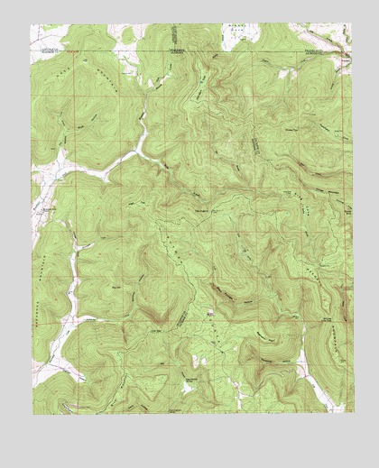
King Cove, AL USGS Topographic Map
Click on map above to begin viewing in our Map Viewer.

This topographic map contains these locations and features:
Feature Name Type Latitude Longitude GNIS ID View Map
Backbone MountainSummitN34.9168°W86.3725°113329View Map
Bee BranchStreamN34.9470°W86.2917°113796View Map
Beech Grove CemeteryCemeteryN34.9895°W86.2503°113814View Map
Beech Grove School (historical)SchoolN34.9912°W86.2511°1318407View Map
Beshears PointCapeN34.8987°W86.2836°113975View Map
Bethel CemeteryCemeteryN34.8970°W86.3036°114024View Map
Bice MountainSummitN34.8812°W86.3411°114208View Map
Big HillSummitN34.9151°W86.3444°114283View Map
Bluff HollowValleyN34.9654°W86.3614°114614View Map
Cagle PointCapeN34.8770°W86.3614°115364View Map
Cramer HollowValleyN34.8915°W86.3689°116810View Map
Crowell CemeteryCemeteryN34.9226°W86.2628°116924View Map
Dry CreekStreamN34.9504°W86.3653°117551View Map
Fanning CemeteryCemeteryN34.9601°W86.3658°157461View Map
Fitch HollowValleyN34.9548°W86.3639°118326View Map
Flag BranchStreamN34.8798°W86.3167°118347View Map
Hale MountainSummitN34.9887°W86.3544°119559View Map
Hall BranchStreamN34.9894°W86.2539°119574View Map
Hambrick SchoolSchoolN34.8812°W86.2953°139182View Map
Hambrick SinksBasinN34.8834°W86.3147°119619View Map
Hayes CemeteryCemeteryN34.9651°W86.2572°119884View Map
High TopSummitN34.9418°W86.3353°120070View Map
Honea (historical)LocaleN34.8918°W86.3672°146978View Map
Hudson CemeteryCemeteryN34.9842°W86.3355°120510View Map
Husky TopSummitN34.9654°W86.2767°120602View Map
Johnson TopSummitN34.9756°W86.3128°151902View Map
Jones CoveValleyN34.9059°W86.3589°121005View Map
King CoveValleyN34.9448°W86.2775°121219View Map
King Cove CemeteryCemeteryN34.9451°W86.2741°149970View Map
Lick BranchStreamN34.9129°W86.2819°121589View Map
Lickskillet CreekStreamN34.9037°W86.3594°121603View Map
Low GapGapN34.9012°W86.3247°122072View Map
Maxwell CemeteryCemeteryN34.8915°W86.2555°122407View Map
Maxwell MountainSummitN34.9118°W86.2617°122410View Map
Moore CoveValleyN34.9771°W86.3303°123009View Map
Mountain Fork ChurchChurchN34.9406°W86.3705°123510View Map
Putman MountainSummitN34.8848°W86.2978°125372View Map
Racepath HollowValleyN34.8915°W86.2705°125401View Map
Rochelle HollowValleyN34.9129°W86.2819°125741View Map
Rocky BranchStreamN34.9595°W86.3350°125823View Map
Rocky Branch HollowValleyN34.9593°W86.3333°147227View Map
Shores Low GapGapN34.9048°W86.2583°126807View Map
Smithey HollowValleyN34.9034°W86.3594°153478View Map
The DugoutGapN34.9398°W86.3047°127809View Map

Note: Coordinates in the location and feature list above are referenced to NAD83 datum.


Copyright (C) 2008-2024 Ryan Niemi / Sunset Dynamics ... All Rights Reserved