TopoQuest Logo
Do you find TopoQuest useful?
Help keep TopoQuest running and adding new maps/features by donating!
Bitcoin:  19c7KJd3qBynnjoSw5npx9KScwjBe4ifkT
Litecoin:  LXs6TkuXGGXo1vDsWCkWVdjQX94eUKd6ui
Home View Maps Find Maps Find Places Resources & Links


Cooper Ridge, Arizona Topographic Map

USGS Map Title: Cooper Ridge, AZ
USGS Map MRC: 36112G2
DRG (GeoTIFF) Download: o36112g2.tif


Neighboring USGS Topographic Map Quads:


  Muggins Flat, AZ  
36112H3
 

  Buck Pasture Canyon, AZ  
36112H2
 

  Coyote Buttes, AZ  
36112H1
 

  Le Fevre Ridge, AZ  
36112G3
 

  Cooper Ridge, AZ  
36112G2
 

  House Rock Spring, AZ  
36112G1
 

  Warm Springs Canyon, AZ  
36112F3
 

  Jacob Lake, AZ  
36112F2
 

  House Rock, AZ  
36112F1


Map MRC Location:

N37°
W113°
N37°
W112°
H8 H7 H6 H5 H4 H3 H2 H1
G8 G7 G6 G5 G4 G3 G2 G1
F8 F7 F6 F5 F4 F3 F2 F1
E8 E7 E6 E5 E4 E3 E2 E1
D8 D7 D6 D5 D4 D3 D2 D1
C8 C7 C6 C5 C4 C3 C2 C1
B8 B7 B6 B5 B4 B3 B2 B1
A8 A7 A6 A5 A4 A3 A2 A1
N36°
W113°
N36°
W112°

Cooper Ridge, AZ USGS 1:24K Topographic Map Preview:
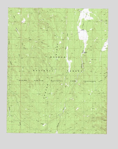
Cooper Ridge, AZ USGS Topographic Map
Click on map above to begin viewing in our Map Viewer.

This topographic map contains these locations and features:
Feature Name Type Latitude Longitude GNIS ID View Map
Basin TankReservoirN36.7894°W112.2358°2091689View Map
Burro ApronReservoirN36.8328°W112.1320°2092053View Map
Cooper Ridge TankReservoirN36.8083°W112.1928°2091687View Map
Cooper Trick TankReservoirN36.8464°W112.1878°2091679View Map
Government ReservoirLakeN36.8309°W112.1559°20777View Map
Joes ReservoirReservoirN36.8530°W112.1555°6435View Map
Le Fevre TankReservoirN36.7717°W112.2461°2091690View Map
Lobo TankReservoirN36.7889°W112.1950°2091691View Map
Middle Fork Willis CanyonValleyN36.8428°W112.2330°7979View Map
North Fork Willis CanyonValleyN36.8428°W112.2330°8733View Map
Orderville CanyonValleyN36.8454°W112.1552°9007View Map
Orderville TankReservoirN36.7758°W112.1775°2091692View Map
Orderville Trick TankReservoirN36.7978°W112.1494°2091684View Map
Ponderosa Trick TankReservoirN36.8061°W112.1397°2091683View Map
Round Valley TankReservoirN36.8361°W112.1758°2091682View Map
South Fork Willis CanyonValleyN36.8430°W112.2330°11606View Map
Stipa TankReservoirN36.7994°W112.1817°2091686View Map
Summit TankReservoirN36.8200°W112.1972°2091688View Map
Summit Trick TankReservoirN36.8719°W112.1583°2091681View Map
Wet Weather SeepReservoirN36.7964°W112.1386°2091685View Map
Wildhorse ParkFlatN36.7592°W112.2043°13798View Map

Note: Coordinates in the location and feature list above are referenced to NAD83 datum.


Copyright (C) 2008-2025 Ryan Niemi / Sunset Dynamics ... All Rights Reserved