TopoQuest Logo
Do you find TopoQuest useful?
Help keep TopoQuest running and adding new maps/features by donating!
Bitcoin:  19c7KJd3qBynnjoSw5npx9KScwjBe4ifkT
Litecoin:  LXs6TkuXGGXo1vDsWCkWVdjQX94eUKd6ui
Home View Maps Find Maps Find Places Resources & Links


Cordesville, South Carolina Topographic Map

USGS Map Title: Cordesville, SC
USGS Map MRC: 33079B8
DRG (GeoTIFF) Download: o33079b8.tif


Neighboring USGS Topographic Map Quads:


  Chicora, SC  
33080C1
 

  Bonneau, SC  
33079C8
 

  Alvin, SC  
33079C7
 

  Moncks Corner, SC  
33080B1
 

  Cordesville, SC  
33079B8
 

  Bethera, SC  
33079B7
 

  Mount Holly, SC  
33080A1
 

  Kittredge, SC  
33079A8
 

  Huger, SC  
33079A7


Map MRC Location:

N34°
W80°
N34°
W79°
H8 H7 H6 H5 H4 H3 H2 H1
G8 G7 G6 G5 G4 G3 G2 G1
F8 F7 F6 F5 F4 F3 F2 F1
E8 E7 E6 E5 E4 E3 E2 E1
D8 D7 D6 D5 D4 D3 D2 D1
C8 C7 C6 C5 C4 C3 C2 C1
B8 B7 B6 B5 B4 B3 B2 B1
A8 A7 A6 A5 A4 A3 A2 A1
N33°
W80°
N33°
W79°

Cordesville, SC USGS 1:24K Topographic Map Preview:
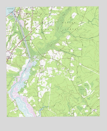
Cordesville, SC USGS Topographic Map
Click on map above to begin viewing in our Map Viewer.

This topographic map contains these locations and features:
Feature Name Type Latitude Longitude GNIS ID View Map
Anderson SchoolSchoolN33.2491°W79.9670°1229352View Map
Berkeley CountyCivilN33.1977°W79.9510°1247985View Map
Berkeley Intermediate SchoolSchoolN33.1963°W79.9786°2486423View Map
Berkeley Middle SchoolSchoolN33.2001°W79.9958°1234426View Map
Berkeley MuseumBuildingN33.1935°W79.9717°2490421View Map
Berkeley Training SchoolSchoolN33.1924°W79.9962°1229400View Map
Biggin CemeteryCemeteryN33.2127°W79.9667°1246888View Map
Biggin CreekStreamN33.1932°W79.9695°1229425View Map
Biggin SwampSwampN33.2151°W79.9706°1246889View Map
Biggins ChurchChurchN33.2124°W79.9670°1234434View Map
Broad Ax BranchStreamN33.2079°W79.9456°1229457View Map
Buck Hall (historical)Populated PlaceN33.1902°W79.9526°1234445View Map
Bullhead RunStreamN33.2041°W79.9362°1247062View Map
California BranchStreamN33.2235°W79.9823°1229500View Map
Callum BranchStreamN33.2213°W79.9265°1229501View Map
Canady BranchStreamN33.2404°W79.9479°1247136View Map
Cane Gully BranchStreamN33.2199°W79.9265°1247143View Map
Chachan PlantationLocaleN33.1671°W79.9637°1234456View Map
Chachan Plantation CemeteryCemeteryN33.1677°W79.9637°1234457View Map
Cherry HillPopulated PlaceN33.2288°W79.9431°1229549View Map
Cherry Hill ChurchChurchN33.2285°W79.9429°1244076View Map
Cherry Hill School (historical)SchoolN33.2288°W79.9415°1234463View Map
CordesvillePopulated PlaceN33.1321°W79.8834°1247384View Map
Cordesville CemeteryCemeteryN33.1802°W79.9192°1234473View Map
Cordesville Fire Department Station 1BuildingN33.1796°W79.9185°2368209View Map
Cordesville First Baptist ChurchChurchN33.1802°W79.9195°1234474View Map
Cordesville Post OfficePost OfficeN33.1337°W79.8858°2489782View Map
Cordesville SchoolSchoolN33.1752°W79.9548°1229592View Map
Emmanuel ChurchChurchN33.1832°W79.9537°1247668View Map
Exeter PlantationLocaleN33.1435°W79.9887°1234484View Map
Exeter Plantation CemeteryCemeteryN33.1432°W79.9892°1234483View Map
Grace ChurchChurchN33.1977°W79.9926°1245800View Map
Holiness ChurchChurchN33.1766°W79.9176°1234520View Map
Holy Comforter ChurchChurchN33.1485°W79.9579°1229809View Map
Kitfield (historical)Populated PlaceN33.2271°W79.9979°1234537View Map
Lewisfield PlantationLocaleN33.1604°W79.9934°1234541View Map
Lewisfield Plantation CemeteryCemeteryN33.1607°W79.9937°1234542View Map
Mary Anne BranchStreamN33.1929°W79.9031°1246550View Map
Mepkin BridgeBridgeN33.1341°W79.9529°1234555View Map
Middle BaySwampN33.1597°W79.8920°1229999View Map
Mingo BranchStreamN33.2404°W79.9479°1230026View Map
Minton Plantation (historical)LocaleN33.2157°W79.9895°1234556View Map
MittenlanePopulated PlaceN33.2010°W79.9976°1234557View Map
Moncks Corner Bi-Lo Plaza Shopping CenterLocaleN33.1954°W79.9945°1234558View Map
Moncks Corner Fire Department Station 1BuildingN33.1885°W79.9918°2368193View Map
Moncks Corner Post OfficePost OfficeN33.1940°W79.9961°1252156View Map
Moncks Corner Wastewater Treatment FacilityLocaleN33.1801°W79.9789°2490476View Map
Monks Corner PlazaLocaleN33.1890°W79.9963°2489527View Map
Mount Carmel ChurchChurchN33.2421°W79.9681°1230049View Map
Old CordesvillePopulated PlaceN33.1777°W79.9167°1249953View Map
Old Santee CanalCanalN33.2182°W79.9801°1230127View Map
Old Santee Canal State ParkParkN33.1924°W79.9692°1234581View Map
Pinopolis DamDamN33.2451°W79.9907°1230177View Map
Roper Hospital BerkeleyHospitalN33.1948°W79.9817°2640118View Map
Saint Lukes ChurchChurchN33.1679°W79.9565°1230272View Map
Santee CirclePopulated PlaceN33.2438°W79.9642°1231776View Map
Santee Circle Fire Department Company 21BuildingN33.2386°W79.9639°2368207View Map
Simpson CrossingPopulated PlaceN33.2496°W79.9751°1231800View Map
South Carolina Department of Social ServicesBuildingN33.2048°W79.9862°2490450View Map
South Carolina Highway PatrolBuildingN33.2056°W79.9867°2334917View Map
South Pinckney PlantationLocaleN33.1349°W79.9879°1234630View Map
Stony LandingPopulated PlaceN33.1932°W79.9692°1231837View Map
Stony Landing PlantationLocaleN33.1932°W79.9701°1234635View Map
Tailrace CanalCanalN33.2235°W79.9784°1251111View Map
Vanilla BaySwampN33.1543°W79.8981°1230442View Map
WadbooPopulated PlaceN33.1910°W79.9376°1234656View Map
Wadboo BridgeBridgeN33.1957°W79.9534°1230445View Map
Wadboo CreekStreamN33.1841°W79.9704°1230446View Map
Wadboo SwampSwampN33.2230°W79.9259°1251307View Map

Note: Coordinates in the location and feature list above are referenced to NAD83 datum.


Copyright (C) 2008-2024 Ryan Niemi / Sunset Dynamics ... All Rights Reserved