TopoQuest Logo
Do you find TopoQuest useful?
Help keep TopoQuest running and adding new maps/features by donating!
Bitcoin:  19c7KJd3qBynnjoSw5npx9KScwjBe4ifkT
Litecoin:  LXs6TkuXGGXo1vDsWCkWVdjQX94eUKd6ui
Home View Maps Find Maps Find Places Resources & Links


Andrews, Oregon Topographic Map

USGS Map Title: Andrews, OR
USGS Map MRC: 42118D5
DRG (GeoTIFF) Download: o42118d5.tif


Neighboring USGS Topographic Map Quads:


  Ankle Creek, OR  
42118E6
 

  Alvord Hot Springs, OR  
42118E5
 

  Miranda Flat SW, OR  
42118E4
 

  V Lake, OR  
42118D6
 

  Andrews, OR  
42118D5
 

  Tule Springs, OR  
42118D4
 

  Fields, OR  
42118C6
 

  Borax Lake, OR  
42118C5
 

  Red Lookout Butte, OR  
42118C4


Map MRC Location:

N43°
W119°
N43°
W118°
H8 H7 H6 H5 H4 H3 H2 H1
G8 G7 G6 G5 G4 G3 G2 G1
F8 F7 F6 F5 F4 F3 F2 F1
E8 E7 E6 E5 E4 E3 E2 E1
D8 D7 D6 D5 D4 D3 D2 D1
C8 C7 C6 C5 C4 C3 C2 C1
B8 B7 B6 B5 B4 B3 B2 B1
A8 A7 A6 A5 A4 A3 A2 A1
N42°
W119°
N42°
W118°

Andrews, OR USGS 1:24K Topographic Map Preview:
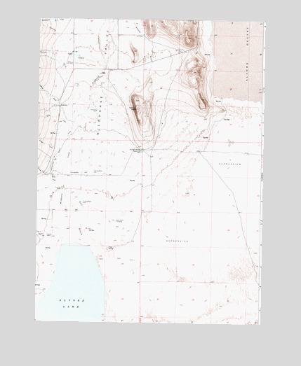
Andrews, OR USGS Topographic Map
Click on map above to begin viewing in our Map Viewer.

This topographic map contains these locations and features:
Feature Name Type Latitude Longitude GNIS ID View Map
Alvord CreekStreamN42.4446°W118.5291°1116900View Map
Alvord LakeLakeN42.3788°W118.6047°1116903View Map
Alvord Post Office (historical)Post OfficeN42.4182°W118.5938°1164181View Map
AndrewsPopulated PlaceN42.4641°W118.6132°1116942View Map
Andrews CemeteryCemeteryN42.4814°W118.6082°1130068View Map
Andrews CreekStreamN42.4602°W118.6030°1116943View Map
Andrews Post Office (historical)Post OfficeN42.4641°W118.6132°1164838View Map
Andrews School (historical)SchoolN42.4661°W118.6144°1638618View Map
Butte CreekStreamN42.4546°W118.6066°1118389View Map
Camp Alvord (historical)MilitaryN42.4769°W118.5883°1851652View Map
Carlson CreekStreamN42.4116°W118.6216°1118613View Map
Corral CreekStreamN42.4716°W118.6235°1132737View Map
Dixon SpringSpringN42.4058°W118.5856°1119975View Map
East Branch Wildhorse CreekStreamN42.4060°W118.5974°1120279View Map
Juniper CreekStreamN42.4446°W118.6141°1122584View Map
Kissack/Reynolds AirportAirportN42.4891°W118.6085°2443889View Map
Kueny DitchCanalN42.4502°W118.6110°1122856View Map
Kueny RanchLocaleN42.4349°W118.6171°1122857View Map
McLean PlaceLocaleN42.4113°W118.6238°1136528View Map
Miranda CreekStreamN42.4288°W118.6110°1124251View Map
Penland RanchLocaleN42.4854°W118.6069°1125288View Map
Reallis HomesteadLocaleN42.4777°W118.5885°1125860View Map
Serrano PointSummitN42.4629°W118.5710°1126746View Map
Serrano Point RanchLocaleN42.4457°W118.5682°1126747View Map
Serrano SpringSpringN42.4460°W118.5676°1126748View Map
Smyth WellsWellN42.4170°W118.5815°1127140View Map
Spring CreekStreamN42.4807°W118.5885°1127424View Map
Wildhorse CreekStreamN42.4071°W118.6066°1129078View Map
Wildhorse ValleyValleyN42.4071°W118.6063°1129086View Map
Wilson CreekStreamN42.4741°W118.6060°1129195View Map

Note: Coordinates in the location and feature list above are referenced to NAD83 datum.


Copyright (C) 2008-2025 Ryan Niemi / Sunset Dynamics ... All Rights Reserved