TopoQuest Logo
Do you find TopoQuest useful?
Help keep TopoQuest running and adding new maps/features by donating!
Bitcoin:  19c7KJd3qBynnjoSw5npx9KScwjBe4ifkT
Litecoin:  LXs6TkuXGGXo1vDsWCkWVdjQX94eUKd6ui
Home View Maps Find Maps Find Places Resources & Links


Fields, Oregon Topographic Map

USGS Map Title: Fields, OR
USGS Map MRC: 42118C6
DRG (GeoTIFF) Download: o42118c6.tif


Neighboring USGS Topographic Map Quads:


  Skull Creek Butte, OR  
42118D7
 

  V Lake, OR  
42118D6
 

  Andrews, OR  
42118D5
 

  Fields Basin, OR  
42118C7
 

  Fields, OR  
42118C6
 

  Borax Lake, OR  
42118C5
 

  Rincon Flat, OR  
42118B7
 

  Ladycomb Peak, OR  
42118B6
 

  Tumtum Lake, OR  
42118B5


Map MRC Location:

N43°
W119°
N43°
W118°
H8 H7 H6 H5 H4 H3 H2 H1
G8 G7 G6 G5 G4 G3 G2 G1
F8 F7 F6 F5 F4 F3 F2 F1
E8 E7 E6 E5 E4 E3 E2 E1
D8 D7 D6 D5 D4 D3 D2 D1
C8 C7 C6 C5 C4 C3 C2 C1
B8 B7 B6 B5 B4 B3 B2 B1
A8 A7 A6 A5 A4 A3 A2 A1
N42°
W119°
N42°
W118°

Fields, OR USGS 1:24K Topographic Map Preview:
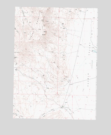
Fields, OR USGS Topographic Map
Click on map above to begin viewing in our Map Viewer.

This topographic map contains these locations and features:
Feature Name Type Latitude Longitude GNIS ID View Map
Alvord PeakSummitN42.3474°W118.7030°1116904View Map
Babes CanyonValleyN42.2543°W118.7410°1117117View Map
Buckwilder PassGapN42.3438°W118.7085°1118252View Map
Burks SpringSpringN42.3561°W118.6791°1118329View Map
Calderwood PlaceLocaleN42.3635°W118.6357°1638506View Map
Dry LakeLakeN42.3263°W118.6276°1120174View Map
El Rancho AirportAirportN42.3333°W118.6507°2650862View Map
FieldsPopulated PlaceN42.2643°W118.6752°1120703View Map
Fields CreekStreamN42.2624°W118.6471°1120706View Map
Fields Elementary SchoolSchoolN42.2633°W118.6714°2417631View Map
Fields Post OfficePost OfficeN42.2643°W118.6752°1165249View Map
Lucky Star MineLocaleN42.3222°W118.6769°1123612View Map
Mogul MineLocaleN42.2989°W118.7051°1124278View Map
O'Keefe SpringSpringN42.3043°W118.7451°1124886View Map
Pedro SpringSpringN42.2852°W118.6994°1125273View Map
Red MountainRidgeN42.3099°W118.6863°1158443View Map
Scoubes CreekStreamN42.3743°W118.6377°1126699View Map
Williams CanyonValleyN42.2641°W118.6721°1129109View Map

Note: Coordinates in the location and feature list above are referenced to NAD83 datum.


Copyright (C) 2008-2024 Ryan Niemi / Sunset Dynamics ... All Rights Reserved