TopoQuest Logo
Do you find TopoQuest useful?
Help keep TopoQuest running and adding new maps/features by donating!
Bitcoin:  19c7KJd3qBynnjoSw5npx9KScwjBe4ifkT
Litecoin:  LXs6TkuXGGXo1vDsWCkWVdjQX94eUKd6ui
Home View Maps Find Maps Find Places Resources & Links


Ankle Creek, Oregon Topographic Map

USGS Map Title: Ankle Creek, OR
USGS Map MRC: 42118E6
DRG (GeoTIFF) Download: o42118e6.tif


Neighboring USGS Topographic Map Quads:


  Tombstone Canyon, OR  
42118F7
 

  Fish Lake, OR  
42118F6
 

  Wildhorse Lake, OR  
42118F5
 

  Roaring Springs SE, OR  
42118E7
 

  Ankle Creek, OR  
42118E6
 

  Alvord Hot Springs, OR  
42118E5
 

  Skull Creek Butte, OR  
42118D7
 

  V Lake, OR  
42118D6
 

  Andrews, OR  
42118D5


Map MRC Location:

N43°
W119°
N43°
W118°
H8 H7 H6 H5 H4 H3 H2 H1
G8 G7 G6 G5 G4 G3 G2 G1
F8 F7 F6 F5 F4 F3 F2 F1
E8 E7 E6 E5 E4 E3 E2 E1
D8 D7 D6 D5 D4 D3 D2 D1
C8 C7 C6 C5 C4 C3 C2 C1
B8 B7 B6 B5 B4 B3 B2 B1
A8 A7 A6 A5 A4 A3 A2 A1
N42°
W119°
N42°
W118°

Ankle Creek, OR USGS 1:24K Topographic Map Preview:
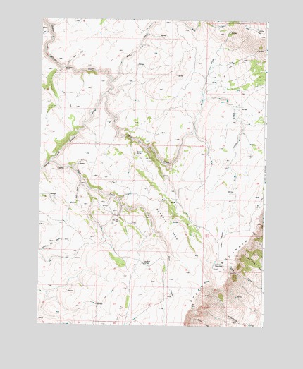
Ankle Creek, OR USGS Topographic Map
Click on map above to begin viewing in our Map Viewer.

This topographic map contains these locations and features:
Feature Name Type Latitude Longitude GNIS ID View Map
Ankle CreekStreamN42.5946°W118.7152°1116958View Map
Bill Taber CabinLocaleN42.6052°W118.7377°1117700View Map
Deep CreekStreamN42.5668°W118.7444°1119790View Map
Dry Mud CreekStreamN42.6054°W118.7360°1120179View Map
Eusabio RidgeRidgeN42.5404°W118.6782°1120532View Map
Joe Huff SpringSpringN42.5253°W118.6918°1122439View Map
Madarieta CabinLocaleN42.5652°W118.6452°1123670View Map
Mud CreekStreamN42.6004°W118.7116°1124444View Map
Newton SpringSpringN42.5703°W118.6972°1124675View Map
Penland MeadowFlatN42.5354°W118.6482°1125287View Map
Public WaterholeSpringN42.5259°W118.6508°1148023View Map
Riley Huff PlaceLocaleN42.5435°W118.7066°1161486View Map
Scott Corral CreekStreamN42.5596°W118.7277°1126682View Map
South Ankle CreekStreamN42.5924°W118.6599°1127229View Map
Starbuck HomesteadLocaleN42.5507°W118.7288°1638617View Map
Steens Mountain WildernessReserveN42.6019°W118.6981°1132757View Map
Willow SpringSpringN42.5303°W118.6311°1130066View Map
Ysassio CreekStreamN42.5727°W118.6921°1638616View Map

Note: Coordinates in the location and feature list above are referenced to NAD83 datum.


Copyright (C) 2008-2025 Ryan Niemi / Sunset Dynamics ... All Rights Reserved