TopoQuest Logo
Do you find TopoQuest useful?
Help keep TopoQuest running and adding new maps/features by donating!
Bitcoin:  19c7KJd3qBynnjoSw5npx9KScwjBe4ifkT
Litecoin:  LXs6TkuXGGXo1vDsWCkWVdjQX94eUKd6ui
Home View Maps Find Maps Find Places Resources & Links


Cornell, Wisconsin Topographic Map

USGS Map Title: Cornell, WI
USGS Map MRC: 45091B2
DRG (GeoTIFF) Download: o45091b2.tif


Neighboring USGS Topographic Map Quads:


  Fireside Lakes, WI  
45091C3
 

  Flambeau Ridge, WI  
45091C2
 

  Ladysmith SE, WI  
45091C1
 

  Bob Lake, WI  
45091B3
 

  Cornell, WI  
45091B2
 

  Holcombe, WI  
45091B1
 

  Jim Falls, WI  
45091A3
 

  Crescent, WI  
45091A2
 

  Colburn, WI  
45091A1


Map MRC Location:

N46°
W92°
N46°
W91°
H8 H7 H6 H5 H4 H3 H2 H1
G8 G7 G6 G5 G4 G3 G2 G1
F8 F7 F6 F5 F4 F3 F2 F1
E8 E7 E6 E5 E4 E3 E2 E1
D8 D7 D6 D5 D4 D3 D2 D1
C8 C7 C6 C5 C4 C3 C2 C1
B8 B7 B6 B5 B4 B3 B2 B1
A8 A7 A6 A5 A4 A3 A2 A1
N45°
W92°
N45°
W91°

Cornell, WI USGS 1:24K Topographic Map Preview:
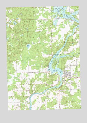
Cornell, WI USGS Topographic Map
Click on map above to begin viewing in our Map Viewer.

This topographic map contains these locations and features:
Feature Name Type Latitude Longitude GNIS ID View Map
Birch CreekStreamN45.2441°W91.1685°1561805View Map
Bob CreekStreamN45.1330°W91.2118°1561988View Map
Brook View FarmsLocaleN45.1472°W91.2289°2711419View Map
Brunet IslandIslandN45.1827°W91.1676°1562295View Map
Brunet Island State ParkParkN45.1819°W91.1560°1562296View Map
City of CornellCivilN45.1632°W91.1498°1583016View Map
Clark CreekStreamN45.1622°W91.1565°1563114View Map
CornellPopulated PlaceN45.1672°W91.1493°1563404View Map
Cornell 2WP7 DamDamN45.1641°W91.1588°1792935View Map
Cornell Area AmbulanceBuildingN45.1632°W91.1496°2698233View Map
Cornell Area Fire DepartmentBuildingN45.1697°W91.1518°2696818View Map
Cornell Elementary SchoolSchoolN45.1668°W91.1469°1842820View Map
Cornell FlowageReservoirN45.1641°W91.1588°1563405View Map
Cornell Hydro Generating StationLocaleN45.1639°W91.1574°2742089View Map
Cornell Middle / High SchoolSchoolN45.1656°W91.1424°1842821View Map
Cornell Police DepartmentBuildingN45.1671°W91.1493°2759471View Map
County Forest Crop Land 3 D-12.210 DamDamN45.2116°W91.2151°1793443View Map
Cranberry CreekStreamN45.2372°W91.1749°1563475View Map
Fairview School (historical)SchoolN45.1483°W91.2126°1842836View Map
Faith Baptist ChurchChurchN45.1675°W91.1421°1842838View Map
First Presbyterian ChurchChurchN45.1661°W91.1471°1842844View Map
Firth LakeLakeN45.2024°W91.2132°1564976View Map
Firth Lake TrailTrailN45.2058°W91.2085°1564977View Map
Firth School (historical)SchoolN45.2289°W91.2476°1842846View Map
Fisher RiverStreamN45.1875°W91.1610°1565017View Map
French CreekStreamN45.1508°W91.1688°1565307View Map
Holcombe 2WP723 DamDamN45.2250°W91.1285°1792943View Map
Holcombe DamDamN45.2247°W91.1279°1566539View Map
Holcombe FlowageReservoirN45.2472°W91.1483°1792944View Map
Holcombe Hydro Generating StationLocaleN45.2241°W91.1274°2742139View Map
Holy Cross Catholic ChurchChurchN45.1672°W91.1413°1842857View Map
Horseshoe Flowage 0.75ReservoirN45.2116°W91.2151°1793444View Map
Jerome LakeLakeN45.2324°W91.2427°1567162View Map
Kingdom Hall of Jehovahs WitnessesChurchN45.1633°W91.1324°1842862View Map
Lemay FarmLocaleN45.1361°W91.1958°2711417View Map
Moonridge TrailTrailN45.2122°W91.2326°1569700View Map
New Hope Assembly of God ChurchChurchN45.1647°W91.1435°1842889View Map
North Fork Bob CreekStreamN45.1355°W91.2182°1570430View Map
Our Saviours Lutheran ChurchChurchN45.1661°W91.1446°1842896View Map
Pine Point County ParkParkN45.2455°W91.1565°1571513View Map
Pleasant Ridge School (historical)SchoolN45.2197°W91.1724°1842899View Map
Quinn PitMineN45.1458°W91.1819°2634038View Map
Roberts School (historical)SchoolN45.1950°W91.1304°1842874View Map
Saint Johns Lutheran ChurchChurchN45.1686°W91.1429°1842881View Map
South Fork Bob CreekStreamN45.1355°W91.2182°1574441View Map
Town of Birch CreekCivilN45.2462°W91.2268°1582811View Map

Note: Coordinates in the location and feature list above are referenced to NAD83 datum.


Copyright (C) 2008-2024 Ryan Niemi / Sunset Dynamics ... All Rights Reserved