TopoQuest Logo
Do you find TopoQuest useful?
Help keep TopoQuest running and adding new maps/features by donating!
Bitcoin:  19c7KJd3qBynnjoSw5npx9KScwjBe4ifkT
Litecoin:  LXs6TkuXGGXo1vDsWCkWVdjQX94eUKd6ui
Home View Maps Find Maps Find Places Resources & Links


Crescent, Wisconsin Topographic Map

USGS Map Title: Crescent, WI
USGS Map MRC: 45091A2
DRG (GeoTIFF) Download: o45091a2.tif


Neighboring USGS Topographic Map Quads:


  Bob Lake, WI  
45091B3
 

  Cornell, WI  
45091B2
 

  Holcombe, WI  
45091B1
 

  Jim Falls, WI  
45091A3
 

  Crescent, WI  
45091A2
 

  Colburn, WI  
45091A1
 

  Lake Wissota, WI  
44091H3
 

  Cadott, WI  
44091H2
 

  Boyd, WI  
44091H1


Map MRC Location:

N46°
W92°
N46°
W91°
H8 H7 H6 H5 H4 H3 H2 H1
G8 G7 G6 G5 G4 G3 G2 G1
F8 F7 F6 F5 F4 F3 F2 F1
E8 E7 E6 E5 E4 E3 E2 E1
D8 D7 D6 D5 D4 D3 D2 D1
C8 C7 C6 C5 C4 C3 C2 C1
B8 B7 B6 B5 B4 B3 B2 B1
A8 A7 A6 A5 A4 A3 A2 A1
N45°
W92°
N45°
W91°

Crescent, WI USGS 1:24K Topographic Map Preview:
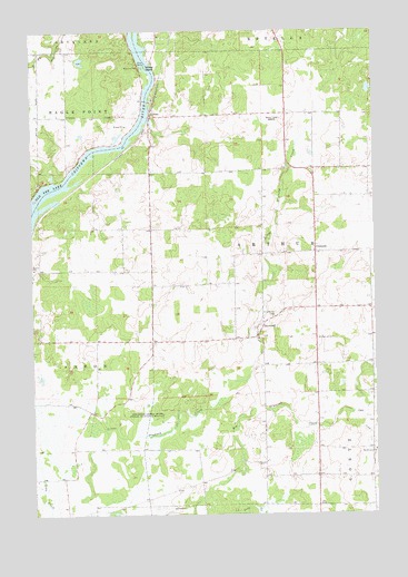
Crescent, WI USGS Topographic Map
Click on map above to begin viewing in our Map Viewer.

This topographic map contains these locations and features:
Feature Name Type Latitude Longitude GNIS ID View Map
Big Drywood ChurchChurchN45.0166°W91.1260°1561709View Map
Bohemian CemeteryCemeteryN45.0452°W91.1462°1562017View Map
Chap CreekStreamN45.0258°W91.1338°1562942View Map
CobbanPopulated PlaceN45.1030°W91.2063°1577553View Map
CrescentPopulated PlaceN45.0677°W91.1468°1563521View Map
DrywoodPopulated PlaceN45.0483°W91.1682°1564128View Map
Drywood Creek State Public Hunting GroundParkN45.0255°W91.2007°1564130View Map
Eleanor School (historical)SchoolN45.0897°W91.1376°1842829View Map
Golden Rule School (historical)SchoolN45.1027°W91.2365°1842849View Map
Matott School (historical)SchoolN45.0589°W91.2057°1842869View Map
Mitchell School (historical)SchoolN45.0166°W91.1665°1842886View Map
Pine Grove CemeteryCemeteryN45.0513°W91.1618°1571454View Map
Saint Anthony ChurchChurchN45.0452°W91.1679°1842878View Map
Seidlitz Dairy FarmLocaleN45.1119°W91.2458°2710233View Map
Town of ArthurCivilN45.0674°W91.1516°1582720View Map
Willow IslandIslandN45.1158°W91.2076°1576793View Map
WWIB-FM (Ladysmith)TowerN45.1097°W91.1621°1582397View Map

Note: Coordinates in the location and feature list above are referenced to NAD83 datum.


Copyright (C) 2008-2025 Ryan Niemi / Sunset Dynamics ... All Rights Reserved