TopoQuest Logo
Do you find TopoQuest useful?
Help keep TopoQuest running and adding new maps/features by donating!
Bitcoin:  19c7KJd3qBynnjoSw5npx9KScwjBe4ifkT
Litecoin:  LXs6TkuXGGXo1vDsWCkWVdjQX94eUKd6ui
Home View Maps Find Maps Find Places Resources & Links


Holcombe, Wisconsin Topographic Map

USGS Map Title: Holcombe, WI
USGS Map MRC: 45091B1
DRG (GeoTIFF) Download: o45091b1.tif


Neighboring USGS Topographic Map Quads:


  Flambeau Ridge, WI  
45091C2
 

  Ladysmith SE, WI  
45091C1
 

  Sheldon, WI  
45090C8
 

  Cornell, WI  
45091B2
 

  Holcombe, WI  
45091B1
 

  Ruby, WI  
45090B8
 

  Crescent, WI  
45091A2
 

  Colburn, WI  
45091A1
 

  Huron, WI  
45090A8


Map MRC Location:

N46°
W92°
N46°
W91°
H8 H7 H6 H5 H4 H3 H2 H1
G8 G7 G6 G5 G4 G3 G2 G1
F8 F7 F6 F5 F4 F3 F2 F1
E8 E7 E6 E5 E4 E3 E2 E1
D8 D7 D6 D5 D4 D3 D2 D1
C8 C7 C6 C5 C4 C3 C2 C1
B8 B7 B6 B5 B4 B3 B2 B1
A8 A7 A6 A5 A4 A3 A2 A1
N45°
W92°
N45°
W91°

Holcombe, WI USGS 1:24K Topographic Map Preview:
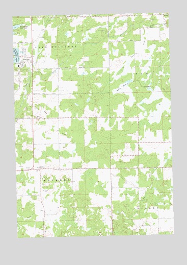
Holcombe, WI USGS Topographic Map
Click on map above to begin viewing in our Map Viewer.

This topographic map contains these locations and features:
Feature Name Type Latitude Longitude GNIS ID View Map
Amish SchoolSchoolN45.1626°W91.0032°2713424View Map
ArnoldPopulated PlaceN45.2489°W91.0043°1577495View Map
Beaver CreekStreamN45.2422°W91.0243°1561435View Map
Buck CreekStreamN45.1955°W91.1229°1562323View Map
Cornell Municipal AirportAirportN45.1646°W91.1051°1581927View Map
County Forest Crop Land 6 G 1137.1 DamDamN45.2150°W91.0301°1793331View Map
Enterprise School (historical)SchoolN45.1952°W91.0907°1842831View Map
Estella CemeteryCemeteryN45.1511°W91.1037°1564700View Map
Estella School (historical)SchoolN45.1594°W91.1049°1842833View Map
Hillebrand FarmsLocaleN45.1764°W91.1144°2711416View Map
HolcombePopulated PlaceN45.2244°W91.1174°1566537View Map
Holcombe CemeteryCemeteryN45.2063°W91.1111°1566538View Map
Holcombe Census Designated PlaceCensusN45.2259°W91.1215°2586505View Map
Holcombe Elementary SchoolSchoolN45.2219°W91.1210°2713200View Map
Lake Holcombe SchoolSchoolN45.2219°W91.1210°1842856View Map
Mallard FlowageReservoirN45.2115°W91.0336°1793332View Map
Martin ChurchChurchN45.1925°W91.1076°1569094View Map
Saint Joseph's Catholic CemeteryCemeteryN45.2081°W91.1108°1573159View Map
Town of EstellaCivilN45.1562°W91.1117°1583173View Map
Town of Lake HolcombeCivilN45.2469°W91.1007°1583512View Map

Note: Coordinates in the location and feature list above are referenced to NAD83 datum.


Copyright (C) 2008-2024 Ryan Niemi / Sunset Dynamics ... All Rights Reserved