TopoQuest Logo
Do you find TopoQuest useful?
Help keep TopoQuest running and adding new maps/features by donating!
Bitcoin:  19c7KJd3qBynnjoSw5npx9KScwjBe4ifkT
Litecoin:  LXs6TkuXGGXo1vDsWCkWVdjQX94eUKd6ui
Home View Maps Find Maps Find Places Resources & Links


Cornish, Maine Topographic Map

USGS Map Title: Cornish, ME
USGS Map MRC: 43070G7
DRG (GeoTIFF) Download: o43070g7.tif


Neighboring USGS Topographic Map Quads:


  Brownfield, ME  
43070H8
 

  Hiram, ME  
43070H7
 

  North Sebago, ME  
43070H6
 

  Kezar Falls, ME  
43070G8
 

  Cornish, ME  
43070G7
 

  Steep Falls, ME  
43070G6
 

  West Newfield, ME  
43070F8
 

  Limerick, ME  
43070F7
 

  Limington, ME  
43070F6


Map MRC Location:

N44°
W71°
N44°
W70°
H8 H7 H6 H5 H4 H3 H2 H1
G8 G7 G6 G5 G4 G3 G2 G1
F8 F7 F6 F5 F4 F3 F2 F1
E8 E7 E6 E5 E4 E3 E2 E1
D8 D7 D6 D5 D4 D3 D2 D1
C8 C7 C6 C5 C4 C3 C2 C1
B8 B7 B6 B5 B4 B3 B2 B1
A8 A7 A6 A5 A4 A3 A2 A1
N43°
W71°
N43°
W70°

Cornish, ME USGS 1:24K Topographic Map Preview:
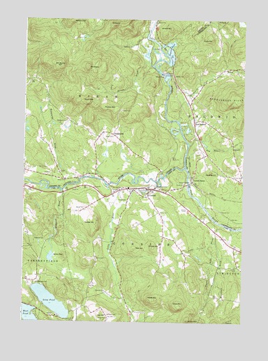
Cornish, ME USGS Topographic Map
Click on map above to begin viewing in our Map Viewer.

This topographic map contains these locations and features:
Feature Name Type Latitude Longitude GNIS ID View Map
Barker CemeteryCemeteryN43.7970°W70.8403°561604View Map
Barnes BrookStreamN43.8559°W70.8020°561623View Map
Benton CemeteryCemeteryN43.8520°W70.7895°562069View Map
Bill Merrill MountainSummitN43.8551°W70.8556°562259View Map
Bonney Memorial LibraryBuildingN43.8051°W70.8007°1910782View Map
Breakneck BrookStreamN43.8337°W70.7873°562926View Map
Clark MountainSummitN43.7562°W70.7859°564041View Map
Cole CemeteriesCemeteryN43.7853°W70.7626°564208View Map
CornishPopulated PlaceN43.8048°W70.8012°564370View Map
Cornish Elementary SchoolSchoolN43.8021°W70.8055°1910829View Map
Cornish Post OfficePost OfficeN43.8024°W70.8227°1910830View Map
Cornish StationLocaleN43.8081°W70.7790°564374View Map
Cornish Volunteer Fire StationBuildingN43.8023°W70.8070°2552853View Map
Cotton Burying GroundCemeteryN43.8728°W70.8582°2724640View Map
Cotton CemeteryCemeteryN43.8673°W70.8448°564388View Map
Day CemeteryCemeteryN43.7520°W70.8262°564832View Map
Day CemeteryCemeteryN43.7653°W70.8353°564833View Map
Day HillSummitN43.7527°W70.8297°564836View Map
Dug Hill BrookStreamN43.8234°W70.7809°565391View Map
Durgin CemeteryCemeteryN43.8265°W70.8245°565434View Map
DurgintownPopulated PlaceN43.8276°W70.8242°579262View Map
Dyer CemeteryCemeteryN43.7928°W70.7567°565455View Map
Eastman CemeteryCemeteryN43.7523°W70.8587°565742View Map
Edgecomb CemeteryCemeteryN43.7840°W70.8628°565787View Map
Flints MountainSummitN43.8667°W70.7684°566313View Map
Foster CemeteryCemeteryN43.8634°W70.8028°566450View Map
Gerrish CemeteryCemeteryN43.8137°W70.8617°566757View Map
Gordon CemeteryCemeteryN43.7723°W70.7534°566966View Map
Gould Bradeen CemeteryCemeteryN43.7659°W70.8676°566985View Map
Gould MountainSummitN43.8409°W70.8384°566997View Map
Great FallsFallsN43.8526°W70.7967°567139View Map
Guptill CemeteryCemeteryN43.7517°W70.8270°567399View Map
Harding HillSummitN43.8122°W70.7683°567605View Map
Hiram Falls DamDamN43.8526°W70.7970°1773581View Map
Hosac MountainSummitN43.7510°W70.7802°568331View Map
Ingalls PondLakeN43.8611°W70.7919°568626View Map
Little RiverStreamN43.8067°W70.7995°570005View Map
Long PondLakeN43.7583°W70.8586°570273View Map
Merrifield BrookStreamN43.7829°W70.7662°571146View Map
Merrill CemeteryCemeteryN43.7762°W70.8328°571158View Map
Mount CutlerSummitN43.8729°W70.8246°564713View Map
Mount MiserySummitN43.8551°W70.8387°571457View Map
New Country SchoolSchoolN43.8318°W70.7771°2738070View Map
Odd Fellows-Rebekah HallBuildingN43.8026°W70.8034°1911067View Map
Ossipee RiverStreamN43.8140°W70.7834°868940View Map
Peaked MountainSummitN43.8379°W70.8251°573090View Map
Pease BrookStreamN43.7904°W70.7617°573116View Map
Pease MountainSummitN43.7595°W70.8006°573119View Map
Pendexter CemeteryCemeteryN43.7526°W70.8267°573153View Map
Pendexter CemeteryCemeteryN43.7626°W70.8278°573154View Map
Pierce CemeteryCemeteryN43.8101°W70.7503°573306View Map
Pike HillSummitN43.7806°W70.8115°573341View Map
Pugsley BrookStreamN43.7809°W70.7698°573875View Map
Ricker CemeteryCemeteryN43.7953°W70.7973°574185View Map
Riverside CemeteryCemeteryN43.8042°W70.8217°574247View Map
Robbins HillSummitN43.8742°W70.8476°574290View Map
Saco River ReservoirReservoirN43.8526°W70.7970°1773582View Map
Sacopee Valley High SchoolSchoolN43.8108°W70.8695°2737911View Map
Sacopee Valley Middle SchoolSchoolN43.8099°W70.8679°2737925View Map
Smalls HillSummitN43.7806°W70.8009°575571View Map
Smalls MountainSummitN43.8715°W70.7918°575573View Map
South Hiram Elementary SchoolSchoolN43.8096°W70.8626°1908194View Map
Spruce PondLakeN43.7768°W70.8591°576161View Map
Tar CemeteryCemeteryN43.8126°W70.7962°576655View Map
Towles HillSummitN43.7911°W70.8340°577224View Map
Town of CornishCivilN43.7681°W70.8103°582421View Map
Town of HiramCivilN43.8638°W70.8258°582520View Map
Wadsworth BrookStreamN43.8084°W70.8434°577771View Map
Wadsworth CemeteryCemeteryN43.8326°W70.8509°577772View Map
Wadsworth CemeteryCemeteryN43.8642°W70.8131°577773View Map
Wedgwood BrookStreamN43.8042°W70.8534°577966View Map
Weeman CemeteryCemeteryN43.7962°W70.7620°577977View Map
West BaldwinPopulated PlaceN43.8331°W70.7778°578019View Map
West Baldwin CemeteryCemeteryN43.8324°W70.7787°2736262View Map
West Baldwin Fire StationBuildingN43.8319°W70.7782°2552858View Map
West Baldwin Post OfficePost OfficeN43.8299°W70.7780°1913967View Map
West PondLakeN43.7530°W70.8726°578206View Map

Note: Coordinates in the location and feature list above are referenced to NAD83 datum.


Copyright (C) 2008-2025 Ryan Niemi / Sunset Dynamics ... All Rights Reserved