TopoQuest Logo
Do you find TopoQuest useful?
Help keep TopoQuest running and adding new maps/features by donating!
Bitcoin:  19c7KJd3qBynnjoSw5npx9KScwjBe4ifkT
Litecoin:  LXs6TkuXGGXo1vDsWCkWVdjQX94eUKd6ui
Home View Maps Find Maps Find Places Resources & Links


Correll, Minnesota Topographic Map

USGS Map Title: Correll, MN
USGS Map MRC: 45096B2
DRG (GeoTIFF) Download: o45096b2.tif


Neighboring USGS Topographic Map Quads:


  Odessa, MN  
45096C3
 

  Artichoke Lake, MN  
45096C2
 

  Lake Oliver, MN  
45096C1
 

  Bellingham, MN  
45096B3
 

  Correll, MN  
45096B2
 

  Appleton, MN  
45096B1
 

  Haydenville, MN  
45096A3
 

  Madison, MN  
45096A2
 

  Cerro Gordo, MN  
45096A1


Map MRC Location:

N46°
W97°
N46°
W96°
H8 H7 H6 H5 H4 H3 H2 H1
G8 G7 G6 G5 G4 G3 G2 G1
F8 F7 F6 F5 F4 F3 F2 F1
E8 E7 E6 E5 E4 E3 E2 E1
D8 D7 D6 D5 D4 D3 D2 D1
C8 C7 C6 C5 C4 C3 C2 C1
B8 B7 B6 B5 B4 B3 B2 B1
A8 A7 A6 A5 A4 A3 A2 A1
N45°
W97°
N45°
W96°

Correll, MN USGS 1:24K Topographic Map Preview:
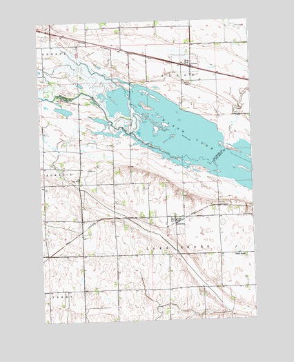
Correll, MN USGS Topographic Map
Click on map above to begin viewing in our Map Viewer.

This topographic map contains these locations and features:
Feature Name Type Latitude Longitude GNIS ID View Map
City of CorrellCivilN45.2319°W96.1626°2393639View Map
City of LouisburgCivilN45.1645°W96.1710°2395769View Map
CorrellLocaleN45.2306°W96.1606°2067203View Map
CorrellPopulated PlaceN45.2308°W96.1595°641513View Map
Correll Post OfficePost OfficeN45.2308°W96.1592°2067204View Map
Correll Volunteer Fire DepartmentBuildingN45.2309°W96.1590°2666669View Map
Good Shepherd Lutheran ChurchChurchN45.2308°W96.1592°2067205View Map
Grace Lutheran ChurchChurchN45.2317°W96.1622°2067206View Map
Lac Qui Parle Wildlife Refuge Number 2 DamDamN45.2033°W96.2253°1777050View Map
Louisberg Lutheran ChurchChurchN45.1672°W96.1708°2065826View Map
Louisberg Lutheran ChurchChurchN45.1672°W96.1708°2066463View Map
LouisburgPopulated PlaceN45.1661°W96.1712°647223View Map
LouisburgLocaleN45.1661°W96.1708°2065872View Map
LouisburgLocaleN45.1661°W96.1708°2066509View Map
Louisburg Fire DepartmentBuildingN45.1669°W96.1716°2666280View Map
Louisburg Lutheran CemeteryCemeteryN45.1653°W96.1764°2065857View Map
Louisburg Post OfficePost OfficeN45.1661°W96.1708°2065871View Map
Louisburg Post OfficePost OfficeN45.1661°W96.1708°2066508View Map
School Number 867 (historical)SchoolN45.1519°W96.1367°651758View Map
Township of Lake ShoreCivilN45.1317°W96.1677°664700View Map

Note: Coordinates in the location and feature list above are referenced to NAD83 datum.


Copyright (C) 2008-2025 Ryan Niemi / Sunset Dynamics ... All Rights Reserved