TopoQuest Logo
Do you find TopoQuest useful?
Help keep TopoQuest running and adding new maps/features by donating!
Bitcoin:  19c7KJd3qBynnjoSw5npx9KScwjBe4ifkT
Litecoin:  LXs6TkuXGGXo1vDsWCkWVdjQX94eUKd6ui
Home View Maps Find Maps Find Places Resources & Links


Krag Peak, Oregon Topographic Map

USGS Map Title: Krag Peak, OR
USGS Map MRC: 45117A3
DRG (GeoTIFF) Download: o45117a3.tif


Neighboring USGS Topographic Map Quads:


  Steamboat Lake, OR  
45117B4
 

  Eagle Cap, OR  
45117B3
 

  Aneroid Mountain, OR  
45117B2
 

  Bennet Peak, OR  
45117A4
 

  Krag Peak, OR  
45117A3
 

  Cornucopia, OR  
45117A2
 

  Balm Creek Reservoir, OR  
44117H4
 

  Sparta Butte, OR  
44117H3
 

  Jimtown, OR  
44117H2


Map MRC Location:

N46°
W118°
N46°
W117°
H8 H7 H6 H5 H4 H3 H2 H1
G8 G7 G6 G5 G4 G3 G2 G1
F8 F7 F6 F5 F4 F3 F2 F1
E8 E7 E6 E5 E4 E3 E2 E1
D8 D7 D6 D5 D4 D3 D2 D1
C8 C7 C6 C5 C4 C3 C2 C1
B8 B7 B6 B5 B4 B3 B2 B1
A8 A7 A6 A5 A4 A3 A2 A1
N45°
W118°
N45°
W117°

Krag Peak, OR USGS 1:24K Topographic Map Preview:
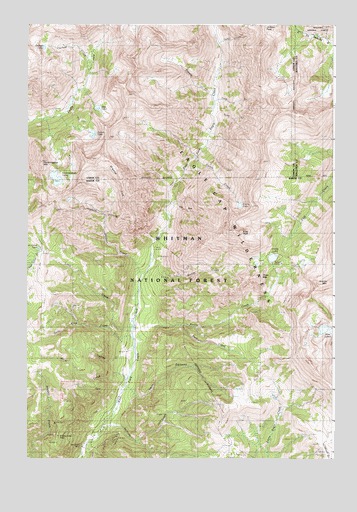
Krag Peak, OR USGS Topographic Map
Click on map above to begin viewing in our Map Viewer.

This topographic map contains these locations and features:
Feature Name Type Latitude Longitude GNIS ID View Map
Bear LakeLakeN45.1008°W117.3465°1137721View Map
Bradley Creek MineMineN45.0060°W117.3624°1138560View Map
Cached LakeLakeN45.1181°W117.3685°1139132View Map
Coon CreekStreamN45.1027°W117.2991°1140070View Map
Crater LakeLakeN45.0579°W117.2753°1140396View Map
Crater Lake DamDamN45.0590°W117.2733°1155545View Map
Culver LakeLakeN45.0933°W117.3473°1140542View Map
Curtis CreekStreamN45.0865°W117.3066°1140570View Map
Curtis LakeLakeN45.0730°W117.2886°1140571View Map
Dodge CreekStreamN45.1199°W117.2971°1141103View Map
East Eagle MineMineN45.0035°W117.3530°1141523View Map
East Eagle TrailheadLocaleN45.0602°W117.3241°1156618View Map
French CreekStreamN45.1043°W117.2991°1142460View Map
Gold King CreekStreamN45.0282°W117.3332°1142820View Map
Granite CliffCliffN45.0810°W117.3374°1142915View Map
Hudson CreekStreamN45.0554°W117.3252°1143891View Map
Hummingbird MountainSummitN45.0846°W117.3685°1143911View Map
Jack CreekStreamN45.0182°W117.3366°1144163View Map
Kettle CreekStreamN45.0329°W117.3307°1144582View Map
Krag PeakSummitN45.0649°W117.2891°1144706View Map
Lawson CreekStreamN45.1238°W117.2996°1144893View Map
Lime CreekStreamN45.0363°W117.3324°1145020View Map
Little Kettle CreekStreamN45.0499°W117.3294°1145192View Map
Lookingglass LakeLakeN45.0805°W117.3635°1145457View Map
Lookingglass Lake DamDamN45.0827°W117.3634°1153939View Map
Lower Pine LakeReservoirN45.0368°W117.2513°1155603View Map
Lower Pine Lake DamDamN45.0365°W117.2506°1155604View Map
Main Creek TrailTrailN45.1024°W117.3566°1145759View Map
Papoose CreekStreamN45.0265°W117.3338°1147405View Map
Park CreekStreamN45.0379°W117.3121°1147434View Map
Pine LakesLakeN45.0373°W117.2540°1147717View Map
Snow CreekStreamN45.0982°W117.2996°1149809View Map
Sullivan CreekStreamN45.0093°W117.3424°1150571View Map
The BoxValleyN45.0732°W117.3160°1150999View Map
Truax MountainSummitN45.0521°W117.2810°1151461View Map
Twin CanyonValleyN45.0188°W117.3360°1151557View Map
Two Color LakeLakeN45.0606°W117.3707°1151608View Map
Upper Pine LakeReservoirN45.0374°W117.2546°1155672View Map
Upper Pine Lake DamDamN45.0373°W117.2525°1155673View Map

Note: Coordinates in the location and feature list above are referenced to NAD83 datum.


Copyright (C) 2008-2024 Ryan Niemi / Sunset Dynamics ... All Rights Reserved