TopoQuest Logo
Do you find TopoQuest useful?
Help keep TopoQuest running and adding new maps/features by donating!
Bitcoin:  19c7KJd3qBynnjoSw5npx9KScwjBe4ifkT
Litecoin:  LXs6TkuXGGXo1vDsWCkWVdjQX94eUKd6ui
Home View Maps Find Maps Find Places Resources & Links


Cotesfield, Nebraska Topographic Map

USGS Map Title: Cotesfield, NE
USGS Map MRC: 41098C6
DRG (GeoTIFF) Download: o41098c6.tif


Neighboring USGS Topographic Map Quads:


  North Loup, NE  
41098D7
 

  Scotia, NE  
41098D6
 

  Scotia NE, NE  
41098D5
 

  Loup City SE, NE  
41098C7
 

  Cotesfield, NE  
41098C6
 

  Elba, NE  
41098C5
 

  Ashton, NE  
41098B7
 

  Farwell, NE  
41098B6
 

  Nysted, NE  
41098B5


Map MRC Location:

N42°
W99°
N42°
W98°
H8 H7 H6 H5 H4 H3 H2 H1
G8 G7 G6 G5 G4 G3 G2 G1
F8 F7 F6 F5 F4 F3 F2 F1
E8 E7 E6 E5 E4 E3 E2 E1
D8 D7 D6 D5 D4 D3 D2 D1
C8 C7 C6 C5 C4 C3 C2 C1
B8 B7 B6 B5 B4 B3 B2 B1
A8 A7 A6 A5 A4 A3 A2 A1
N41°
W99°
N41°
W98°

Cotesfield, NE USGS 1:24K Topographic Map Preview:
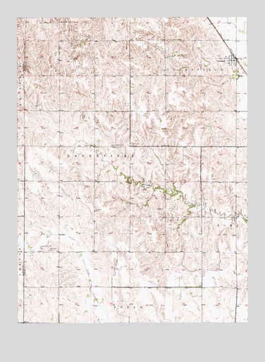
Cotesfield, NE USGS Topographic Map
Click on map above to begin viewing in our Map Viewer.

This topographic map contains these locations and features:
Feature Name Type Latitude Longitude GNIS ID View Map
CotesfieldPopulated PlaceN41.3572°W98.6326°828358View Map
CotesfieldLocaleN41.3572°W98.6326°1874838View Map
Cotesfield City ParkParkN41.3597°W98.6342°1874840View Map
Cotesfield Detention DamDamN41.3586°W98.6396°1767133View Map
Cotesfield Post OfficePost OfficeN41.3572°W98.6326°1874839View Map
Cotesfield ReservoirReservoirN41.3586°W98.6399°1767134View Map
Cotesfield Village Police DepartmentBuildingN41.3572°W98.6326°1874837View Map
Danish Evangelical Lutheran ChurchChurchN41.3225°W98.7079°1874843View Map
DannevirkePopulated PlaceN41.3225°W98.7084°828577View Map
Dannevirke CemeteryCemeteryN41.3228°W98.6990°828578View Map
Dannevirke Election PrecinctCivilN41.3209°W98.7065°1928807View Map
Dannevirke Post Office (historical)Post OfficeN41.3225°W98.7084°1874767View Map
Mount Carmel CemeteryCemeteryN41.2797°W98.7331°831450View Map
Our Lady of Mount Carmel ChurchChurchN41.2803°W98.7370°1874849View Map
Paplin (historical)Populated PlaceN41.2803°W98.7367°1874848View Map
Saint Mary CemeteryCemeteryN41.3497°W98.6540°832976View Map
School Number 29SchoolN41.3058°W98.6695°836519View Map
School Number 35 (historical)SchoolN41.2956°W98.6973°836620View Map
School Number 5 (historical)SchoolN41.3467°W98.6459°836811View Map
School Number 52LocaleN41.2500°W98.6454°836846View Map
School Number 58SchoolN41.2808°W98.7379°836900View Map
School Number 71SchoolN41.3731°W98.7276°837044View Map
Township of DannevirkeCivilN41.3333°W98.7087°1874746View Map
Village of CotesfieldCivilN41.3576°W98.6336°2398634View Map

Note: Coordinates in the location and feature list above are referenced to NAD83 datum.


Copyright (C) 2008-2024 Ryan Niemi / Sunset Dynamics ... All Rights Reserved