TopoQuest Logo
Do you find TopoQuest useful?
Help keep TopoQuest running and adding new maps/features by donating!
Bitcoin:  19c7KJd3qBynnjoSw5npx9KScwjBe4ifkT
Litecoin:  LXs6TkuXGGXo1vDsWCkWVdjQX94eUKd6ui
Home View Maps Find Maps Find Places Resources & Links


Nysted, Nebraska Topographic Map

USGS Map Title: Nysted, NE
USGS Map MRC: 41098B5
DRG (GeoTIFF) Download: o41098b5.tif


Neighboring USGS Topographic Map Quads:


  Cotesfield, NE  
41098C6
 

  Elba, NE  
41098C5
 

  Wolbach SW, NE  
41098C4
 

  Farwell, NE  
41098B6
 

  Nysted, NE  
41098B5
 

  Saint Paul, NE  
41098B4
 

  Boelus, NE  
41098A6
 

  Dannebrog, NE  
41098A5
 

  Saint Paul SW, NE  
41098A4


Map MRC Location:

N42°
W99°
N42°
W98°
H8 H7 H6 H5 H4 H3 H2 H1
G8 G7 G6 G5 G4 G3 G2 G1
F8 F7 F6 F5 F4 F3 F2 F1
E8 E7 E6 E5 E4 E3 E2 E1
D8 D7 D6 D5 D4 D3 D2 D1
C8 C7 C6 C5 C4 C3 C2 C1
B8 B7 B6 B5 B4 B3 B2 B1
A8 A7 A6 A5 A4 A3 A2 A1
N41°
W99°
N41°
W98°

Nysted, NE USGS 1:24K Topographic Map Preview:
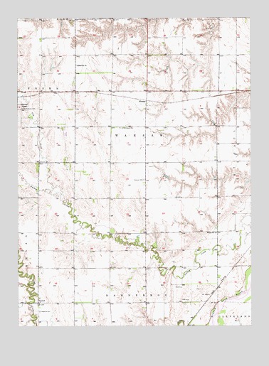
Nysted, NE USGS Topographic Map
Click on map above to begin viewing in our Map Viewer.

This topographic map contains these locations and features:
Feature Name Type Latitude Longitude GNIS ID View Map
Cow CreekStreamN41.1808°W98.6065°828416View Map
Czechoslovakia CemeteryCemeteryN41.2133°W98.6228°828542View Map
Howard CountyCivilN41.2200°W98.5171°835868View Map
Jacobs Waste Treatment DamDamN41.1987°W98.6001°1769932View Map
Jacobs Waste Treatment ReservoirReservoirN41.2005°W98.6002°1769933View Map
Jensen DamDamN41.1853°W98.5453°1767147View Map
Jensen ReservoirReservoirN41.1857°W98.5472°1767148View Map
MidwayPopulated PlaceN41.2147°W98.5570°835381View Map
NystedPopulated PlaceN41.1345°W98.6145°831778View Map
Nysted Evangelical CemeteryCemeteryN41.1308°W98.6140°829162View Map
Nysted Post Office (historical)Post OfficeN41.1345°W98.6145°1874752View Map
Ransom DamDamN41.1483°W98.5253°1770110View Map
Ransom ReservoirReservoirN41.1483°W98.5253°1770111View Map
Saint Peders Lutheran ChurchChurchN41.1347°W98.6137°1874844View Map
Saint Wenceslaus CemeteryCemeteryN41.2056°W98.5706°833114View Map
Saint Wenceslaus Cemetery Historical MarkerParkN41.2056°W98.5706°1874847View Map
School Number 13SchoolN41.1628°W98.5190°836216View Map
School Number 18SchoolN41.2308°W98.5940°836329View Map
School Number 27SchoolN41.2350°W98.5565°836493View Map
School Number 38SchoolN41.1767°W98.6148°836657View Map
School Number 55SchoolN41.2131°W98.5076°836868View Map
School Number 61SchoolN41.1622°W98.5740°836946View Map
School Number 8SchoolN41.1917°W98.5573°837100View Map
Scotch CemeteryCemeteryN41.1917°W98.6134°833309View Map
Township of WarsawCivilN41.2083°W98.5420°1874737View Map
Warsaw CemeteryCemeteryN41.1844°W98.5578°834489View Map
Warsaw Election PrecinctCivilN41.2001°W98.5607°1929362View Map

Note: Coordinates in the location and feature list above are referenced to NAD83 datum.


Copyright (C) 2008-2025 Ryan Niemi / Sunset Dynamics ... All Rights Reserved