TopoQuest Logo
Do you find TopoQuest useful?
Help keep TopoQuest running and adding new maps/features by donating!
Bitcoin:  19c7KJd3qBynnjoSw5npx9KScwjBe4ifkT
Litecoin:  LXs6TkuXGGXo1vDsWCkWVdjQX94eUKd6ui
Home View Maps Find Maps Find Places Resources & Links


Cotton Plant, Louisiana Topographic Map

USGS Map Title: Cotton Plant, LA
USGS Map MRC: 32092A3
DRG (GeoTIFF) Download: o32092a3.tif


Neighboring USGS Topographic Map Quads:


  Womack, LA  
32092B4
 

  Vixen, LA  
32092B3
 

  Blankston, LA  
32092B2
 

  Sikes, LA  
32092A4
 

  Cotton Plant, LA  
32092A3
 

  Clark, LA  
32092A2
 

  Flat Creek, LA  
31092H4
 

  Olla West, LA  
31092H3
 

  Olla East, LA  
31092H2


Map MRC Location:

N33°
W93°
N33°
W92°
H8 H7 H6 H5 H4 H3 H2 H1
G8 G7 G6 G5 G4 G3 G2 G1
F8 F7 F6 F5 F4 F3 F2 F1
E8 E7 E6 E5 E4 E3 E2 E1
D8 D7 D6 D5 D4 D3 D2 D1
C8 C7 C6 C5 C4 C3 C2 C1
B8 B7 B6 B5 B4 B3 B2 B1
A8 A7 A6 A5 A4 A3 A2 A1
N32°
W93°
N32°
W92°

Cotton Plant, LA USGS 1:24K Topographic Map Preview:
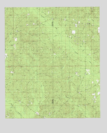
Cotton Plant, LA USGS Topographic Map
Click on map above to begin viewing in our Map Viewer.

This topographic map contains these locations and features:
Feature Name Type Latitude Longitude GNIS ID View Map
Bentle CreekStreamN32.0438°W92.2518°532951View Map
Bozeman BranchStreamN32.0824°W92.3699°533356View Map
Bozeman Branch Gas FieldOilfieldN32.1043°W92.3563°549123View Map
Buck BranchStreamN32.0699°W92.2774°533494View Map
ChesterPopulated PlaceN32.1115°W92.3132°540722View Map
Cotton PlantPopulated PlaceN32.1060°W92.2663°556551View Map
Cotton Plant Gas FieldOilfieldN32.1057°W92.2585°542391View Map
Cypress CreekStreamN32.0999°W92.3035°534360View Map
Fox BranchStreamN32.0904°W92.3013°535075View Map
Garden CreekStreamN32.0735°W92.2838°535173View Map
Hart CreekStreamN32.0802°W92.2918°535547View Map
Hatthaway Branch Gas FieldOilfieldN32.0099°W92.3468°549143View Map
Hebron Baptist ChurchChurchN32.0971°W92.3579°554689View Map
Hebron BranchStreamN32.1063°W92.3204°535607View Map
Hebron CemeteryCemeteryN32.0982°W92.3596°549144View Map
Hickory Valley Gas FieldOilfieldN32.0252°W92.3515°549146View Map
Kelly CemeteryCemeteryN32.0713°W92.2943°554918View Map
Lone Hill ChurchChurchN32.0596°W92.3632°536664View Map
McCarty CemeteryCemeteryN32.0546°W92.3640°536967View Map
Morgan CreekStreamN32.0846°W92.2935°537205View Map
NewportPopulated PlaceN32.0827°W92.3682°540721View Map
Newport Oil and Gas FieldOilfieldN32.0865°W92.3118°557043View Map
Newsom CemeteryCemeteryN32.0488°W92.3007°537669View Map
North Hickory Valley Gas FieldOilfieldN32.0790°W92.3713°549165View Map
Northeast Hickory Valley Gas FieldOilfieldN32.0502°W92.3363°549164View Map
Old Newport (historical)Populated PlaceN32.1052°W92.3404°549168View Map
Old Union Baptist ChurchChurchN32.1232°W92.2599°555557View Map
Old Union CemeteryCemeteryN32.1243°W92.2604°542419View Map
Piney Creek Gas FieldOilfieldN32.0196°W92.3071°542422View Map
Powers CemeteryCemeteryN32.0315°W92.2679°538379View Map
Roberts CemeteryCemeteryN32.0279°W92.2776°538639View Map
Sardis ChurchChurchN32.0288°W92.2768°539179View Map
Sardis Church of Gas FieldOilfieldN32.0363°W92.2626°542425View Map
Spring Hill ChurchChurchN32.0302°W92.2801°539596View Map

Note: Coordinates in the location and feature list above are referenced to NAD83 datum.


Copyright (C) 2008-2025 Ryan Niemi / Sunset Dynamics ... All Rights Reserved