TopoQuest Logo
Do you find TopoQuest useful?
Help keep TopoQuest running and adding new maps/features by donating!
Bitcoin:  19c7KJd3qBynnjoSw5npx9KScwjBe4ifkT
Litecoin:  LXs6TkuXGGXo1vDsWCkWVdjQX94eUKd6ui
Home View Maps Find Maps Find Places Resources & Links


Cottontown, Tennessee Topographic Map

USGS Map Title: Cottontown, TN
USGS Map MRC: 36086D5
DRG (GeoTIFF) Download: o36086d5.tif


Neighboring USGS Topographic Map Quads:


  Orlinda, TN  
36086E6
 

  Portland, TN  
36086E5
 

  Fountain Head, TN  
36086E4
 

  White House, TN  
36086D6
 

  Cottontown, TN  
36086D5
 

  Gallatin, TN  
36086D4
 

  Goodlettsville, TN  
36086C6
 

  Hendersonville, TN  
36086C5
 

  Laguardo, TN  
36086C4


Map MRC Location:

N37°
W87°
N37°
W86°
H8 H7 H6 H5 H4 H3 H2 H1
G8 G7 G6 G5 G4 G3 G2 G1
F8 F7 F6 F5 F4 F3 F2 F1
E8 E7 E6 E5 E4 E3 E2 E1
D8 D7 D6 D5 D4 D3 D2 D1
C8 C7 C6 C5 C4 C3 C2 C1
B8 B7 B6 B5 B4 B3 B2 B1
A8 A7 A6 A5 A4 A3 A2 A1
N36°
W87°
N36°
W86°

Cottontown, TN USGS 1:24K Topographic Map Preview:
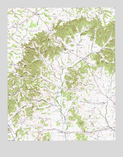
Cottontown, TN USGS Topographic Map
Click on map above to begin viewing in our Map Viewer.

This topographic map contains these locations and features:
Feature Name Type Latitude Longitude GNIS ID View Map
Bandmill HollowValleyN36.4529°W86.5855°1276259View Map
Barrett CemeteryCemeteryN36.4270°W86.5403°1276382View Map
Barrett CemeteryCemeteryN36.4292°W86.5330°1276383View Map
Bigbee CemeteryCemeteryN36.4423°W86.5719°1277442View Map
Bloodworth CemeteryCemeteryN36.3859°W86.5144°1277702View Map
Briggance BranchStreamN36.4567°W86.5272°1278375View Map
Briggance CemeteryCemeteryN36.4442°W86.5611°1278376View Map
Briggance CemeteryCemeteryN36.4631°W86.5255°1278377View Map
Brinkley BranchStreamN36.4084°W86.5656°1278404View Map
Bug HollowValleyN36.4524°W86.5386°1278931View Map
Bursby HollowValleyN36.4717°W86.5221°1279124View Map
Capps GapGapN36.4353°W86.6103°1305680View Map
Carter-Collier CemeteryCemeteryN36.3878°W86.5083°1279823View Map
Chestnut RidgeRidgeN36.4217°W86.6100°1280417View Map
Commissioner District 12CivilN36.4972°W86.6008°2464365View Map
Commissioner District 4CivilN36.4284°W86.5301°2464090View Map
Cotton CemeteryCemeteryN36.4525°W86.5403°1281354View Map
CottontownPopulated PlaceN36.4514°W86.5380°1281368View Map
Cottontown Baptist ChurchChurchN36.4509°W86.5369°1320610View Map
Cottontown Census Designated PlaceCensusN36.4489°W86.5336°2584576View Map
Cottontown Church of ChristChurchN36.4492°W86.5344°1325959View Map
Cottontown Fire AssociationBuildingN36.4546°W86.5436°2653758View Map
Cottontown Post OfficePost OfficeN36.4542°W86.5446°1651534View Map
Cottontown School (historical)SchoolN36.4525°W86.5380°1320611View Map
County House HillSummitN36.4812°W86.5261°1281385View Map
Crab HollowValleyN36.4581°W86.5184°1281519View Map
Craig-Hudson CemeteryCemeteryN36.3828°W86.5539°1281550View Map
Crutcher Lake DamDamN36.3750°W86.5750°1302553View Map
Cummings CemeteryCemeteryN36.4128°W86.5289°1281850View Map
Cummings CemeteryCemeteryN36.4198°W86.5183°1281851View Map
Cummings CrossroadsPopulated PlaceN36.4784°W86.5761°1281854View Map
Cunningham CemeteryCemeteryN36.4728°W86.5289°1281871View Map
Dan Kirk BranchStreamN36.3817°W86.6158°1282009View Map
Dempsey CemeteryCemeteryN36.4134°W86.5500°1282334View Map
Dorris CemeteryCemeteryN36.4064°W86.5489°1282651View Map
Douglas CemeteryCemeteryN36.3917°W86.5625°1282725View Map
Douglas ChapelChurchN36.3828°W86.5614°1282730View Map
Dripping SpringSpringN36.4752°W86.5392°1282799View Map
Durham HollowValleyN36.4554°W86.5848°1283232View Map
Edwards CemeteryCemeteryN36.4381°W86.5142°1283554View Map
Fairmont SchoolSchoolN36.4950°W86.5944°1283982View Map
Friendship CemeteryCemeteryN36.4828°W86.6186°1646770View Map
Garrison CemeteryCemeteryN36.4323°W86.6039°1285209View Map
George CemeteryCemeteryN36.4817°W86.5742°1285297View Map
Gillespie ProspectMineN36.4309°W86.5311°1320638View Map
Green CemeteryCemeteryN36.4156°W86.5067°1286084View Map
Groundhop HollowValleyN36.4291°W86.5278°1286350View Map
Hardin CemeteryCemeteryN36.4228°W86.5547°1286823View Map
Hardin-Bennett CemeteryCemeteryN36.4917°W86.5750°1286841View Map
Hogg CemeteryCemeteryN36.4617°W86.5608°1288001View Map
Hollis ChapelChurchN36.4953°W86.5189°1320654View Map
Hollis Chapel SchoolSchoolN36.4945°W86.5192°1288073View Map
Honeycutt CemeteryCemeteryN36.4245°W86.6172°1288214View Map
Horn-Hudson CemeteryCemeteryN36.3984°W86.5305°1288361View Map
Howlis CemeteryCemeteryN36.4789°W86.5358°1288571View Map
Hutlet HollowValleyN36.3759°W86.6179°1288871View Map
Jackson HollowValleyN36.4117°W86.5502°1289229View Map
Joel HollowValleyN36.4620°W86.5118°1289474View Map
Johnsons CrossroadsPopulated PlaceN36.4942°W86.5931°1289663View Map
Jones CemeteryCemeteryN36.4495°W86.6097°1289760View Map
Kill Buck KnobSummitN36.3912°W86.5400°1290156View Map
Kirk HillSummitN36.4575°W86.5105°1290294View Map
Liberty Community HallLocaleN36.4109°W86.5125°1291147View Map
Liberty United Methodist ChurchChurchN36.4106°W86.5119°1325964View Map
Liggett BranchStreamN36.4239°W86.5639°1291262View Map
Little Bethel ChurchChurchN36.4606°W86.5608°1291388View Map
McCloud CemeteryCemeteryN36.4920°W86.5339°1293162View Map
McCloud CemeteryCemeteryN36.4989°W86.5055°1293163View Map
McMurtry CemeteryCemeteryN36.3845°W86.6228°1293428View Map
Mount Olivet Baptist ChurchChurchN36.4070°W86.5958°1646696View Map
Mount Olivet Baptist Church CemeteryCemeteryN36.4067°W86.5962°1646697View Map
Mount Olivet SchoolSchoolN36.4073°W86.5964°1294716View Map
Murphy-Bush CemeteryCemeteryN36.3825°W86.5319°1295131View Map
O'Ryan KnobSummitN36.4478°W86.5197°1296046View Map
OcanaPopulated PlaceN36.3825°W86.5583°1311947View Map
Old Friendship ChurchChurchN36.4820°W86.6192°1306860View Map
Old Indian CemeteryCemeteryN36.3925°W86.5297°1296327View Map
Palmer ChapelChurchN36.4467°W86.6228°1646694View Map
Palmer Chapel CemeteryCemeteryN36.4456°W86.6180°1646695View Map
Palmer Chapel SchoolSchoolN36.4470°W86.6225°1296697View Map
Pee Dee CreekStreamN36.4328°W86.5631°1297105View Map
Pitt CemeteryCemeteryN36.4759°W86.5747°1297741View Map
Pitt HillSummitN36.4345°W86.5453°1297742View Map
Pitt-Bursby CemeteryCemeteryN36.4717°W86.5233°1297743View Map
Polk LakeReservoirN36.4127°W86.6158°1298062View Map
Poplar HollowValleyN36.4712°W86.5047°1298210View Map
Rival (historical)Populated PlaceN36.3870°W86.5067°1311953View Map
Robertson ProspectMineN36.3798°W86.5361°1320688View Map
Sandy ValleyValleyN36.3941°W86.6235°1300776View Map
Scobey HillSummitN36.4623°W86.5361°1300911View Map
Shackle Island Census Designated PlaceCensusN36.3775°W86.6168°2584593View Map
Shaw BranchStreamN36.3995°W86.5606°1269929View Map
Shaw CemeteryCemeteryN36.4756°W86.6211°1269935View Map
Shoot HollowValleyN36.3884°W86.6243°1270159View Map
Singleton CemeteryCemeteryN36.4262°W86.5064°1270364View Map
Station Camp (historical)Populated PlaceN36.3981°W86.5594°1311964View Map
Station Camp ChurchChurchN36.4206°W86.5642°1303809View Map
Stone BranchStreamN36.4331°W86.5172°1271471View Map
Stone HillSummitN36.4489°W86.5147°1271492View Map
Stratton CemeteryCemeteryN36.3839°W86.5058°1271579View Map
Strother BranchStreamN36.4500°W86.5411°1271608View Map
Strother CemeteryCemeteryN36.4464°W86.5753°1271609View Map
Strother CemeteryCemeteryN36.4700°W86.5380°1271610View Map
Strother ChurchChurchN36.4598°W86.5536°1303882View Map
Strother-Mitchell CemeteryCemeteryN36.4389°W86.5389°1271611View Map
Sumner County HomeLocaleN36.4650°W86.5419°1271852View Map
Two ChestnutPopulated PlaceN36.4470°W86.6169°1273132View Map
Village Green CemeteryCemeteryN36.4195°W86.5019°1273460View Map
Walnut GrovePopulated PlaceN36.4842°W86.6131°1273715View Map
Walnut Grove CemeteryCemeteryN36.4848°W86.6111°1646771View Map
Walnut Grove Census Designated PlaceCensusN36.4890°W86.6057°2584596View Map
Walnut Grove United Methodist ChurchChurchN36.4842°W86.6069°1325970View Map
Webb ProspectMineN36.3859°W86.5858°1320720View Map
White CemeteryCemeteryN36.4298°W86.5383°1274356View Map
White House Division (historical)CensusN36.4803°W86.6133°1648977View Map
Zarecor CemeteryCemeteryN36.4520°W86.5844°1275350View Map

Note: Coordinates in the location and feature list above are referenced to NAD83 datum.


Copyright (C) 2008-2024 Ryan Niemi / Sunset Dynamics ... All Rights Reserved