TopoQuest Logo
Do you find TopoQuest useful?
Help keep TopoQuest running and adding new maps/features by donating!
Bitcoin:  19c7KJd3qBynnjoSw5npx9KScwjBe4ifkT
Litecoin:  LXs6TkuXGGXo1vDsWCkWVdjQX94eUKd6ui
Home View Maps Find Maps Find Places Resources & Links


Portland, Tennessee Topographic Map

USGS Map Title: Portland, TN
USGS Map MRC: 36086E5
DRG (GeoTIFF) Download: o36086e5.tif


Neighboring USGS Topographic Map Quads:


  Prices Mill, KY  
36086F6
 

  Franklin, KY  
36086F5
 

  Hickory Flat, KY  
36086F4
 

  Orlinda, TN  
36086E6
 

  Portland, TN  
36086E5
 

  Fountain Head, TN  
36086E4
 

  White House, TN  
36086D6
 

  Cottontown, TN  
36086D5
 

  Gallatin, TN  
36086D4


Map MRC Location:

N37°
W87°
N37°
W86°
H8 H7 H6 H5 H4 H3 H2 H1
G8 G7 G6 G5 G4 G3 G2 G1
F8 F7 F6 F5 F4 F3 F2 F1
E8 E7 E6 E5 E4 E3 E2 E1
D8 D7 D6 D5 D4 D3 D2 D1
C8 C7 C6 C5 C4 C3 C2 C1
B8 B7 B6 B5 B4 B3 B2 B1
A8 A7 A6 A5 A4 A3 A2 A1
N36°
W87°
N36°
W86°

Portland, TN USGS 1:24K Topographic Map Preview:
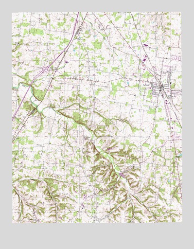
Portland, TN USGS Topographic Map
Click on map above to begin viewing in our Map Viewer.

This topographic map contains these locations and features:
Feature Name Type Latitude Longitude GNIS ID View Map
Armstrong CemeteryCemeteryN36.5650°W86.6114°1644155View Map
Austin BranchStreamN36.5667°W86.5925°1275995View Map
Belcher HollowValleyN36.5360°W86.5521°1647552View Map
Brewer CemeteryCemeteryN36.5625°W86.6153°1644183View Map
Buntin CemeteryCemeteryN36.5842°W86.6042°1644186View Map
Byram ChapelChurchN36.6067°W86.6197°1314112View Map
Byrams Chapel CemeteryCemeteryN36.6064°W86.6192°1644189View Map
Cedarcroft BranchStreamN36.5203°W86.6228°1280106View Map
Cheeks Stand (historical)LocaleN36.5739°W86.6078°1644198View Map
Chestnut GrovePopulated PlaceN36.5359°W86.5294°1647558View Map
Chestnut Grove ChurchChurchN36.5331°W86.5369°1305889View Map
City of PortlandCivilN36.5878°W86.5190°2404562View Map
Clearview Church of ChristChurchN36.5453°W86.6031°1646709View Map
Clearview SchoolSchoolN36.5453°W86.6025°1280685View Map
Cold Springs MuseumBuildingN36.5831°W86.5089°1320607View Map
Commissioner District 2CivilN36.5985°W86.5131°2463976View Map
Cummings CemeteryCemeteryN36.6209°W86.5892°1306234View Map
Elmer Hinton Memorial LibraryBuildingN36.5825°W86.5089°1320616View Map
Groves CemeteryCemeteryN36.6081°W86.6078°1644306View Map
Hall TownPopulated PlaceN36.5037°W86.5636°1286600View Map
Hall Town CreekStreamN36.5178°W86.5383°1286601View Map
Halltown Baptist ChurchChurchN36.5039°W86.5650°1325962View Map
Halltown CemeteryCemeteryN36.5053°W86.5633°1646710View Map
Hardin CemeteryCemeteryN36.5867°W86.5322°1286824View Map
Highland Rim TerracePopulated PlaceN36.5598°W86.5125°1311928View Map
Highland Volunteer Fire Department Station 1BuildingN36.5573°W86.5054°2653924View Map
Highland Volunteer Fire Department Station 2BuildingN36.5100°W86.5743°2654289View Map
Hodges Cherry Mound Airport (historical)AirportN36.5362°W86.6222°1301434View Map
Hollis Chapel CreekStreamN36.5178°W86.5383°1311930View Map
Immanuel ChurchChurchN36.6098°W86.5772°1288918View Map
Interchange 117CrossingN36.5914°W86.6006°1310493View Map
Jacobs CemeteryCemeteryN36.5664°W86.6186°1644318View Map
Liberty Free Will Baptist Church of PortlandChurchN36.5842°W86.5664°2634713View Map
Link CemeteryCemeteryN36.5281°W86.5922°1291344View Map
Link CemeteryCemeteryN36.5345°W86.5836°1291345View Map
Maple Hill CemeteryCemeteryN36.5875°W86.5139°1320662View Map
Meadowbrook ParkParkN36.5692°W86.5139°1320664View Map
Mount Pleasant ChurchChurchN36.5503°W86.5725°1294779View Map
MulloyPopulated PlaceN36.5498°W86.6233°1295095View Map
New DealPopulated PlaceN36.5173°W86.5636°1295468View Map
New Deal Census Designated PlaceCensusN36.5139°W86.5629°2584587View Map
New Hope Baptist ChurchChurchN36.5923°W86.5683°1646711View Map
New Hope CemeteryCemeteryN36.5917°W86.5683°1646712View Map
Oak Grove CemeteryCemeteryN36.5409°W86.6164°1646708View Map
Oakmont Elementary SchoolSchoolN36.5092°W86.5731°1648456View Map
Orlinda Volunteer Fire Department Station 2BuildingN36.5960°W86.5899°2654092View Map
Phillip Bradshaw LakeReservoirN36.5434°W86.5567°1302670View Map
Phillip Bradshaw Lake DamDamN36.5434°W86.5567°1302671View Map
Pleasant ValleyPopulated PlaceN36.5014°W86.6064°1647563View Map
Pleasant Valley CemeteryCemeteryN36.5017°W86.6072°1646707View Map
Pleasant Valley ChurchChurchN36.5017°W86.6064°1297940View Map
PortlandPopulated PlaceN36.5817°W86.5164°1298281View Map
Portland City HallBuildingN36.5806°W86.5136°1320681View Map
Portland City ParkParkN36.5792°W86.5181°1320682View Map
Portland Fire DepartmentBuildingN36.5877°W86.5205°2653754View Map
Portland First Baptist ChurchChurchN36.5812°W86.5164°1320683View Map
Portland High SchoolSchoolN36.5709°W86.5114°1320684View Map
Portland Medical CenterHospitalN36.5573°W86.5117°1320649View Map
Portland Middle SchoolSchoolN36.5562°W86.5072°1320685View Map
Portland Police DepartmentBuildingN36.5873°W86.5205°2765788View Map
Portland Post OfficePost OfficeN36.5737°W86.5165°1651546View Map
ReubensvillePopulated PlaceN36.5914°W86.5925°1299239View Map
Richland Park Community CenterBuildingN36.5831°W86.5083°1320687View Map
Sang CemeteryCemeteryN36.6017°W86.5864°1644421View Map
ScattersvillePopulated PlaceN36.5909°W86.5678°1300871View Map
Scattersville School (historical)SchoolN36.5934°W86.5683°1320694View Map
Sharps BranchStreamN36.5131°W86.5400°1311962View Map
Sumner County Vocational Education SchoolSchoolN36.5725°W86.5117°1320707View Map
Union ChapelChurchN36.5853°W86.5781°1273195View Map
Union Hall School (historical)SchoolN36.6053°W86.6203°1316517View Map
Watt Hardison Elementary SchoolSchoolN36.5898°W86.5103°1320719View Map
WMRL-AM (Portland)TowerN36.6031°W86.5336°1640008View Map
Young CemeteryCemeteryN36.5748°W86.6069°1644482View Map

Note: Coordinates in the location and feature list above are referenced to NAD83 datum.


Copyright (C) 2008-2025 Ryan Niemi / Sunset Dynamics ... All Rights Reserved