TopoQuest Logo
Do you find TopoQuest useful?
Help keep TopoQuest running and adding new maps/features by donating!
Bitcoin:  19c7KJd3qBynnjoSw5npx9KScwjBe4ifkT
Litecoin:  LXs6TkuXGGXo1vDsWCkWVdjQX94eUKd6ui
Home View Maps Find Maps Find Places Resources & Links


Couderay, Wisconsin Topographic Map

USGS Map Title: Couderay, WI
USGS Map MRC: 45091G3
DRG (GeoTIFF) Download: o45091g3.tif


Neighboring USGS Topographic Map Quads:


  Reserve, WI  
45091H4
 

  Chief Lake, WI  
45091H3
 

  New Post, WI  
45091H2
 

  Hauer, WI  
45091G4
 

  Couderay, WI  
45091G3
 

  Radisson, WI  
45091G2
 

  Edgewater, WI  
45091F4
 

  Weirgor, WI  
45091F3
 

  Exeland, WI  
45091F2


Map MRC Location:

N46°
W92°
N46°
W91°
H8 H7 H6 H5 H4 H3 H2 H1
G8 G7 G6 G5 G4 G3 G2 G1
F8 F7 F6 F5 F4 F3 F2 F1
E8 E7 E6 E5 E4 E3 E2 E1
D8 D7 D6 D5 D4 D3 D2 D1
C8 C7 C6 C5 C4 C3 C2 C1
B8 B7 B6 B5 B4 B3 B2 B1
A8 A7 A6 A5 A4 A3 A2 A1
N45°
W92°
N45°
W91°

Couderay, WI USGS 1:24K Topographic Map Preview:
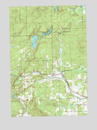
Couderay, WI USGS Topographic Map
Click on map above to begin viewing in our Map Viewer.

This topographic map contains these locations and features:
Feature Name Type Latitude Longitude GNIS ID View Map
Ashegon LakeLakeN45.8433°W91.3140°1560976View Map
Beverly LakeLakeN45.7726°W91.3714°1561666View Map
Beverly Lake State Wildlife Management AreaParkN45.7700°W91.3679°1561667View Map
Biernit SwampSwampN45.8013°W91.2610°1561674View Map
CouderayPopulated PlaceN45.7955°W91.3068°1563431View Map
Couderay Volunteer Fire DepartmentBuildingN45.7950°W91.3070°2696953View Map
Devils CreekStreamN45.7952°W91.3643°1563928View Map
Devils LakeLakeN45.8348°W91.3345°1563940View Map
Eddy CreekStreamN45.7947°W91.2904°1564436View Map
Eddy Creek PondReservoirN45.8003°W91.2932°1564437View Map
Eddy Creek SpringSpringN45.8427°W91.2952°1564438View Map
Eddy Creek State Wildlife Management AreaParkN45.8030°W91.2927°1564439View Map
LemingtonPopulated PlaceN45.7591°W91.3529°1577696View Map
Pike LakeLakeN45.8727°W91.2988°1571386View Map
Reserve Census Designated PlaceCensusN45.8338°W91.3544°2393206View Map
Sacred Heart Church (historical)ChurchN45.7622°W91.2654°1833794View Map
Section Twenty CreekStreamN45.7683°W91.2599°1573884View Map
Swift CreekStreamN45.7947°W91.3582°1575187View Map
Town of CouderayCivilN45.8040°W91.3468°1583021View Map
Village of CouderayCivilN45.7977°W91.3005°1583020View Map
WOJB-FM (Reserve)TowerN45.8711°W91.3491°1582446View Map

Note: Coordinates in the location and feature list above are referenced to NAD83 datum.


Copyright (C) 2008-2024 Ryan Niemi / Sunset Dynamics ... All Rights Reserved