TopoQuest Logo
Do you find TopoQuest useful?
Help keep TopoQuest running and adding new maps/features by donating!
Bitcoin:  19c7KJd3qBynnjoSw5npx9KScwjBe4ifkT
Litecoin:  LXs6TkuXGGXo1vDsWCkWVdjQX94eUKd6ui
Home View Maps Find Maps Find Places Resources & Links


Covesville, Virginia Topographic Map

USGS Map Title: Covesville, VA
USGS Map MRC: 37078H6
DRG (GeoTIFF) Download: o37078h6.tif


Neighboring USGS Topographic Map Quads:


  Waynesboro East, VA  
38078A7
 

  Crozet, VA  
38078A6
 

  Charlottesville West, VA  
38078A5
 

  Greenfield, VA  
37078H7
 

  Covesville, VA  
37078H6
 

  Alberene, VA  
37078H5
 

  Lovingston, VA  
37078G7
 

  Schuyler, VA  
37078G6
 

  Esmont, VA  
37078G5


Map MRC Location:

N38°
W79°
N38°
W78°
H8 H7 H6 H5 H4 H3 H2 H1
G8 G7 G6 G5 G4 G3 G2 G1
F8 F7 F6 F5 F4 F3 F2 F1
E8 E7 E6 E5 E4 E3 E2 E1
D8 D7 D6 D5 D4 D3 D2 D1
C8 C7 C6 C5 C4 C3 C2 C1
B8 B7 B6 B5 B4 B3 B2 B1
A8 A7 A6 A5 A4 A3 A2 A1
N37°
W79°
N37°
W78°

Covesville, VA USGS 1:24K Topographic Map Preview:
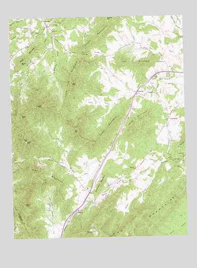
Covesville, VA USGS Topographic Map
Click on map above to begin viewing in our Map Viewer.

This topographic map contains these locations and features:
Feature Name Type Latitude Longitude GNIS ID View Map
BatesvillePopulated PlaceN37.9957°W78.7222°1492521View Map
Batesville Post OfficePost OfficeN37.9956°W78.7223°1675004View Map
Batesville United Methodist ChurchChurchN37.9971°W78.7234°1675005View Map
Bethel ChurchChurchN37.9179°W78.7161°1463194View Map
Boaz MountainsSummitN37.9113°W78.7261°1492601View Map
Boxwood LawnLocaleN37.9765°W78.7072°1675008View Map
Bundoran AirportAirportN37.9671°W78.6814°1498621View Map
Burnt MountainSummitN37.9754°W78.7411°1492681View Map
Castle RockSummitN37.9501°W78.7270°1464526View Map
CastlebrookLocaleN37.9954°W78.7247°1675016View Map
Cedar Vale School (historical)SchoolN37.9660°W78.7392°1675018View Map
Chalk MountainSummitN37.9326°W78.6842°1492741View Map
Chiles DamDamN37.9535°W78.7414°1489039View Map
Chiles PondReservoirN37.9539°W78.7421°1489040View Map
Cook MountainSummitN37.9407°W78.6567°1492803View Map
Cove CemeteryCemeteryN37.8846°W78.7106°1690296View Map
Cove Presbyterian ChurchChurchN37.8849°W78.7109°1675027View Map
CovesvillePopulated PlaceN37.8901°W78.7047°1492813View Map
Covesville Baptist ChurchChurchN37.8954°W78.6989°1675028View Map
Covesville Post OfficePost OfficeN37.8911°W78.7045°1675029View Map
CrossroadsPopulated PlaceN37.9568°W78.6589°1492827View Map
Fan MountainsSummitN37.8851°W78.6608°1492931View Map
Garland School (historical)SchoolN37.9174°W78.6256°1675056View Map
Garlands StoreLocaleN37.9176°W78.6270°1690318View Map
Hammer BranchStreamN37.9110°W78.6470°1467688View Map
Harris BranchStreamN37.9104°W78.6586°1467770View Map
Heard MountainSummitN37.9299°W78.7392°1493068View Map
High TopSummitN37.9626°W78.7053°1493084View Map
Israel GapGapN37.9799°W78.6972°1468542View Map
Israel MountainSummitN37.9946°W78.6784°1493129View Map
Jumping BranchStreamN37.9174°W78.6350°1468901View Map
Long Arm MountainSummitN37.9626°W78.7050°1493222View Map
Martins CreekStreamN37.9154°W78.7084°1470135View Map
McClauhan Farm Pond Number One DamDamN37.8801°W78.7247°1489025View Map
McClauhan Farm Pond Number Two DamDamN37.8901°W78.7164°1489026View Map
Mill MountainSummitN37.9354°W78.7014°1470524View Map
Miran ForestPopulated PlaceN37.9682°W78.7150°1675083View Map
Moon HouseBuildingN37.9982°W78.7245°1690346View Map
Mooreland CemeteryCemeteryN37.9745°W78.6392°1675088View Map
Mooreland ChurchChurchN37.9743°W78.6392°1470715View Map
Moses MountainSummitN37.9443°W78.7425°1493312View Map
Mount Ed ChurchChurchN37.9915°W78.7275°1470865View Map
Mount OliverSummitN37.8779°W78.6922°1471912View Map
Mount View ChurchChurchN37.9921°W78.7186°1471105View Map
North GardenPopulated PlaceN37.9407°W78.6367°1493354View Map
North Garden Post OfficePost OfficeN37.9562°W78.6583°2766262View Map
North Garden Volunteer Fire CompanyBuildingN37.9569°W78.6594°2075642View Map
North Garden Volunteer Fire Company Station 3BuildingN37.9559°W78.6581°1675102View Map
Persimmon MountainSummitN37.9046°W78.6864°1493418View Map
Ragged MountainsRangeN37.9618°W78.6945°1675116View Map
Red Hill Elementary SchoolSchoolN37.9643°W78.6352°1473052View Map
Rich CoveValleyN37.8926°W78.7225°1473177View Map
Rising Sun CemeteryCemeteryN37.9210°W78.6259°1675119View Map
Rising Sun ChurchChurchN37.9215°W78.6256°1473251View Map
Ruddocks PondReservoirN37.9164°W78.6977°1489050View Map
Samuel Miller DistrictCivilN37.9714°W78.6416°1927487View Map
Sego DamDamN37.9835°W78.6631°1489018View Map
Sego PondReservoirN37.9830°W78.6638°1489019View Map
Sharp TopSummitN37.9754°W78.7411°1474451View Map
South GardenLocaleN37.9182°W78.6347°1474871View Map
South Garden Baptist ChurchChurchN37.9176°W78.6342°1675140View Map
Tom MountainSummitN37.9738°W78.6697°1493713View Map
Trinity CemeteryCemeteryN37.9565°W78.6475°1675154View Map
Trinity ChurchChurchN37.9568°W78.6467°1475879View Map
Walnut TopSummitN37.8940°W78.7411°1493754View Map
Whiteside BranchStreamN37.9949°W78.7225°1476676View Map
Wieboldts DamDamN37.9151°W78.6964°1489049View Map
Wild Rose CemeteryCemeteryN37.9962°W78.7139°1476711View Map
Zion CemeteryCemeteryN37.9486°W78.6625°1675167View Map
Zion ChurchChurchN37.9474°W78.6628°1474396View Map

Note: Coordinates in the location and feature list above are referenced to NAD83 datum.


Copyright (C) 2008-2025 Ryan Niemi / Sunset Dynamics ... All Rights Reserved