TopoQuest Logo
Do you find TopoQuest useful?
Help keep TopoQuest running and adding new maps/features by donating!
Bitcoin:  19c7KJd3qBynnjoSw5npx9KScwjBe4ifkT
Litecoin:  LXs6TkuXGGXo1vDsWCkWVdjQX94eUKd6ui
Home View Maps Find Maps Find Places Resources & Links


Schuyler, Virginia Topographic Map

USGS Map Title: Schuyler, VA
USGS Map MRC: 37078G6
DRG (GeoTIFF) Download: o37078g6.tif


Neighboring USGS Topographic Map Quads:


  Greenfield, VA  
37078H7
 

  Covesville, VA  
37078H6
 

  Alberene, VA  
37078H5
 

  Lovingston, VA  
37078G7
 

  Schuyler, VA  
37078G6
 

  Esmont, VA  
37078G5
 

  Shipman, VA  
37078F7
 

  Howardsville, VA  
37078F6
 

  Glenmore, VA  
37078F5


Map MRC Location:

N38°
W79°
N38°
W78°
H8 H7 H6 H5 H4 H3 H2 H1
G8 G7 G6 G5 G4 G3 G2 G1
F8 F7 F6 F5 F4 F3 F2 F1
E8 E7 E6 E5 E4 E3 E2 E1
D8 D7 D6 D5 D4 D3 D2 D1
C8 C7 C6 C5 C4 C3 C2 C1
B8 B7 B6 B5 B4 B3 B2 B1
A8 A7 A6 A5 A4 A3 A2 A1
N37°
W79°
N37°
W78°

Schuyler, VA USGS 1:24K Topographic Map Preview:
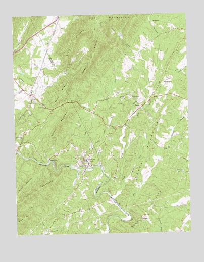
Schuyler, VA USGS Topographic Map
Click on map above to begin viewing in our Map Viewer.

This topographic map contains these locations and features:
Feature Name Type Latitude Longitude GNIS ID View Map
Appleberry MountainSummitN37.8596°W78.6886°1462527View Map
Bailey MountainSummitN37.7768°W78.7447°1462683View Map
Bear CreekStreamN37.8296°W78.7342°1462882View Map
Bethel ChurchChurchN37.7935°W78.7059°1463190View Map
Bolling SidingLocaleN37.8360°W78.6431°1463645View Map
Briar ForkStreamN37.8099°W78.6728°1463797View Map
Brush MountainSummitN37.8657°W78.6964°1463948View Map
BungletownPopulated PlaceN37.8713°W78.6436°1499187View Map
Butler MountainSummitN37.8113°W78.7186°1464175View Map
Centenary ChurchChurchN37.8271°W78.6742°1464669View Map
Chestnut Grove CemeteryCemeteryN37.7856°W78.6295°1675021View Map
Chestnut Grove ChurchChurchN37.7849°W78.6295°1464818View Map
Chestnut Grove School (historical)SchoolN37.7849°W78.6303°1675023View Map
Cove Valley DamDamN37.8418°W78.7431°1490444View Map
Curds FordCrossingN37.7710°W78.6822°1675031View Map
DamonPopulated PlaceN37.8229°W78.6592°1499322View Map
Dutch CreekStreamN37.7974°W78.7492°1466058View Map
FaberPopulated PlaceN37.8318°W78.7375°1499400View Map
Faber AirportAirportN37.8270°W78.7310°1498717View Map
Faber Post OfficePost OfficeN37.8314°W78.7371°2766199View Map
Faber Volunteer Fire DepartmentBuildingN37.8310°W78.7415°2086122View Map
Green CreekStreamN37.7690°W78.6792°1467464View Map
Green MountainSummitN37.8074°W78.6489°1499494View Map
Harris BridgeLocaleN37.7918°W78.7259°1467771View Map
Harris CreekStreamN37.7813°W78.6717°1467778View Map
Hickory CreekStreamN37.8332°W78.7353°1484057View Map
Hog CreekStreamN37.7618°W78.6706°1468098View Map
Ivy CreekStreamN37.7871°W78.6947°1468551View Map
Kleinburg School (historical)SchoolN37.8068°W78.7086°1500961View Map
Locust Grove CemeteryCemeteryN37.8057°W78.7447°1500929View Map
Locust Grove ChurchChurchN37.8057°W78.7445°1469730View Map
Monasco MountainSummitN37.7560°W78.7495°1470668View Map
Moses CrossingCrossingN37.7976°W78.7489°1500962View Map
Mount AltoLocaleN37.7582°W78.6592°1470805View Map
Mount AltoSummitN37.7751°W78.6422°1462432View Map
Mount Alto ChurchChurchN37.7660°W78.6511°1675091View Map
Mount Shiloh CemeteryCemeteryN37.8229°W78.7281°1500934View Map
Mount Shiloh ChurchChurchN37.8229°W78.7284°1471060View Map
Nelson County Rescue Squad Station 1 HeadquartersBuildingN37.8315°W78.7428°2086125View Map
Oak Ridge ChurchChurchN37.8240°W78.6720°1471766View Map
Oak Ridge School (historical)SchoolN37.8240°W78.6725°1675108View Map
Old DominionPopulated PlaceN37.8276°W78.6661°1499819View Map
Rock Spring CemeteryCemeteryN37.8326°W78.7461°1500951View Map
Rock Springs ChurchChurchN37.8318°W78.7456°1473396View Map
Rockfish River DamDamN37.7873°W78.6997°1490442View Map
Rocky BranchStreamN37.8146°W78.6670°1473431View Map
Saint Joys ChurchChurchN37.7613°W78.7147°1473793View Map
Salem ChurchChurchN37.7632°W78.7056°1473954View Map
SchuylerPopulated PlaceN37.7924°W78.6984°1500039View Map
Schuyler Census Designated PlaceCensusN37.7940°W78.7002°2584917View Map
Schuyler Elementary School (historical)SchoolN37.7913°W78.7017°1690362View Map
Schuyler Post OfficePost OfficeN37.7906°W78.7016°2780818View Map
Sharon ChurchChurchN37.7976°W78.6403°1474447View Map
Sheepneck BranchStreamN37.8379°W78.6520°1474463View Map
Shiloh MountainSummitN37.8307°W78.7131°1500095View Map
TillmansPopulated PlaceN37.8288°W78.6367°1675151View Map
Waltons Mountain MuseumBuildingN37.7913°W78.7017°1690378View Map

Note: Coordinates in the location and feature list above are referenced to NAD83 datum.


Copyright (C) 2008-2024 Ryan Niemi / Sunset Dynamics ... All Rights Reserved