TopoQuest Logo
Do you find TopoQuest useful?
Help keep TopoQuest running and adding new maps/features by donating!
Bitcoin:  19c7KJd3qBynnjoSw5npx9KScwjBe4ifkT
Litecoin:  LXs6TkuXGGXo1vDsWCkWVdjQX94eUKd6ui
Home View Maps Find Maps Find Places Resources & Links


Cow Valley West, Oregon Topographic Map

USGS Map Title: Cow Valley West, OR
USGS Map MRC: 44117C7
DRG (GeoTIFF) Download: o44117c7.tif


Neighboring USGS Topographic Map Quads:


  Devils Heel, OR  
44117D8
 

  Wendt Butte, OR  
44117D7
 

  Bridgeport, OR  
44117D6
 

  Ironside, OR  
44117C8
 

  Cow Valley West, OR  
44117C7
 

  Cow Valley East, OR  
44117C6
 

  Clover Creek Ranch, OR  
44117B8
 

  Scratch Post Butte, OR  
44117B7
 

  Brady Creek, OR  
44117B6


Map MRC Location:

N45°
W118°
N45°
W117°
H8 H7 H6 H5 H4 H3 H2 H1
G8 G7 G6 G5 G4 G3 G2 G1
F8 F7 F6 F5 F4 F3 F2 F1
E8 E7 E6 E5 E4 E3 E2 E1
D8 D7 D6 D5 D4 D3 D2 D1
C8 C7 C6 C5 C4 C3 C2 C1
B8 B7 B6 B5 B4 B3 B2 B1
A8 A7 A6 A5 A4 A3 A2 A1
N44°
W118°
N44°
W117°

Cow Valley West, OR USGS 1:24K Topographic Map Preview:
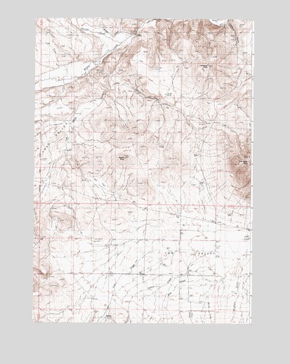
Cow Valley West, OR USGS Topographic Map
Click on map above to begin viewing in our Map Viewer.

This topographic map contains these locations and features:
Feature Name Type Latitude Longitude GNIS ID View Map
Blue CreekStreamN44.2679°W117.7719°1117840View Map
BonitaPopulated PlaceN44.2524°W117.8338°1136084View Map
Bonita Post Office (historical)Post OfficeN44.2524°W117.8338°1164938View Map
Cow Valley ButteSummitN44.3185°W117.7519°1119434View Map
Grouse CreekStreamN44.3652°W117.8260°1121461View Map
Hugg CreekStreamN44.3685°W117.8185°1122113View Map
Hugg SpringSpringN44.3720°W117.8366°1131936View Map
Indian GulchValleyN44.3193°W117.8580°1131949View Map
Long CreekStreamN44.3552°W117.8616°1123409View Map
Lost ValleyValleyN44.3457°W117.8344°1123521View Map
Lost Valley CreekStreamN44.3471°W117.8321°1123522View Map
Lyman CreekStreamN44.2857°W117.7627°1123626View Map
Moltham Reservoir FiveReservoirN44.2554°W117.8719°1131944View Map
Rinehart CreekStreamN44.2804°W117.7533°1126038View Map
Rye FlatFlatN44.3068°W117.8385°1126387View Map
Saddle ButteSummitN44.3177°W117.8235°1126417View Map
Sheep CreekStreamN44.2549°W117.7752°1116740View Map
Spring CreekStreamN44.3468°W117.8316°1127421View Map
Woods CreekStreamN44.2671°W117.7691°1129313View Map
Worsham ButteSummitN44.3563°W117.7763°1129328View Map

Note: Coordinates in the location and feature list above are referenced to NAD83 datum.


Copyright (C) 2008-2025 Ryan Niemi / Sunset Dynamics ... All Rights Reserved