TopoQuest Logo
Do you find TopoQuest useful?
Help keep TopoQuest running and adding new maps/features by donating!
Bitcoin:  19c7KJd3qBynnjoSw5npx9KScwjBe4ifkT
Litecoin:  LXs6TkuXGGXo1vDsWCkWVdjQX94eUKd6ui
Home View Maps Find Maps Find Places Resources & Links


Bridgeport, Oregon Topographic Map

USGS Map Title: Bridgeport, OR
USGS Map MRC: 44117D6
DRG (GeoTIFF) Download: o44117d6.tif


Neighboring USGS Topographic Map Quads:


  Dooley Mountain, OR  
44117E7
 

  French Gulch, OR  
44117E6
 

  Lost Basin, OR  
44117E5
 

  Wendt Butte, OR  
44117D7
 

  Bridgeport, OR  
44117D6
 

  Mormon Basin, OR  
44117D5
 

  Cow Valley West, OR  
44117C7
 

  Cow Valley East, OR  
44117C6
 

  Becker Creek, OR  
44117C5


Map MRC Location:

N45°
W118°
N45°
W117°
H8 H7 H6 H5 H4 H3 H2 H1
G8 G7 G6 G5 G4 G3 G2 G1
F8 F7 F6 F5 F4 F3 F2 F1
E8 E7 E6 E5 E4 E3 E2 E1
D8 D7 D6 D5 D4 D3 D2 D1
C8 C7 C6 C5 C4 C3 C2 C1
B8 B7 B6 B5 B4 B3 B2 B1
A8 A7 A6 A5 A4 A3 A2 A1
N44°
W118°
N44°
W117°

Bridgeport, OR USGS 1:24K Topographic Map Preview:
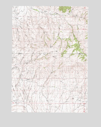
Bridgeport, OR USGS Topographic Map
Click on map above to begin viewing in our Map Viewer.

This topographic map contains these locations and features:
Feature Name Type Latitude Longitude GNIS ID View Map
Amelia ButteSummitN44.3913°W117.6505°1116911View Map
Auburn CreekStreamN44.4890°W117.7433°1117084View Map
August Meyer GulchValleyN44.4929°W117.7052°1117089View Map
Bill Neighbor PeakSummitN44.4513°W117.6874°1136069View Map
Birch Creek DitchCanalN44.3957°W117.6969°1131888View Map
Blue Trigger GulchValleyN44.4765°W117.6516°1117871View Map
Brewery SpringSpringN44.3897°W117.6361°1118058View Map
BridgeportPopulated PlaceN44.4857°W117.7452°1161286View Map
Bridgeport CemeteryCemeteryN44.4915°W117.7483°1131905View Map
Bridgeport Post OfficePost OfficeN44.4857°W117.7452°1164955View Map
Brinker CreekStreamN44.4515°W117.6385°1118083View Map
China TownPopulated PlaceN44.4929°W117.6994°1161313View Map
ClarksvillePopulated PlaceN44.4913°W117.6799°1161315View Map
Clarksville Cemetery (historical)CemeteryN44.4871°W117.6810°1955406View Map
Clarksville Post Office (historical)Post OfficeN44.4913°W117.6799°1165054View Map
Cottonwood CreekStreamN44.4882°W117.6630°1119332View Map
Cottonwood GulchValleyN44.3857°W117.7249°1119339View Map
Deadman GulchValleyN44.3938°W117.6266°1119761View Map
East Fork First CreekStreamN44.3821°W117.6705°1136239View Map
El Dorado Post Office (historical)Post OfficeN44.4263°W117.7458°1164331View Map
EldoradoPopulated PlaceN44.4263°W117.7458°1161356View Map
Freeze Out GulchValleyN44.4354°W117.7180°1120969View Map
French GulchValleyN44.3996°W117.7205°1158247View Map
George Henry GulchValleyN44.4843°W117.7277°1121099View Map
George Washington GulchValleyN44.3952°W117.7458°1121102View Map
Gravelly CoveBasinN44.4929°W117.6605°1121338View Map
Gravelly GulchValleyN44.4896°W117.6544°1121339View Map
Greenhorn GulchValleyN44.3879°W117.7330°1121411View Map
Iron Door MineMineN44.4618°W117.6685°1122269View Map
Iron GulchValleyN44.3871°W117.7308°1122270View Map
Jennison GulchValleyN44.4802°W117.7405°1122407View Map
Johnson GulchValleyN44.4799°W117.7430°1122483View Map
Kentucky FlatFlatN44.4415°W117.7019°1122700View Map
Kentucky GulchValleyN44.4374°W117.7094°1131894View Map
Log Town CreekStreamN44.4688°W117.6499°1123353View Map
Long GulchValleyN44.3804°W117.7158°1123413View Map
Lynns DitchCanalN44.4215°W117.7371°1123638View Map
Malheur CemeteryCemeteryN44.4124°W117.7219°1160677View Map
Malheur City (historical)Populated PlaceN44.4129°W117.7249°1161431View Map
Malheur Post Office (historical)Post OfficeN44.4129°W117.7249°1164492View Map
Marble CreekStreamN44.3777°W117.6858°1131898View Map
Morfitt DitchCanalN44.3832°W117.7260°1131887View Map
Poison Root GulchValleyN44.4265°W117.7333°1125508View Map
Quartz GulchValleyN44.3865°W117.7294°1125731View Map
Racey Brothers SpringSpringN44.4400°W117.7477°1125767View Map
Rich CreekStreamN44.3877°W117.7446°1125977View Map
Sargent Place (historical)LocaleN44.4049°W117.6813°1136731View Map
Shasta ButteSummitN44.4404°W117.6794°1126797View Map
Shasta GapGapN44.4465°W117.6777°1126798View Map
Shasta GulchValleyN44.3885°W117.7402°1126799View Map
Shasta SpringSpringN44.4448°W117.6904°1131893View Map
Towne GulchValleyN44.4899°W117.6819°1128179View Map
Tub SpringSpringN44.4578°W117.6399°1131952View Map
Wendt DitchCanalN44.4865°W117.7322°1128802View Map
West Fork First CreekStreamN44.3821°W117.6705°1128849View Map
Wiser CreekStreamN44.3779°W117.6463°1129258View Map

Note: Coordinates in the location and feature list above are referenced to NAD83 datum.


Copyright (C) 2008-2024 Ryan Niemi / Sunset Dynamics ... All Rights Reserved