TopoQuest Logo
Do you find TopoQuest useful?
Help keep TopoQuest running and adding new maps/features by donating!
Bitcoin:  19c7KJd3qBynnjoSw5npx9KScwjBe4ifkT
Litecoin:  LXs6TkuXGGXo1vDsWCkWVdjQX94eUKd6ui
Home View Maps Find Maps Find Places Resources & Links


Cowdrey, Colorado Topographic Map

USGS Map Title: Cowdrey, CO
USGS Map MRC: 40106G3
DRG (GeoTIFF) Download: o40106g3.tif


Neighboring USGS Topographic Map Quads:


  Independence Mountain, CO  
40106H4
 

  Northgate, CO  
40106H3
 

  Kings Canyon, CO  
40106H2
 

  Lake John, CO  
40106G4
 

  Cowdrey, CO  
40106G3
 

  Eagle Hill, CO  
40106G2
 

  Delaney Butte, CO  
40106F4
 

  Walden, CO  
40106F3
 

  Gould NW, CO  
40106F2


Map MRC Location:

N41°
W107°
N41°
W106°
H8 H7 H6 H5 H4 H3 H2 H1
G8 G7 G6 G5 G4 G3 G2 G1
F8 F7 F6 F5 F4 F3 F2 F1
E8 E7 E6 E5 E4 E3 E2 E1
D8 D7 D6 D5 D4 D3 D2 D1
C8 C7 C6 C5 C4 C3 C2 C1
B8 B7 B6 B5 B4 B3 B2 B1
A8 A7 A6 A5 A4 A3 A2 A1
N40°
W107°
N40°
W106°

Cowdrey, CO USGS 1:24K Topographic Map Preview:
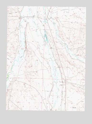
Cowdrey, CO USGS Topographic Map
Click on map above to begin viewing in our Map Viewer.

This topographic map contains these locations and features:
Feature Name Type Latitude Longitude GNIS ID View Map
Alma DitchCanalN40.8047°W106.2983°2710931View Map
Boone DitchCanalN40.7889°W106.3667°170337View Map
BrownleePopulated PlaceN40.7847°W106.2867°170355View Map
Brownlee RanchLocaleN40.7814°W106.2867°170356View Map
Buckeye DitchCanalN40.7823°W106.2910°2631062View Map
Buffmeyer DrawValleyN40.8171°W106.2666°170360View Map
California GulchValleyN40.8043°W106.3651°169989View Map
Carlstrom RanchLocaleN40.8622°W106.3350°170344View Map
Carlstrom ReservoirReservoirN40.8448°W106.3157°170335View Map
Champion DitchCanalN40.7865°W106.2977°2711488View Map
Coe Ditch Number 1CanalN40.8714°W106.2839°170350View Map
Coe Ditch Number 2CanalN40.8689°W106.2839°170349View Map
CowdreyPopulated PlaceN40.8597°W106.3131°170351View Map
Cowdrey DamDamN40.8333°W106.3139°201140View Map
Cowdrey DitchCanalN40.8137°W106.3020°2711852View Map
Cowdrey EnlargementCanalN40.8278°W106.3242°170339View Map
Cowdrey Post OfficePost OfficeN40.8599°W106.3134°2759184View Map
Cowdrey ReservoirReservoirN40.8373°W106.3136°201141View Map
Crystal Spring CreekStreamN40.8639°W106.3114°170361View Map
Cumberland DitchCanalN40.8389°W106.3117°201888View Map
Dalom DitchCanalN40.7772°W106.3728°201927View Map
Davis DitchCanalN40.8416°W106.3464°170340View Map
Give A Dam Jones DitchCanalN40.8144°W106.2722°170353View Map
Government CreekStreamN40.8655°W106.3117°170008View Map
Government Ditch Number 1CanalN40.8708°W106.2603°170348View Map
Hanson RanchLocaleN40.8500°W106.3478°170341View Map
Harry Hadden DitchCanalN40.8729°W106.2700°2712507View Map
Hi - Ho DitchCanalN40.8583°W106.3295°201889View Map
Hill RanchLocaleN40.8253°W106.2978°170354View Map
Hunter DitchCanalN40.8639°W106.3097°170345View Map
Illinois RiverStreamN40.7522°W106.3031°170358View Map
Kiwa DitchCanalN40.8561°W106.3422°170342View Map
Landhurst DitchCanalN40.8630°W106.2540°2723244View Map
Lee DrawValleyN40.7811°W106.2835°170359View Map
Mammouth DitchCanalN40.8250°W106.3573°170336View Map
Mansfield DrawValleyN40.8667°W106.3549°170370View Map
Moore Ditch Number 1CanalN40.8672°W106.3061°170346View Map
North Park Ditch Number 5CanalN40.7625°W106.2850°169461View Map
North Park Ditch Number 7CanalN40.7694°W106.3014°170357View Map
North Sand CreekStreamN40.8647°W106.2967°201921View Map
Pioneer DitchCanalN40.8389°W106.2909°170352View Map
Queen DitchCanalN40.7611°W106.2814°201917View Map
Rough and Ready DitchCanalN40.8678°W106.2776°2724187View Map
Sand Creek DitchCanalN40.8561°W106.2645°170347View Map
Seneca DitchCanalN40.8180°W106.3200°170338View Map

Note: Coordinates in the location and feature list above are referenced to NAD83 datum.


Copyright (C) 2008-2025 Ryan Niemi / Sunset Dynamics ... All Rights Reserved