TopoQuest Logo
Do you find TopoQuest useful?
Help keep TopoQuest running and adding new maps/features by donating!
Bitcoin:  19c7KJd3qBynnjoSw5npx9KScwjBe4ifkT
Litecoin:  LXs6TkuXGGXo1vDsWCkWVdjQX94eUKd6ui
Home View Maps Find Maps Find Places Resources & Links


Northgate, Colorado Topographic Map

USGS Map Title: Northgate, CO
USGS Map MRC: 40106H3
DRG (GeoTIFF) Download: o40106h3.tif


Neighboring USGS Topographic Map Quads:


  Elkhorn Point, WY  
41106A4
 

  Horatio Rock, WY  
41106A3
 

  Foxpark, WY  
41106A2
 

  Independence Mountain, CO  
40106H4
 

  Northgate, CO  
40106H3
 

  Kings Canyon, CO  
40106H2
 

  Lake John, CO  
40106G4
 

  Cowdrey, CO  
40106G3
 

  Eagle Hill, CO  
40106G2


Map MRC Location:

N41°
W107°
N41°
W106°
H8 H7 H6 H5 H4 H3 H2 H1
G8 G7 G6 G5 G4 G3 G2 G1
F8 F7 F6 F5 F4 F3 F2 F1
E8 E7 E6 E5 E4 E3 E2 E1
D8 D7 D6 D5 D4 D3 D2 D1
C8 C7 C6 C5 C4 C3 C2 C1
B8 B7 B6 B5 B4 B3 B2 B1
A8 A7 A6 A5 A4 A3 A2 A1
N40°
W107°
N40°
W106°

Northgate, CO USGS 1:24K Topographic Map Preview:
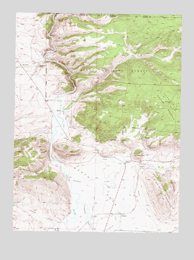
Northgate, CO USGS Topographic Map
Click on map above to begin viewing in our Map Viewer.

This topographic map contains these locations and features:
Feature Name Type Latitude Longitude GNIS ID View Map
A Bar A DitchCanalN40.9403°W106.3466°2710677View Map
Almeda DitchCanalN40.9205°W106.2922°2710932View Map
Badger MineMineN40.9594°W106.3428°1683274View Map
Camp CreekStreamN40.9455°W106.3409°170005View Map
Camp Creek DitchCanalN40.9389°W106.3367°170024View Map
Camp Creek MineMineN40.9500°W106.2589°170030View Map
Canadian DitchCanalN40.8916°W106.3147°170022View Map
Canadian RiverStreamN40.8911°W106.3275°170302View Map
Capron DitchCanalN40.9166°W106.3034°170023View Map
Dean PeakSummitN40.9191°W106.2825°170019View Map
Durgin DitchCanalN40.9014°W106.3006°170021View Map
Fischer DrawValleyN40.8787°W106.3424°169986View Map
Flourspar MineMineN40.9291°W106.2931°170028View Map
Forney DepositMineN40.9872°W106.3439°1683269View Map
Gero TunnelMineN40.9241°W106.2753°170027View Map
Ginger Quill DamDamN40.9716°W106.3539°199976View Map
Ginger Quill ReservoirReservoirN40.9717°W106.3552°199977View Map
Kramer MinesMineN40.9253°W106.2642°1683270View Map
Michigan RiverStreamN40.8769°W106.3395°172408View Map
Newport DitchCanalN40.8889°W106.2756°170020View Map
North ParkFlatN40.9000°W106.3089°170018View Map
NorthgatePopulated PlaceN40.8858°W106.2942°170025View Map
Northgate Number Two MineMineN40.9155°W106.3067°1735373View Map
Ouaintance RanchLocaleN40.9708°W106.3575°170016View Map
Penber MineMineN40.9236°W106.2739°170026View Map
Pinkham CreekStreamN40.9128°W106.3381°170006View Map
Pinkham MountainSummitN40.9361°W106.2511°201887View Map
Placer CreekStreamN40.8761°W106.3492°169987View Map
Poquette DitchCanalN40.8794°W106.3395°170343View Map
Quaintance MineMineN40.9666°W106.3595°1683271View Map
Quaintance RanchLocaleN40.9703°W106.3572°197405View Map
Riggs DepositMineN40.9780°W106.3497°1683273View Map
Riggs MineMineN40.9744°W106.3603°1683272View Map
Salt CreekStreamN40.9841°W106.3481°170015View Map
Sentinal MountainSummitN40.8969°W106.2625°170031View Map
Spaulding DitchCanalN40.9033°W106.3106°2724275View Map
Spring GulchValleyN40.8890°W106.3738°169988View Map
Springer PitMineN40.9341°W106.2775°170029View Map
Tepee CreekStreamN40.9953°W106.3459°170009View Map
Thirty Six DitchCanalN40.8780°W106.3122°2724335View Map
Three WayLocaleN40.9150°W106.2922°197404View Map
Threemile CreekStreamN40.9728°W106.3520°169985View Map
Walker DitchCanalN40.9154°W106.2636°2724396View Map
Watson DitchCanalN40.9040°W106.3280°2724401View Map
Watson MountainSummitN40.9191°W106.3342°170017View Map
Whale PitMineN40.9155°W106.3067°1735374View Map

Note: Coordinates in the location and feature list above are referenced to NAD83 datum.


Copyright (C) 2008-2025 Ryan Niemi / Sunset Dynamics ... All Rights Reserved