TopoQuest Logo
Do you find TopoQuest useful?
Help keep TopoQuest running and adding new maps/features by donating!
Bitcoin:  19c7KJd3qBynnjoSw5npx9KScwjBe4ifkT
Litecoin:  LXs6TkuXGGXo1vDsWCkWVdjQX94eUKd6ui
Home View Maps Find Maps Find Places Resources & Links


Crab Orchard, West Virginia Topographic Map

USGS Map Title: Crab Orchard, WV
USGS Map MRC: 37081F2
DRG (GeoTIFF) Download: o37081f2.tif


Neighboring USGS Topographic Map Quads:


  Eccles, WV  
37081G3
 

  Beckley, WV  
37081G2
 

  Prince, WV  
37081G1
 

  Lester, WV  
37081F3
 

  Crab Orchard, WV  
37081F2
 

  Shady Spring, WV  
37081F1
 

  Rhodell, WV  
37081E3
 

  Odd, WV  
37081E2
 

  Flat Top, WV  
37081E1


Map MRC Location:

N38°
W82°
N38°
W81°
H8 H7 H6 H5 H4 H3 H2 H1
G8 G7 G6 G5 G4 G3 G2 G1
F8 F7 F6 F5 F4 F3 F2 F1
E8 E7 E6 E5 E4 E3 E2 E1
D8 D7 D6 D5 D4 D3 D2 D1
C8 C7 C6 C5 C4 C3 C2 C1
B8 B7 B6 B5 B4 B3 B2 B1
A8 A7 A6 A5 A4 A3 A2 A1
N37°
W82°
N37°
W81°

Crab Orchard, WV USGS 1:24K Topographic Map Preview:
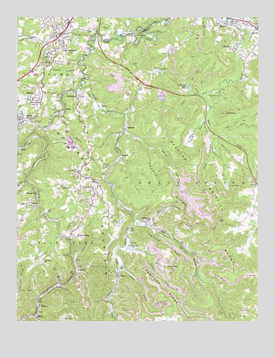
Crab Orchard, WV USGS Topographic Map
Click on map above to begin viewing in our Map Viewer.

This topographic map contains these locations and features:
Feature Name Type Latitude Longitude GNIS ID View Map
AbneyPopulated PlaceN37.6884°W81.2040°1553687View Map
AffinityPopulated PlaceN37.7129°W81.2259°1553701View Map
BattleshipPopulated PlaceN37.6626°W81.1922°2747476View Map
BeaverPopulated PlaceN37.7476°W81.1423°1553828View Map
Beaver Census Designated PlaceCensusN37.7356°W81.1499°2389185View Map
Beaver Elementary School (historical)SchoolN37.7471°W81.1393°1742664View Map
Beaver Junior High School (historical)SchoolN37.7462°W81.1254°1742665View Map
Beaver Volunteer Fire Department Station 1BuildingN37.7491°W81.1436°2577978View Map
BesocoPopulated PlaceN37.6276°W81.2409°1535674View Map
Best Transports Ambulance Service 651BuildingN37.6900°W81.2127°2581143View Map
Blue JayPopulated PlaceN37.7371°W81.1379°1553930View Map
Blue Jay LakeReservoirN37.7219°W81.1616°1536125View Map
Blue Jay Post OfficePost OfficeN37.7382°W81.1359°1742679View Map
Bower School (historical)SchoolN37.6759°W81.2107°1742684View Map
Bowyer CreekStreamN37.6654°W81.1876°1536270View Map
Bowyer School (historical)SchoolN37.6646°W81.1720°1742683View Map
Brammer School (historical)SchoolN37.7243°W81.2373°1742689View Map
CedarPopulated PlaceN37.7371°W81.2123°1554090View Map
Coal CityPopulated PlaceN37.6790°W81.2104°1554161View Map
Coal City Census Designated PlaceCensusN37.6776°W81.2180°2389337View Map
Coal City Elementary SchoolSchoolN37.6953°W81.2207°2088167View Map
Coal City Post OfficePost OfficeN37.6867°W81.2182°1742712View Map
Coal City Volunteer Fire DepartmentBuildingN37.6896°W81.2128°2577723View Map
Community ChurchChurchN37.7287°W81.1759°1537553View Map
Crab OrchardPopulated PlaceN37.7407°W81.2307°1537765View Map
Crab Orchard Census Designated PlaceCensusN37.7410°W81.2299°2389365View Map
Crab Orchard CreekStreamN37.7409°W81.2101°1537766View Map
Crab Orchard Elementary SchoolSchoolN37.7394°W81.2300°1742719View Map
Crab Orchard Post OfficePost OfficeN37.7403°W81.2334°1742720View Map
Crooked RunStreamN37.7084°W81.1515°1537844View Map
Daniels Census Designated PlaceCensusN37.7240°W81.1267°2389393View Map
EpperlyPopulated PlaceN37.6723°W81.2420°1554408View Map
FirecoPopulated PlaceN37.6448°W81.1982°1554455View Map
FitzpatrickPopulated PlaceN37.7440°W81.1865°1549682View Map
Fitzpatrick ParkParkN37.7459°W81.2037°1539014View Map
Friendly ChurchChurchN37.7446°W81.2140°1539265View Map
Glade ForkStreamN37.7198°W81.1498°1539428View Map
Harper SpringSpringN37.6862°W81.2415°1678479View Map
Hecks KnobSummitN37.7107°W81.1423°1540118View Map
Hick Hollow ChurchChurchN37.6262°W81.2251°1540193View Map
Hill Top ChurchChurchN37.7318°W81.2320°1540296View Map
HotcoalLocaleN37.6962°W81.2479°1554748View Map
House of Prayer Christian AcademySchoolN37.7073°W81.2466°2489151View Map
Independence High SchoolSchoolN37.6966°W81.2235°2088227View Map
Independence Middle SchoolSchoolN37.6972°W81.2259°2088228View Map
Jan - Care Ambulance Service BeaverBuildingN37.7495°W81.1441°2581184View Map
JonbenPopulated PlaceN37.6562°W81.1920°1554827View Map
Jonben Post OfficePost OfficeN37.6548°W81.1915°1742815View Map
Lampkin BranchStreamN37.6465°W81.1968°1541336View Map
Laurel BranchStreamN37.7109°W81.2273°1541367View Map
Laurel CreekStreamN37.6554°W81.1934°1541412View Map
Left Fork Beaver CreekStreamN37.7021°W81.1429°1541626View Map
LegoPopulated PlaceN37.6340°W81.2387°1549781View Map
LillybrookPopulated PlaceN37.6448°W81.2204°1549784View Map
LynwinnPopulated PlaceN37.6809°W81.2273°1542655View Map
McVeyPopulated PlaceN37.7129°W81.2051°1555091View Map
MidwayPopulated PlaceN37.7196°W81.2370°1543237View Map
Midway Post OfficePost OfficeN37.7144°W81.2380°1742862View Map
Mount Olive ChurchChurchN37.6657°W81.1968°1543702View Map
Old Country ChurchChurchN37.6496°W81.2357°1544350View Map
PembertonPopulated PlaceN37.7179°W81.2190°1544696View Map
Pemberton Post OfficePost OfficeN37.7193°W81.2201°1742892View Map
PickshinPopulated PlaceN37.6418°W81.2282°1544803View Map
Pines CreekStreamN37.6273°W81.2398°1544912View Map
Pond KnobSummitN37.6476°W81.1648°1555388View Map
PrincewickPopulated PlaceN37.6601°W81.2179°1555414View Map
Princewick Post OfficePost OfficeN37.6596°W81.2257°1742910View Map
Rock BranchStreamN37.7434°W81.2082°1545892View Map
Rocky BranchStreamN37.7029°W81.1470°1546005View Map
Sand BranchStreamN37.7496°W81.1407°1552788View Map
Soak CreekStreamN37.7201°W81.2176°1547050View Map
Sophia Police DepartmentBuildingN37.7070°W81.2499°2728159View Map
Sophia Post OfficePost OfficeN37.7090°W81.2499°1742968View Map
Spangler Factory (historical)Populated PlaceN37.7432°W81.1929°1742970View Map
Spencer BranchStreamN37.6657°W81.1812°1547125View Map
Stanton Griffith RidgeRidgeN37.6732°W81.1440°1547339View Map
Stoco High School (historical)SchoolN37.6868°W81.2182°1547436View Map
Stoco Jr High School (historical)SchoolN37.6315°W81.2384°1547437View Map
Stover ForkStreamN37.7448°W81.2237°1547536View Map
SullivanPopulated PlaceN37.7037°W81.1943°1555739View Map
Take In HollowPopulated PlaceN37.7319°W81.2176°2747516View Map
Take-In CreekStreamN37.7032°W81.1943°1547874View Map
Take-In RidgeRidgeN37.6751°W81.1690°1547875View Map
Taylor School (historical)SchoolN37.6607°W81.1287°1742995View Map
Thompson RidgeRidgeN37.6348°W81.1737°1548049View Map
TildenPopulated PlaceN37.7290°W81.1768°1555814View Map
Town of SophiaCivilN37.7081°W81.2490°2391419View Map
Trace RidgeRidgeN37.6373°W81.1612°1548241View Map
Turkey BranchStreamN37.7307°W81.2184°1548325View Map
West Fork Winding GulfStreamN37.6832°W81.2451°1548933View Map
WhitbyPopulated PlaceN37.6662°W81.1843°1555966View Map
Whitby Post OfficePost OfficeN37.6659°W81.1857°1743010View Map
Winding GulfPopulated PlaceN37.6782°W81.2398°1556003View Map
Winding Gulf Embankment DamDamN37.6701°W81.2348°1559283View Map
Winding Gulf Post OfficePost OfficeN37.6784°W81.2401°1743020View Map
WoodpeckPopulated PlaceN37.6934°W81.1962°1556023View Map

Note: Coordinates in the location and feature list above are referenced to NAD83 datum.


Copyright (C) 2008-2024 Ryan Niemi / Sunset Dynamics ... All Rights Reserved