TopoQuest Logo
Do you find TopoQuest useful?
Help keep TopoQuest running and adding new maps/features by donating!
Bitcoin:  19c7KJd3qBynnjoSw5npx9KScwjBe4ifkT
Litecoin:  LXs6TkuXGGXo1vDsWCkWVdjQX94eUKd6ui
Home View Maps Find Maps Find Places Resources & Links


Odd, West Virginia Topographic Map

USGS Map Title: Odd, WV
USGS Map MRC: 37081E2
DRG (GeoTIFF) Download: o37081e2.tif


Neighboring USGS Topographic Map Quads:


  Lester, WV  
37081F3
 

  Crab Orchard, WV  
37081F2
 

  Shady Spring, WV  
37081F1
 

  Rhodell, WV  
37081E3
 

  Odd, WV  
37081E2
 

  Flat Top, WV  
37081E1
 

  Crumpler, WV  
37081D3
 

  Matoaka, WV  
37081D2
 

  Athens, WV  
37081D1


Map MRC Location:

N38°
W82°
N38°
W81°
H8 H7 H6 H5 H4 H3 H2 H1
G8 G7 G6 G5 G4 G3 G2 G1
F8 F7 F6 F5 F4 F3 F2 F1
E8 E7 E6 E5 E4 E3 E2 E1
D8 D7 D6 D5 D4 D3 D2 D1
C8 C7 C6 C5 C4 C3 C2 C1
B8 B7 B6 B5 B4 B3 B2 B1
A8 A7 A6 A5 A4 A3 A2 A1
N37°
W82°
N37°
W81°

Odd, WV USGS 1:24K Topographic Map Preview:
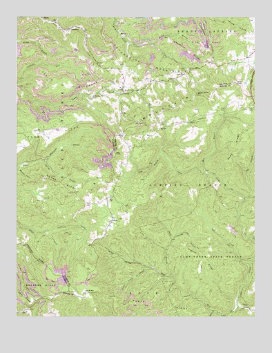
Odd, WV USGS Topographic Map
Click on map above to begin viewing in our Map Viewer.

This topographic map contains these locations and features:
Feature Name Type Latitude Longitude GNIS ID View Map
Bald KnobSummitN37.5979°W81.1354°1553782View Map
BarnLocaleN37.5759°W81.1793°1535244View Map
Bear CreekStreamN37.5235°W81.1312°1535353View Map
Bluff MountainSummitN37.5115°W81.2068°1553943View Map
Bluff RidgeRidgeN37.5023°W81.1790°1536152View Map
Brammer School (historical)SchoolN37.5851°W81.1457°1557136View Map
Camp Creek State ForestForestN37.5221°W81.1445°1536924View Map
Camp Creek State ParkParkN37.5082°W81.1329°2043576View Map
Camp Wasp School (historical)SchoolN37.6004°W81.1795°1742698View Map
Cassidy BranchStreamN37.5323°W81.1684°1537086View Map
Chestnut RidgeRidgeN37.6107°W81.1598°1537292View Map
Chestnut Ridge ChurchChurchN37.6018°W81.1637°1537297View Map
Chestnut Ridge School (historical)SchoolN37.6140°W81.1584°1742702View Map
Clark BranchStreamN37.5168°W81.1704°1537350View Map
Devils BackboneRidgeN37.5965°W81.2226°1538156View Map
EgeriaPopulated PlaceN37.5393°W81.2001°1549668View Map
Egeria ChurchChurchN37.5493°W81.2004°1538568View Map
Egeria School (historical)SchoolN37.5479°W81.2057°1742744View Map
Fairwind School (historical)SchoolN37.5423°W81.1448°1557190View Map
Giles County Sheriff's OfficeBuildingN37.5511°W81.2308°2086273View Map
Good Hope ChurchChurchN37.5921°W81.2101°1539501View Map
Guyan RidgeRidgeN37.5562°W81.2273°1539805View Map
Hatcher School (historical)SchoolN37.5534°W81.2234°1742784View Map
Howard Shrewsbury SpringSpringN37.5048°W81.2432°1678181View Map
Indian Grave MountainSummitN37.5926°W81.1554°1554766View Map
Jewell School (historical)SchoolN37.5471°W81.2173°1742812View Map
JosephinePopulated PlaceN37.6201°W81.2237°1554834View Map
Josephine Post OfficePost OfficeN37.6206°W81.2218°1742817View Map
Keaton BranchStreamN37.6140°W81.1784°1541094View Map
Lefthand Fork Bluff ForkStreamN37.5359°W81.2345°1541762View Map
Long Wanted School (historical)SchoolN37.5346°W81.2465°1742838View Map
Low Gap School (historical)SchoolN37.5996°W81.1687°1742839View Map
Low Gap School (historical)SchoolN37.6076°W81.1334°1742840View Map
Marsh ForkStreamN37.5001°W81.1482°1542782View Map
Mash ForkStreamN37.5040°W81.1332°1542844View Map
Massie RidgeRidgeN37.5251°W81.1526°1542857View Map
Meadow ForkStreamN37.5612°W81.2495°1543061View Map
Memorial ChurchChurchN37.5784°W81.1748°1543118View Map
Mill BranchStreamN37.5598°W81.1504°1543298View Map
Miller HollowValleyN37.5209°W81.1823°1543385View Map
Mountain Valley ChurchChurchN37.5943°W81.1940°1543872View Map
OddPopulated PlaceN37.5934°W81.1940°1544325View Map
Odd Post OfficePost OfficeN37.5931°W81.1939°1742881View Map
Pearisburg Police DepartmentBuildingN37.5519°W81.2272°2086277View Map
Puzzle BranchStreamN37.5496°W81.1304°1545327View Map
Rich KnobSummitN37.5682°W81.1984°1555470View Map
Richland HollowValleyN37.5654°W81.2351°1545557View Map
Riley Mills School (historical)SchoolN37.5073°W81.2318°1741574View Map
Sams RidgeRidgeN37.5721°W81.1348°1546332View Map
Schreder HollowValleyN37.5173°W81.1701°1557330View Map
Seng BranchStreamN37.5682°W81.1734°1546565View Map
Sneed School (historical)SchoolN37.5268°W81.1645°1557335View Map
Sugar Camp BranchStreamN37.5207°W81.1812°1547624View Map
Tommy Ridge School (historical)SchoolN37.5662°W81.2345°1742997View Map
WillibetPopulated PlaceN37.6182°W81.1962°1555991View Map
Wythe County Sheriffs OfficeBuildingN37.5881°W81.1450°2085846View Map

Note: Coordinates in the location and feature list above are referenced to NAD83 datum.


Copyright (C) 2008-2024 Ryan Niemi / Sunset Dynamics ... All Rights Reserved