TopoQuest Logo
Do you find TopoQuest useful?
Help keep TopoQuest running and adding new maps/features by donating!
Bitcoin:  19c7KJd3qBynnjoSw5npx9KScwjBe4ifkT
Litecoin:  LXs6TkuXGGXo1vDsWCkWVdjQX94eUKd6ui
Home View Maps Find Maps Find Places Resources & Links


Craggy Pinnacle, North Carolina Topographic Map

USGS Map Title: Craggy Pinnacle, NC
USGS Map MRC: 35082F4
DRG (GeoTIFF) Download: o35082f4.tif


Neighboring USGS Topographic Map Quads:


  Mars Hill, NC  
35082G5
 

  Barnardsville, NC  
35082G4
 

  Mount Mitchell, NC  
35082G3
 

  Weaverville, NC  
35082F5
 

  Craggy Pinnacle, NC  
35082F4
 

  Montreat, NC  
35082F3
 

  Asheville, NC  
35082E5
 

  Oteen, NC  
35082E4
 

  Black Mountain, NC  
35082E3


Map MRC Location:

N36°
W83°
N36°
W82°
H8 H7 H6 H5 H4 H3 H2 H1
G8 G7 G6 G5 G4 G3 G2 G1
F8 F7 F6 F5 F4 F3 F2 F1
E8 E7 E6 E5 E4 E3 E2 E1
D8 D7 D6 D5 D4 D3 D2 D1
C8 C7 C6 C5 C4 C3 C2 C1
B8 B7 B6 B5 B4 B3 B2 B1
A8 A7 A6 A5 A4 A3 A2 A1
N35°
W83°
N35°
W82°

Craggy Pinnacle, NC USGS 1:24K Topographic Map Preview:
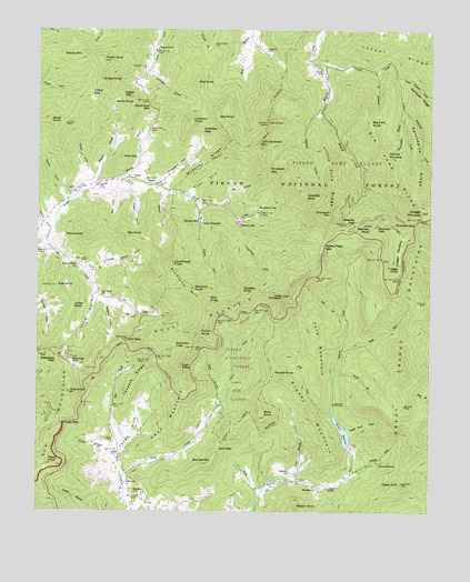
Craggy Pinnacle, NC USGS Topographic Map
Click on map above to begin viewing in our Map Viewer.

This topographic map contains these locations and features:
Feature Name Type Latitude Longitude GNIS ID View Map
Alexander BranchStreamN35.7401°W82.4640°1008669View Map
Alexander KnobSummitN35.7221°W82.4387°1023521View Map
Anderson CemeteryCemeteryN35.7459°W82.4448°1008719View Map
Ballard CemeteryCemeteryN35.6909°W82.4840°1008895View Map
Ballard CoveValleyN35.6902°W82.4745°1008898View Map
Barrett CoveValleyN35.7060°W82.4910°1008944View Map
Bartlett MountainSummitN35.6379°W82.4443°1018976View Map
Bearpen GapGapN35.6996°W82.3921°1009032View Map
Bearpen KnobSummitN35.6996°W82.3940°1019010View Map
Bearwallow BranchStreamN35.7276°W82.3848°1009045View Map
Bee BranchStreamN35.7048°W82.4418°1009099View Map
Bee Tree Lake DamDamN35.6413°W82.4011°1017261View Map
BeechPopulated PlaceN35.7118°W82.4701°1009122View Map
Beetree ChurchChurchN35.6315°W82.4101°1009145View Map
Beetree ChurchChurchN35.6357°W82.4187°1009146View Map
Beetree GapGapN35.6996°W82.3993°1009153View Map
Beetree ReservoirReservoirN35.6456°W82.4021°1009154View Map
Bell BranchStreamN35.6754°W82.4015°1009158View Map
Big Fork KnobSummitN35.7254°W82.3940°1019134View Map
Big Fork RidgeRidgeN35.7148°W82.3846°1009319View Map
Blackberry InnPopulated PlaceN35.7023°W82.4296°1009451View Map
Browns ChapelChurchN35.7107°W82.4629°1009668View Map
Brushy MountainSummitN35.6509°W82.4135°1019338View Map
Bull GapGapN35.6698°W82.4712°1009803View Map
Bull MountainSummitN35.6798°W82.4379°1019397View Map
Camel FieldValleyN35.7145°W82.4849°1009930View Map
Camp SequoyahLocaleN35.6998°W82.4482°1009975View Map
Carson CemeteryCemeteryN35.7454°W82.4282°1010059View Map
Carter CreekStreamN35.7409°W82.4087°1010068View Map
Cedar CliffSummitN35.6329°W82.3840°1010116View Map
Copperas MountainRangeN35.7362°W82.4035°1023522View Map
Courthouse KnobSummitN35.6898°W82.4565°1019805View Map
Craggy FlatsSwampN35.6968°W82.3818°1023520View Map
Craggy GardensRidgeN35.6926°W82.3848°1010554View Map
Craggy KnobSummitN35.6893°W82.3851°1019840View Map
Craggy Mountain Scenic AreaAreaN35.7204°W82.3785°1018138View Map
Craggy PinnacleSummitN35.7034°W82.3779°1019841View Map
Craven GapGapN35.6479°W82.4910°1010567View Map
Douglas FalkFallsN35.7268°W82.3801°1017966View Map
Eagle Rock CoveValleyN35.6461°W82.4003°1010964View Map
Eller CoveValleyN35.7072°W82.4521°1011065View Map
Fork MountainSummitN35.6743°W82.4126°1020315View Map
Frosty KnobSummitN35.7421°W82.4793°1011401View Map
Grassy KnobSummitN35.7373°W82.4799°1020511View Map
Great Craggy MountainsRangeN35.6959°W82.3790°1011687View Map
Gregg BranchStreamN35.6273°W82.4282°1011743View Map
Haw KnobSummitN35.7365°W82.4498°1020641View Map
Hawkbill CreekStreamN35.7296°W82.4101°1011917View Map
Hawkbill RockSummitN35.7059°W82.4143°1020648View Map
High SwanSummitN35.6629°W82.4535°1020760View Map
Honeycut CoveValleyN35.6783°W82.4784°1012152View Map
Huey CemeteryCemeteryN35.6440°W82.4748°1012252View Map
Ingles GapGapN35.7329°W82.4726°1012357View Map
Jack GapGapN35.6412°W82.4418°1012392View Map
Jess KnobSummitN35.7279°W82.4432°1020948View Map
Jimmy BranchStreamN35.6879°W82.4851°1012480View Map
Jones CoveValleyN35.6402°W82.4744°1012551View Map
Jones KnobSummitN35.6790°W82.4887°1020982View Map
Jump CoveValleyN35.6795°W82.4818°1012579View Map
Keasler BranchStreamN35.6396°W82.4740°1012601View Map
Kits KnobSummitN35.6834°W82.4937°1021057View Map
Lane PinnacleSummitN35.6812°W82.4218°1012677View Map
Laurel ForkStreamN35.7062°W82.4504°1012734View Map
Left Fork Beetree CreekStreamN35.6498°W82.4051°1012806View Map
Little Fork RidgeRidgeN35.7109°W82.4071°1012963View Map
Little Snowball MountainSummitN35.7201°W82.4307°1021240View Map
Locust RidgeRidgeN35.7426°W82.3823°1013070View Map
Long BranchStreamN35.6332°W82.4248°1013119View Map
Lovelace GapGapN35.7254°W82.4476°1013211View Map
Lovelace KnobSummitN35.7262°W82.4510°1021295View Map
Maney BranchStreamN35.7126°W82.4721°1013299View Map
McDaires CoveValleyN35.7115°W82.4599°1013414View Map
McDaires RidgeRidgeN35.7154°W82.4465°1013415View Map
Middle MountainSummitN35.7434°W82.4868°1021431View Map
Mineral CreekStreamN35.7412°W82.4090°1013616View Map
Moody CoveValleyN35.7114°W82.4821°1013665View Map
North KnobSummitN35.7254°W82.4954°1021669View Map
Ox Creek ChurchChurchN35.6812°W82.4798°1014164View Map
Paint ForkPopulated PlaceN35.7446°W82.4632°1014178View Map
Paint Fork CemeteryCemeteryN35.7404°W82.4654°1014181View Map
Paint Fork GapGapN35.7312°W82.4648°1014183View Map
Paynes KnobSummitN35.6621°W82.4251°1021836View Map
Peach KnobSummitN35.6384°W82.4962°1021842View Map
Peach Orchard CreekStreamN35.7382°W82.3860°1014284View Map
Pennix CoveValleyN35.6996°W82.4979°1014324View Map
Pine MountainSummitN35.7165°W82.4729°1021926View Map
Pinnacle GapGapN35.6998°W82.3804°1014472View Map
Potato Field GapGapN35.6946°W82.4090°1014609View Map
Rattlesnake LodgePopulated PlaceN35.6684°W82.4557°1022161View Map
Raven KnobSummitN35.7312°W82.4696°1022164View Map
Ray CoveValleyN35.7075°W82.4760°1014772View Map
Ray KnobSummitN35.6976°W82.4712°1022175View Map
Rice KnobSummitN35.6559°W82.4893°1014845View Map
RicevillePopulated PlaceN35.6326°W82.4701°1022246View Map
Riceville ChurchChurchN35.6301°W82.4668°1014848View Map
Riceville Volunteer Fire DepartmentBuildingN35.6307°W82.4721°2638235View Map
Rich KnobSummitN35.6793°W82.4446°1022254View Map
Richland KnobSummitN35.6826°W82.4501°1022275View Map
Richland MountainSummitN35.6826°W82.4501°1022276View Map
Right Fork Beetree CreekStreamN35.6673°W82.4023°1014895View Map
Roaring GapGapN35.6632°W82.4879°1014948View Map
Rock KnobSummitN35.6509°W82.4285°1022326View Map
Rocky KnobSummitN35.6718°W82.4479°1022358View Map
Salton GapGapN35.7337°W82.4829°1015190View Map
Sassafras GapGapN35.6648°W82.4935°1015278View Map
Sawmill BranchStreamN35.7393°W82.3926°1015297View Map
Sawyer CoveValleyN35.7064°W82.4596°1015305View Map
Shope CreekStreamN35.6343°W82.4726°1015478View Map
Snowball GapGapN35.7137°W82.4262°1015646View Map
Snowball MountainSummitN35.7021°W82.4073°1022690View Map
Spruce ForkStreamN35.6351°W82.3998°1015755View Map
Spruce PinnacleSummitN35.7187°W82.3896°1022760View Map
Sprucepine RidgeRidgeN35.7179°W82.3798°1015763View Map
Sugar CoveValleyN35.7071°W82.4686°1015908View Map
Sugarcamp ForkStreamN35.7015°W82.4368°1015930View Map
SummerhavenPopulated PlaceN35.6382°W82.3915°1022835View Map
Swan MountainSummitN35.6473°W82.4554°1022862View Map
Tanbark RidgeRidgeN35.6593°W82.4673°1016018View Map
Union Valley ChurchChurchN35.6896°W82.4876°1016325View Map
Vance KnobSummitN35.6971°W82.4843°1023068View Map
Watch KnobSummitN35.6273°W82.4168°1023124View Map
Waterfall CreekStreamN35.7298°W82.3840°1016462View Map
Webb CemeteryCemeteryN35.7401°W82.4101°1016487View Map
Wolf BranchStreamN35.6521°W82.4426°1016767View Map
Wolfden KnobSummitN35.6818°W82.4326°1023305View Map
Wolfe BranchStreamN35.6609°W82.4046°1016792View Map
Woodfin ReservoirReservoirN35.6999°W82.4357°997582View Map
Woodfin Reservoir DamDamN35.6984°W82.4365°1017271View Map

Note: Coordinates in the location and feature list above are referenced to NAD83 datum.


Copyright (C) 2008-2024 Ryan Niemi / Sunset Dynamics ... All Rights Reserved