TopoQuest Logo
Do you find TopoQuest useful?
Help keep TopoQuest running and adding new maps/features by donating!
Bitcoin:  19c7KJd3qBynnjoSw5npx9KScwjBe4ifkT
Litecoin:  LXs6TkuXGGXo1vDsWCkWVdjQX94eUKd6ui
Home View Maps Find Maps Find Places Resources & Links


Black Mountain, North Carolina Topographic Map

USGS Map Title: Black Mountain, NC
USGS Map MRC: 35082E3
DRG (GeoTIFF) Download: o35082e3.tif


Neighboring USGS Topographic Map Quads:


  Craggy Pinnacle, NC  
35082F4
 

  Montreat, NC  
35082F3
 

  Old Fort, NC  
35082F2
 

  Oteen, NC  
35082E4
 

  Black Mountain, NC  
35082E3
 

  Moffitt Hill, NC  
35082E2
 

  Fruitland, NC  
35082D4
 

  Bat Cave, NC  
35082D3
 

  Lake Lure, NC  
35082D2


Map MRC Location:

N36°
W83°
N36°
W82°
H8 H7 H6 H5 H4 H3 H2 H1
G8 G7 G6 G5 G4 G3 G2 G1
F8 F7 F6 F5 F4 F3 F2 F1
E8 E7 E6 E5 E4 E3 E2 E1
D8 D7 D6 D5 D4 D3 D2 D1
C8 C7 C6 C5 C4 C3 C2 C1
B8 B7 B6 B5 B4 B3 B2 B1
A8 A7 A6 A5 A4 A3 A2 A1
N35°
W83°
N35°
W82°

Black Mountain, NC USGS 1:24K Topographic Map Preview:
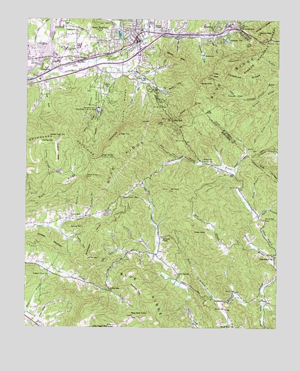
Black Mountain, NC USGS Topographic Map
Click on map above to begin viewing in our Map Viewer.

This topographic map contains these locations and features:
Feature Name Type Latitude Longitude GNIS ID View Map
Allison RidgeRidgeN35.5962°W82.2518°1008695View Map
Assembly LakeReservoirN35.6171°W82.2753°1017251View Map
Black KnobSummitN35.5612°W82.3446°1009436View Map
Black MountainPopulated PlaceN35.6179°W82.3212°1019196View Map
Black Mountain Bi-Lo PlazaLocaleN35.6090°W82.3471°1017936View Map
Black Mountain Fire Department Main StationBuildingN35.6188°W82.3213°2638874View Map
Black Mountain Fire Department Station 2BuildingN35.6048°W82.3360°2639026View Map
Black Mountain Middle SchoolSchoolN35.6223°W82.3148°1017522View Map
Black Mountain Police DepartmentBuildingN35.6190°W82.3207°2769707View Map
Black Mountain Post OfficePost OfficeN35.6180°W82.3193°2774128View Map
Black Mountain Primary SchoolSchoolN35.6207°W82.3187°1017523View Map
Black Mountain ReservoirReservoirN35.6103°W82.2874°1017248View Map
Black Mountain Reservoir DamDamN35.6101°W82.2882°1017249View Map
Black Mountain SchoolSchoolN35.6154°W82.3401°1017980View Map
Blue Ridge Y M C A CampLocaleN35.5871°W82.3396°1009495View Map
Blue Rock MountainSummitN35.5043°W82.3212°1009497View Map
Briar BranchStreamN35.5987°W82.3426°1009591View Map
Brittin CoveValleyN35.5962°W82.3072°1009618View Map
Broad River ChurchChurchN35.5012°W82.2704°1009624View Map
Broad River Volunteer Fire and Rescue DepartmentBuildingN35.5103°W82.2575°2638428View Map
Buck RidgeRidgeN35.5579°W82.3604°1009747View Map
Burgin CoveValleyN35.6178°W82.2983°1009819View Map
Cabin CoveValleyN35.5314°W82.3278°1009881View Map
Camp BranchStreamN35.6051°W82.3240°1009937View Map
Camp Ridgecrest DamDamN35.6174°W82.2759°1017250View Map
Cane Creek GapGapN35.5532°W82.3273°1010007View Map
Carver Optional Elementary SchoolSchoolN35.6221°W82.3573°1017521View Map
Chestnut FlatsFlatN35.5151°W82.3193°1010245View Map
Chestnut RidgeRidgeN35.6032°W82.2676°1010266View Map
Clear BranchStreamN35.5265°W82.2529°1023911View Map
Clear Branch ChurchChurchN35.5287°W82.2518°1010311View Map
Cross MountainSummitN35.5601°W82.2515°1019866View Map
Curteys ChapelChurchN35.6218°W82.3096°1010616View Map
Dill KnobSummitN35.5560°W82.3037°1010817View Map
Duck BranchStreamN35.5451°W82.2601°1010931View Map
Dunsmore CoveValleyN35.6174°W82.2900°1010948View Map
Dyeleaf MountainSummitN35.5329°W82.3596°1020062View Map
Eads GapGapN35.5162°W82.3332°1010959View Map
Echo LakeReservoirN35.5468°W82.3395°1017230View Map
Echo Lake DamDamN35.5468°W82.3382°1017231View Map
Elizabeth ChapelChurchN35.5371°W82.3076°1011048View Map
Ellison BranchStreamN35.5443°W82.3476°1011075View Map
Evans KnobSummitN35.5996°W82.2893°1020177View Map
Fellowship SanatoriumHospitalN35.6226°W82.3571°1023969View Map
Flat BranchStreamN35.5540°W82.3732°1011249View Map
Flat CreekStreamN35.6187°W82.3154°1011256View Map
Fortune FieldBasinN35.5946°W82.2709°1011346View Map
Garren Creek Volunteer Fire DepartmentBuildingN35.5308°W82.3101°2638935View Map
Garren MountainSummitN35.5282°W82.3440°1020401View Map
Glade CreekStreamN35.5643°W82.2712°1011505View Map
Glen CoveValleyN35.6177°W82.2823°1011528View Map
Grice BranchStreamN35.5485°W82.2623°1011746View Map
GrovestonePopulated PlaceN35.6065°W82.3626°1020572View Map
High TopSummitN35.5787°W82.3290°1020764View Map
High WindySummitN35.5696°W82.3376°1020766View Map
Isinglass RidgeRidgeN35.5712°W82.3598°1012376View Map
Jesses High TopSummitN35.5776°W82.3560°1020949View Map
Jobs PeakSummitN35.6029°W82.2818°1020957View Map
Johnson CoveValleyN35.5889°W82.3385°1012530View Map
Julian F Keith Alcohol and Drug Abuse Treatment CenterBuildingN35.6129°W82.3518°2701533View Map
Kitsuma PeakSummitN35.6201°W82.2607°1012644View Map
Lake EvensReservoirN35.5370°W82.3310°1017225View Map
Lake TomahawkReservoirN35.6188°W82.3289°1016186View Map
Lake Tomahawk DamDamN35.6175°W82.3288°1017254View Map
Lakey GapGapN35.5848°W82.3032°1012661View Map
Lakey Gap ChapelChurchN35.6001°W82.3182°1012662View Map
Lakey KnobSummitN35.5837°W82.3107°1021089View Map
Laughter CoveValleyN35.5370°W82.3495°1012688View Map
Laurel LakeReservoirN35.5970°W82.3353°1012746View Map
Laurel Springs ChurchChurchN35.5215°W82.3001°1012754View Map
Licklog BranchStreamN35.5621°W82.3637°1012851View Map
Licklog GapGapN35.5751°W82.3671°1012861View Map
Little CoveValleyN35.5996°W82.3649°1012931View Map
Little Pisgah Camp DamDamN35.5368°W82.3298°1017226View Map
Little Pisgah MountainSummitN35.5004°W82.3326°1013006View Map
Lynch CoveValleyN35.6016°W82.3196°1013269View Map
McCoy CoveValleyN35.6197°W82.3054°1013409View Map
Miami MountainSummitN35.6104°W82.3035°1021419View Map
Miller CoveValleyN35.5684°W82.3005°1013585View Map
Mountain OrphanageSchoolN35.6148°W82.3698°1013801View Map
North Carolina State Test FarmLocaleN35.6071°W82.3704°1017981View Map
North Fork Swannanoa RiverStreamN35.6046°W82.3687°1014009View Map
Pleasant Grove ChurchChurchN35.5204°W82.3632°1014514View Map
Ponderosa LakeReservoirN35.5629°W82.3585°1017235View Map
Ponderosa Lake DamDamN35.5632°W82.3597°1017234View Map
Reed BranchStreamN35.5062°W82.3746°1014799View Map
RidgecrestPopulated PlaceN35.6207°W82.2826°1022286View Map
Ridgecrest Post OfficePost OfficeN35.6172°W82.2812°2774270View Map
Rock CreekStreamN35.5098°W82.2571°1024270View Map
Rocky KnobSummitN35.5393°W82.2915°1022355View Map
Rush BranchStreamN35.5110°W82.2804°1015130View Map
Sand BranchStreamN35.5137°W82.2707°1015215View Map
Sheep RidgeRidgeN35.5907°W82.3265°1015403View Map
Spring MountainSummitN35.5410°W82.3526°1022754View Map
Spring Mountain BranchStreamN35.5451°W82.3448°1015746View Map
Spring Mountain ChurchChurchN35.5446°W82.3526°1015747View Map
Stepp BranchStreamN35.6026°W82.3718°1015816View Map
Sugar HollowValleyN35.5037°W82.3684°1015923View Map
Swannanoa Correctional Center for WomenBuildingN35.6113°W82.3731°2769858View Map
Swannanoa GapGapN35.6215°W82.2704°1015974View Map
Swannanoa TunnelTunnelN35.6223°W82.2729°1015977View Map
Tabernacle ChurchChurchN35.6198°W82.3496°1016004View Map
The GladeBasinN35.5868°W82.2846°1016087View Map
Tom CreekStreamN35.5657°W82.2768°1016181View Map
Tomahawk BranchStreamN35.6090°W82.3357°1016185View Map
Town of Black MountainCivilN35.6142°W82.3275°2405272View Map
Township of Broad RiverCivilN35.5284°W82.2735°1026445View Map
Turkey RidgeRidgeN35.5829°W82.3451°1016278View Map
Western Carolina State Veterans CemeteryCemeteryN35.6110°W82.3554°2773426View Map
Western North Carolina Shopping CenterLocaleN35.6107°W82.3387°1017937View Map
WFGW-AM (Black Mountain)TowerN35.6054°W82.3498°1018466View Map
Wilkey ChurchChurchN35.5687°W82.2873°1016684View Map
Wolfpit BranchStreamN35.6079°W82.3418°1016803View Map
WONO-AM (Black Mountain)TowerN35.6221°W82.3171°1018472View Map
Youngs RidgeRidgeN35.6201°W82.2605°1016884View Map

Note: Coordinates in the location and feature list above are referenced to NAD83 datum.


Copyright (C) 2008-2024 Ryan Niemi / Sunset Dynamics ... All Rights Reserved