TopoQuest Logo
Do you find TopoQuest useful?
Help keep TopoQuest running and adding new maps/features by donating!
Bitcoin:  19c7KJd3qBynnjoSw5npx9KScwjBe4ifkT
Litecoin:  LXs6TkuXGGXo1vDsWCkWVdjQX94eUKd6ui
Home View Maps Find Maps Find Places Resources & Links


Craig, Missouri Topographic Map

USGS Map Title: Craig, MO
USGS Map MRC: 40095B3
DRG (GeoTIFF) Download: o40095b3.tif


Neighboring USGS Topographic Map Quads:


  Fairfax, MO  
40095C4
 

  Tarkio SE, MO  
40095C3
 

  Dotham, MO  
40095C2
 

  Corning, MO  
40095B4
 

  Craig, MO  
40095B3
 

  Mound City, MO  
40095B2
 

  Rulo, NE  
40095A4
 

  Big Lake, MO  
40095A3
 

  Kimsey Creek, MO  
40095A2


Map MRC Location:

N41°
W96°
N41°
W95°
H8 H7 H6 H5 H4 H3 H2 H1
G8 G7 G6 G5 G4 G3 G2 G1
F8 F7 F6 F5 F4 F3 F2 F1
E8 E7 E6 E5 E4 E3 E2 E1
D8 D7 D6 D5 D4 D3 D2 D1
C8 C7 C6 C5 C4 C3 C2 C1
B8 B7 B6 B5 B4 B3 B2 B1
A8 A7 A6 A5 A4 A3 A2 A1
N40°
W96°
N40°
W95°

Craig, MO USGS 1:24K Topographic Map Preview:
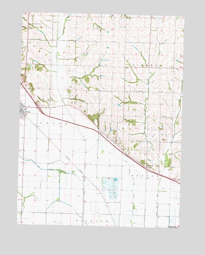
Craig, MO USGS Topographic Map
Click on map above to begin viewing in our Map Viewer.

This topographic map contains these locations and features:
Feature Name Type Latitude Longitude GNIS ID View Map
Bellevue School (historical)SchoolN40.2187°W95.2582°747047View Map
Browning LakeReservoirN40.1817°W95.3053°761922View Map
Browning Lake DamDamN40.1817°W95.3053°761921View Map
Brush College School (historical)SchoolN40.2192°W95.3680°714820View Map
Cherrydale School (historical)SchoolN40.2017°W95.3336°715769View Map
City of CraigCivilN40.1924°W95.3743°2393661View Map
CraigPopulated PlaceN40.1947°W95.3711°716455View Map
Craig Post OfficePost OfficeN40.1922°W95.3741°2782645View Map
Craig Volunteer Fire Department Holt Station 1BuildingN40.1971°W95.3749°2621551View Map
Dale Center School (historical)SchoolN40.2406°W95.2769°716643View Map
East Branch Squaw CreekStreamN40.1806°W95.2558°726976View Map
East Fork Little Tarkio CreekStreamN40.2472°W95.3403°717294View Map
Independent Order of Odd Fellows CemeteryCemeteryN40.1986°W95.3533°2702311View Map
Liberty School (historical)SchoolN40.2042°W95.2861°720999View Map
Lonesome School (historical)SchoolN40.2336°W95.3139°721490View Map
Mount Hope School (historical)SchoolN40.2485°W95.3518°722769View Map
Nauman LakeReservoirN40.2133°W95.3136°762414View Map
Nauman Lake DamDamN40.2133°W95.3136°762413View Map
New Liberty CemeteryCemeteryN40.2058°W95.2866°2702318View Map
Squaw CreekStreamN40.1561°W95.2647°722442View Map
Summit School (historical)SchoolN40.1658°W95.2869°727296View Map
Wild Rose School (historical)SchoolN40.1639°W95.3430°728828View Map
Wildcat CreekStreamN40.1619°W95.2628°728536View Map

Note: Coordinates in the location and feature list above are referenced to NAD83 datum.


Copyright (C) 2008-2025 Ryan Niemi / Sunset Dynamics ... All Rights Reserved